
The Victoria Circle Paddle Loop
 The low isthmus of land in View Royal, now encompassing Portage Park and a short section of the old Island Highway was a traditional First Nations short cut or ‘portage’ separating Portage Inlet from Esquimalt Harbour. The portage makes it possible to paddle a complete circle leaving from any point in Victoria Harbour, Esquimalt Harbour or anywhere along the Gorge Waterway and returning to it from the opposite direction.
My good friend Brian Henry, owner of Ocean River Sports in Victoria, BC, and I decided to put the kayaks on the water and reconnect with this historical paddling route. This route is both beautiful and interesting and is also relatively easy as long as you check your tides, currents and weather to make sure it is an appropriate day.
The Upper Harbour & Selkirk Waterway
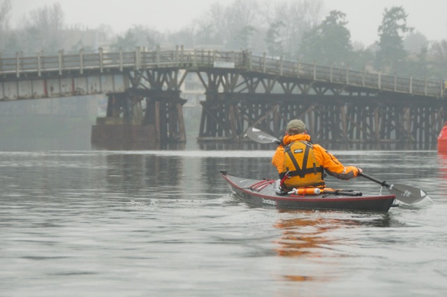
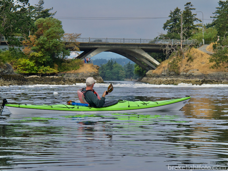
The Victoria Waterways Loop can be paddled in either direction, but we chose to kayak from the Inner Harbour, leaving from the Ocean River Sports docks, conveniently located at the bottom of Swift Street just in front of the Craft Beer Market, and just North of Johnson St. Bridge. It is an easy put in off the ORS docks and once on the water we headed north along the Upper Harbour towards the Bay St Bridge and the Selkirk Waterway. Once you pass under the Bay St Bridge you continure towards the Selkirk Trestle, built by the Canadian National Railway in 1903 and is now part of the Galloping Goose walk and bikeway. Passing under the trestle you enter the Gorge Waterway, and begin to see the beauty of this inland passage, with beautiful homes, parks, bridges and other interesting landmarks. It is a peaceful and easy paddle so far. However, after less than 30 minutes of paddling, you will come upon a constriction where the waters narrow down to approx. 10 meters (30’) wide directly beneath the Gorge-Tillicum Bridge.
For more information on the history of the Victoria Waterways Loop and some historical images, check out this post on our sister website: Historic Marine Paddle Route
The Selkirk Trestle
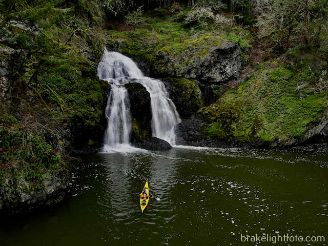
Tillicum Narrows
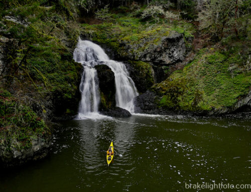
This is Tillicum Narrows and when the tides are right, or wrong depending on your perspective, it can become a raging tidal rapid. This wonder is a reversing tidal overfall that can run as fast as 12 knots, or 22 kph at times. You must take care and read the tide and current tables in order to plan your trip though the Tillicum Narrows when it is slack tide or at least slow enough to allow you safe passage. Otherwise, you may have to portage around by exiting at the dock on the right.
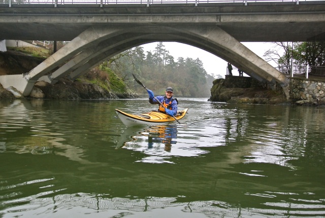
Gorge Tillicum Bridge
Warning: See the trip planning section to understand how to get through the Tillicum rapids. At this point, there can be very strong currents, up to 12 knots on the ebb. Depending on the flow of the water, it can be with or against you. There are powerful eddylines on each side of the main channel (eddylines are a transition line between the main current and the slower waters flowing in the opposite direction closer to shore) At any extreme currents these eddylines can be extremely dangerous and can easily capsize a kayak or canoe. Lives have been lost here!
Rapids flowing on the ebb tide at Tillicum Narrows
The Gorge Waterway & Portage Inlet
Once through Tillicum Narrows, you will find yourself in a beautiful urban setting with Gorge Tillicum Park on your left and the Gorge Walkway on your right. The first building you pass on your right, on the water’s edge is home to the Victoria Canoe and Kayak Club,. As you get closer to the Admirals Rd bridge your will see the National Historical Site, Craigflower School House, situated in Kosapsom Park. The school was opened in 1855. On the other side of the bridge, on your left, you will see Craigflower Manor, also a National Historic Site, which was completed in 1856 and served as home and office to the family on Craigflower farm.
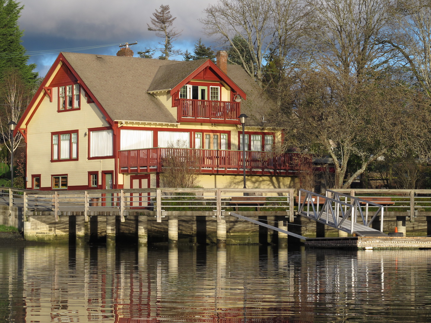
The Victoria Canoe & Kayak Club House

Beautiful Portage Inlet
From Kosapsom Park paddle under the Admirals St Bridge and cross to the south shore. There is a public water access site located between 2772 and 2775 Shoreline Dr a short distance past the bridge (see map). A ramp and access road have been built here making for easy access to the Portage, which begins just across the street along the fence line of Shoreline School.
Optionally, you can continue paddling up to the end of Portage Inlet, a sinuous stretch of water that literally doubles back on itself. It is well worth exploring. If you do this It is possible to land to the left of the municipal service building at the far end of the inlet depending on the tide levels. At low tides, there are large mud flats located here and the boot sucking mud is not negotiable. This is why the preferred takeout is the Shoreline Dr exit on other side of the peninsula.
This section of the trip, exiting at the end of Portage Inlet on a high tide, took us approximately 1 hour and 20 minutes.
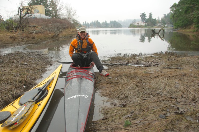
Time to portage – High tides are the only time you can exit behind Spectrum School at the end of Portage Inlet
Public Water Access to Shoreline Trail just above the Admirals Street Bridge
The launch ramp onto the Gorge Waterway across the street from Spectrum School
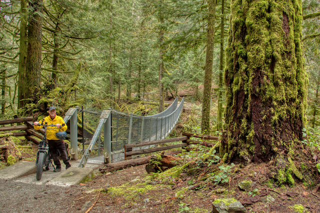
The Portage
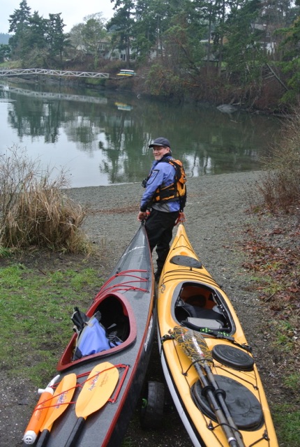
Whether you exit on the east side of the peninsula at the Shoreline Dr boat ramp or paddle around to the end of Portage Inlet, this is the beginning of the portage. At this point you go from paddling your boats to carrying them.
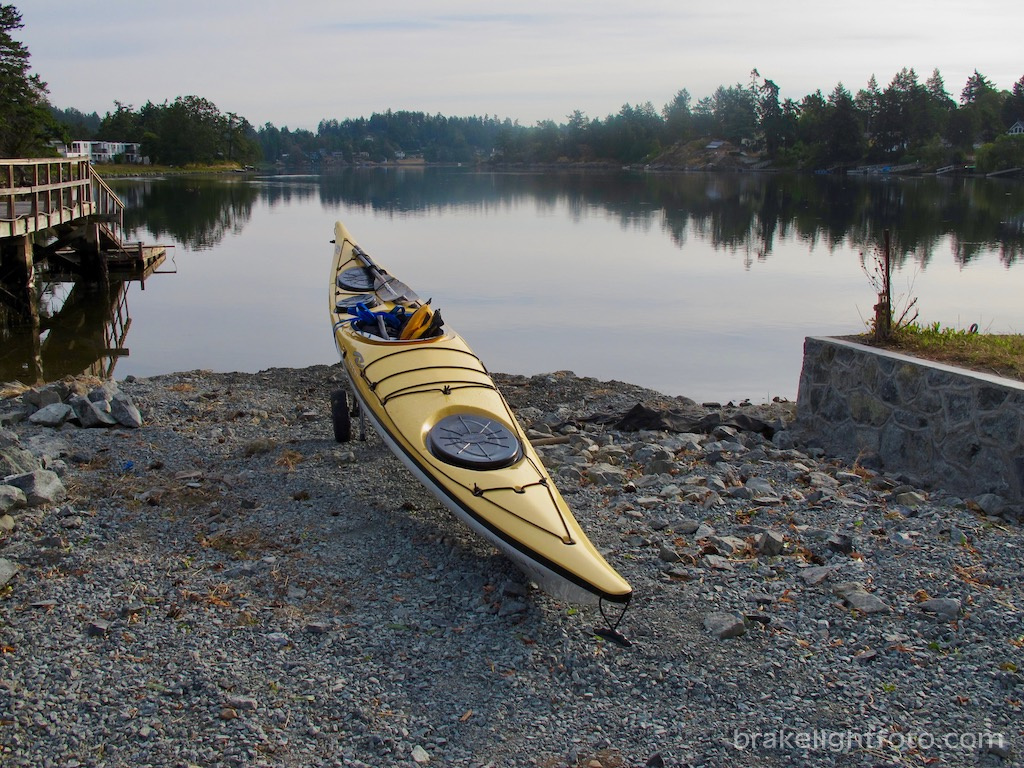
Kayaks aren’t the easiest thing to carry by yourself, so if you’re going solo, I highly recommend a kayak cart. These clever devices easily disassemble for storage in your kayak but once reassembled easily allow you to pull your kayak along, particularly useful if you are carrying a lot of gear with you. Check out our post Kayak Carts. They are also available at Ocean River Sports in Victoria, for purchase or rental.
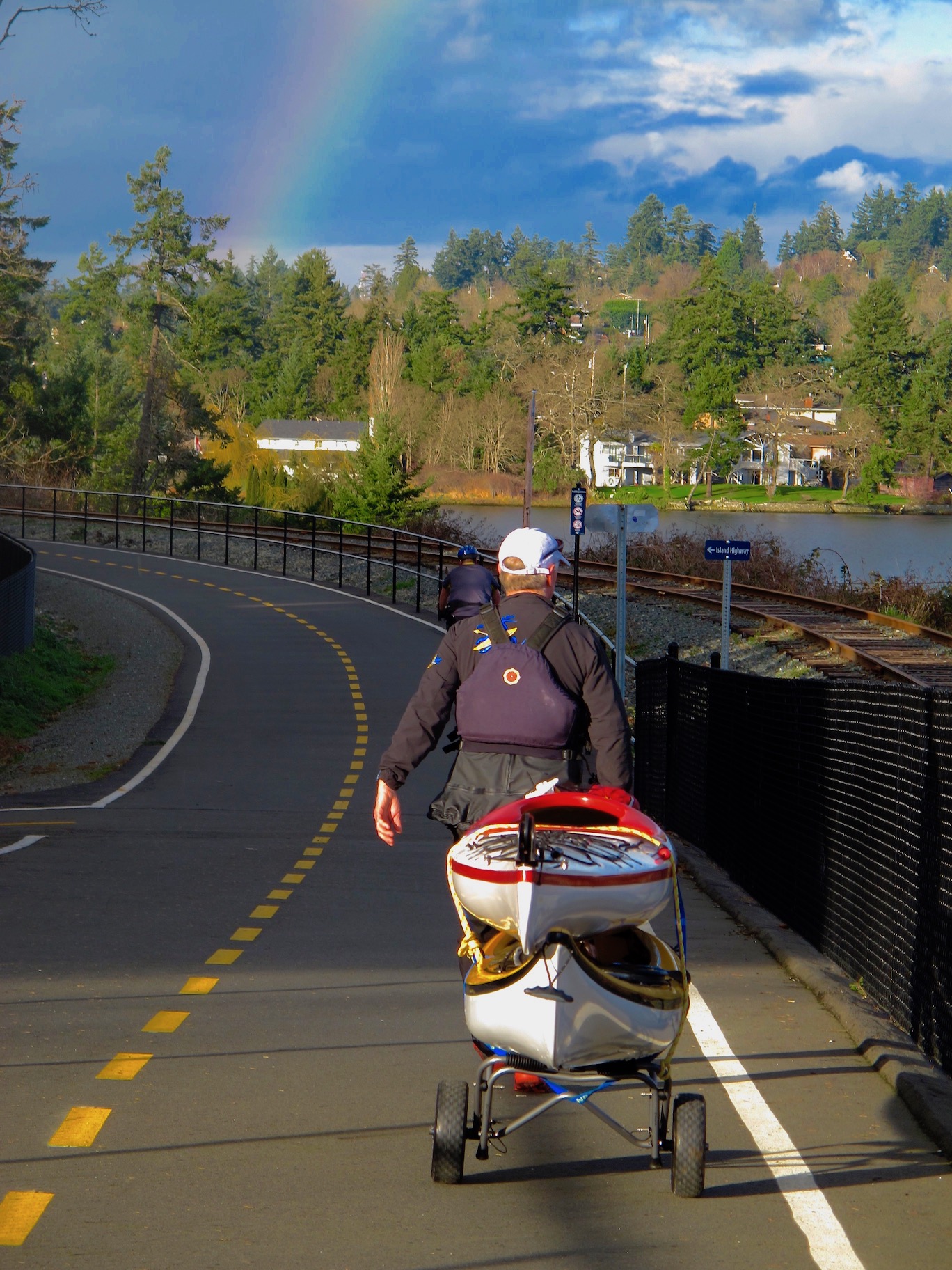
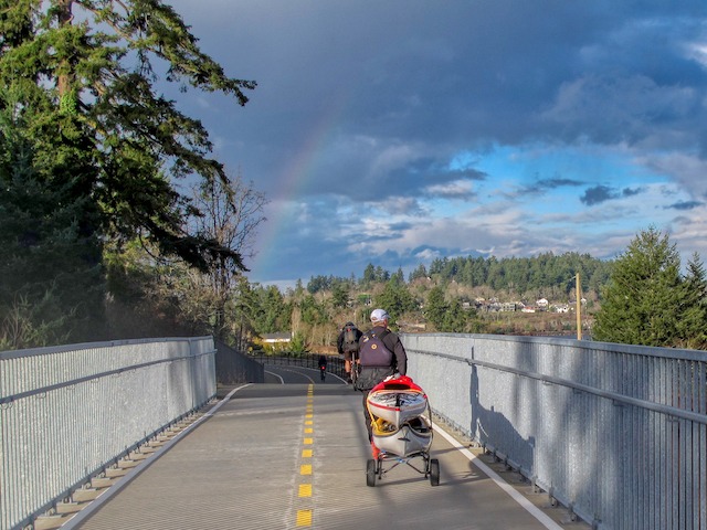
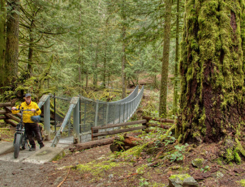
Crossing the Old Island Hwy on the pedestrian bridge
If you don’t have a kayak cart and there are two of you, it is possible to do a double carry, depending on the weight of your kayaks, but a cart still makes it much easier. One cart can work by stacking the boats on top of one another.
Once we had the kayak cart loaded up, we followed the walkways to the railway/pedestrian bridge which is part of the E&N Rail Trail. Crossing on the bridge makes for a much safer crossing of the very busy Old Island Highway. The E&N Rail Trail leads to the pathways of Portage Park.
By the way, if you feel hungry at this point and your timing is good, an easy 100 meter detour up the hill will take you to the Four Mile Brew Pub & Grill for lunch. A great spot to refuel along the way!
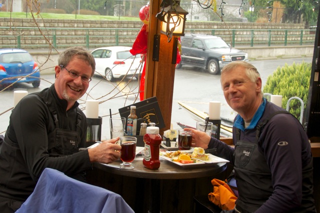
Refueling at the Four Mile Pub – our kayaks are parked just outside
The paths through Portage Park are good. Some of them are paved and some are packed gravel so it is a short, easy and pleasant hike down to the beach on Thetis Cove. At the end of the portage you will see the stark difference between this more wild ‘west coast’ landscape, and the landscape of the more urban inlet. There are a few beautiful small islands with Richards Island located in the middle of the bay.
The Portage Park pathway
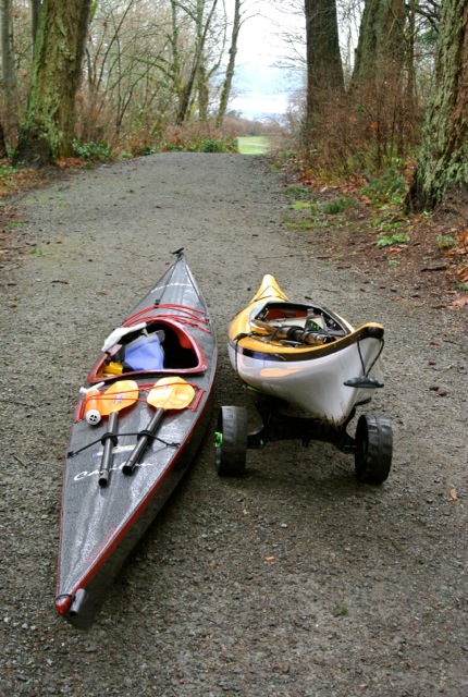
Bruce on the bow of a double carry at Thetis Cove
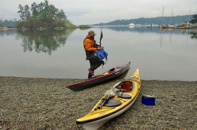
Brian loading up for the start of 2nd half of the loop at Thetis Cove, in Portage Park
As you paddle out of Thetis Cove you will first pass Songhees First Nations land on the left and then Naden Canadian Forces Naval Base and Esquimalt Graving Docks also on your left. There are more Naval facilities on the right. While in Esquimalt Harbour there are some exclusion areas and rules you will need to follow. See the pamphlet below.
Important: Esquimalt Harbour is a controlled access area. All visitors must contact the King’s Harbour Master prior to entering, moving within or departing the harbour. Use VHF Channel 10 or 250-363-2160 on your phone.
Esquimalt Harbour Movement Rules
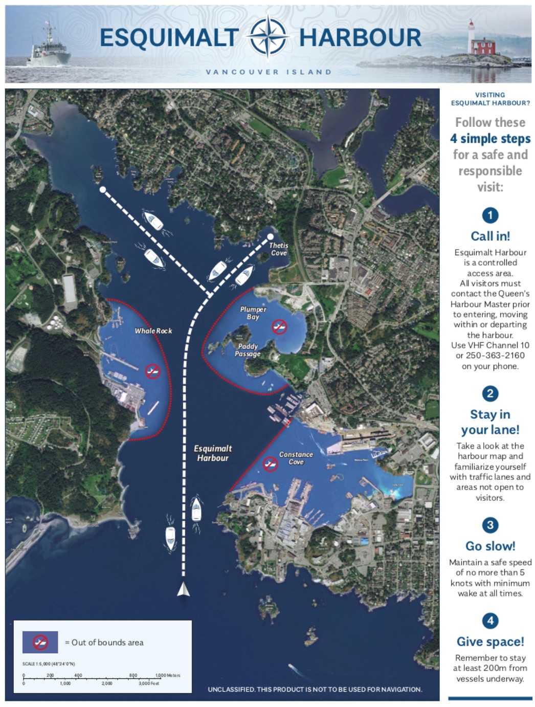
Esquimalt Harbour Movement Rules
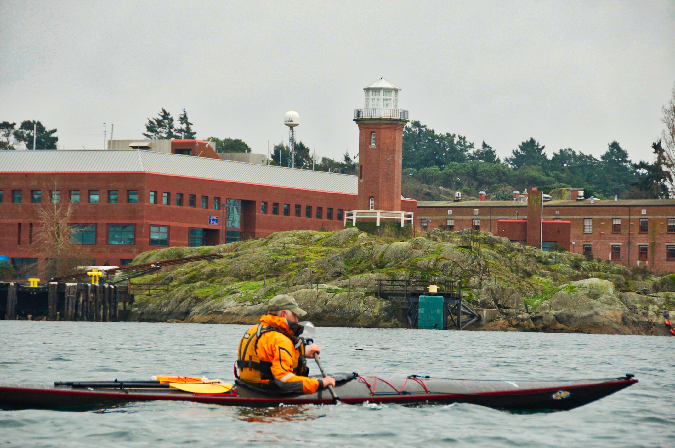
As you pass Constance Cove on your left where the graving dock and main naval docks are located, there is an interesting tower on the point often mistaken as a lighthouse. Bickford Tower was erected in 1901 as a signaling tower for semaphore signal flags and other means of naval visual communication. Two years after its construction the tower became obsolete due to the introduction of a military telephone system. On your right you will pass by the historic Fisgard Lighthouse, the oldest lighthouse on the BC coast, and the Fort Rod Hill National Historic Site.
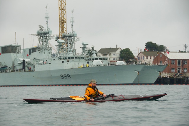
Naval Frigates at the Esquimalt Naval base
Bickford Tower
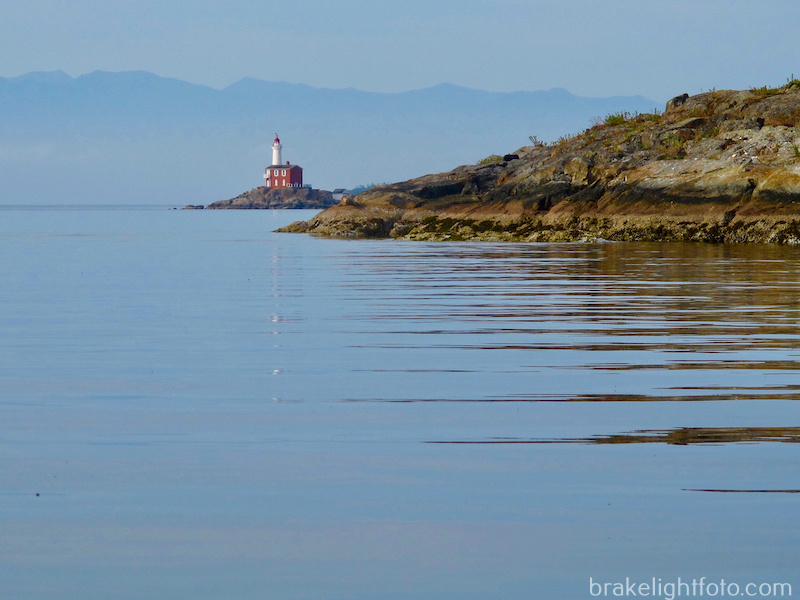
Fisgard Lighthouse, Fort Rod Hill National Historic Site
Cole Island
If you have the time and the energy, you can take a short detour by turning right as you leave the beach at Portage Park and paddle down to Cole Island. Cole Island was part of Fort Rod Hill National Historic Site but is now protected under the auspices of the British Columbia Government’s Heritage Branch thanks to the Friends of Cole Island Society (FoCI). The buildings you see are the remains of the Royal Navy’s ammunition depot dating back to 1859. These spectacular brick structures drop right into the water and make for some great photo opportunities. The FoCl have installed a dock on the island making access much easier. Visitors are welcome from sun-up to sun-down.
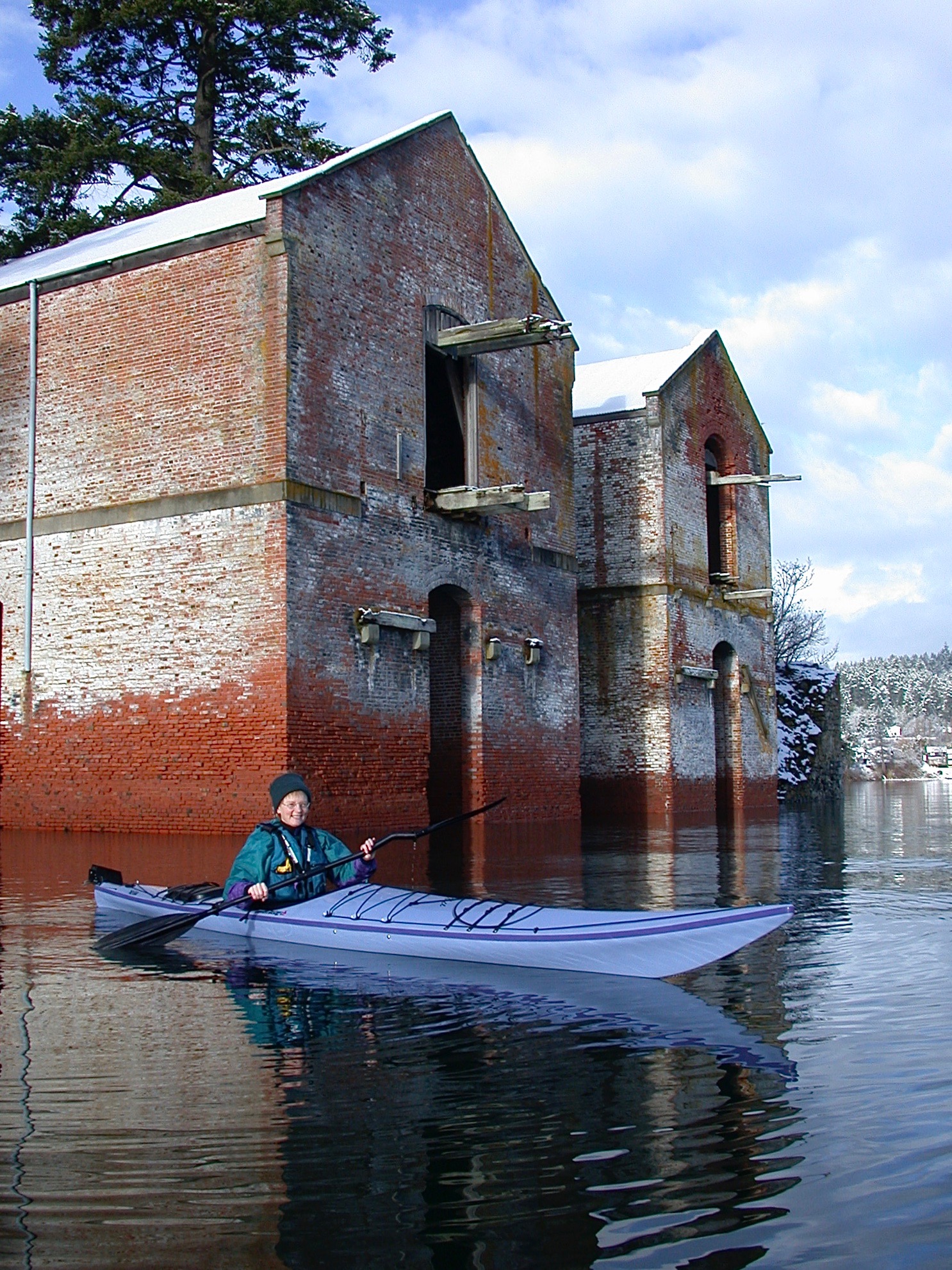
Cole Island
Esquimalt Harbour to Victoria Harbour
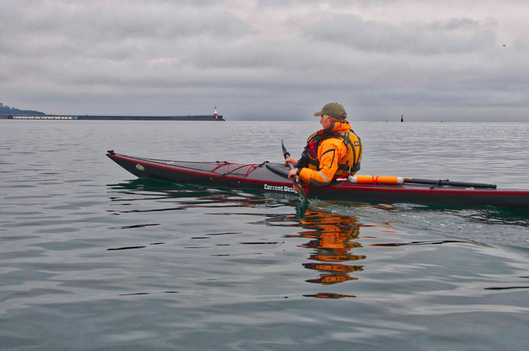
Once you are out of the harbour you will enter the more exposed waters of Juan de Fuca Strait as you head southeast along the shoreline. You will pass beautiful Saxe Point Park and Macaulay Point Park along the way. The coastline along here has a much more rugged west coast feel.
As you round the point coming out of Esquimalt Harbour, you will be entering the very exposed Juan De Fuca Strait, so caution must be taken to check the weather forecast. Unless you are an expert paddler, you probably don’t want to go if the winds are forecast over 10-12 knots. This shoreline can be a rough and inhospitable stretch of water.
Victoria’s Outer Harbour with Ogden Point Breakwater in the background
Victoria Harbour
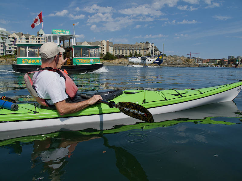
Once you turn into the entrance of Victoria Harbour, paddle in on the west side, staying along the shore out of the way of larger ships and aircraft. Victoria has a very active marine airport so it is a requirement for kayakers to stay on the left side of the harbour all of the way to the inner harbour and back under the Johnson Street Bridge. Once under the bridge, check for traffic and cross over any time it is safe. From here it is a short distance back to the Ocean River Sport’s docks.
If you want to explore more of Victoria Harbour on your loop, care must be taken. There are 2 spots where you can legally cross the harbour before reaching the Johnson Street bridge. These are shown on the traffic scheme chart posted below. If you cross at Berens Island to Shoal Point you can explore the southeast side of the harbour. If the lights are flashing, do not cross, there will a seaplane landing or taking off.
This route will take you past Fisherman’s Wharf and if you didn’t stop for lunch during the portage this is a great place to take time for lunch, a snack, a coffee or cold drink or even ice cream!
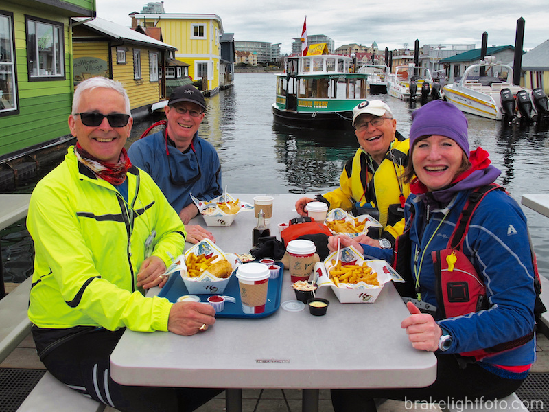
Happy Paddler’s enjoying lunch at Fisherman’s Wharf
From Fisherman’s Wharf you can head along the shore to the narrows and cross from Laurel Point to Shoal Point and carry on back to the Ocean River dock. Optionally you can choose to explore the Inner Harbour. Take extra care while paddling this portion of the harbour as there can be a lot of traffic from pleasure boats and ferries to seaplanes! Once you’ve finished your exploration you can go back and cross at Laurel Point, which is the safest thing to do. Once again, do not cross if the light marker is flashing. Optionally you can carry on around Ship Point and the Victoria Harbour Seaplane Terminal. Stay well clear of the docks and any aircraft docked there. Do not paddle under the wings!
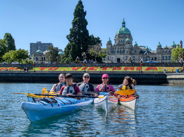
Enjoying the Inner Harbour!
Victoria Harbour Traffic Scheme
The chart below shows the Port of Victoria Traffic Scheme and the 2 locations where you can legally and safely cross the harbour before reaching the Johnson Street bridge. Click the link for more detailed information for safely paddling around Victoria Harbour: Safety Guidelines for Paddling Victoria Harbour
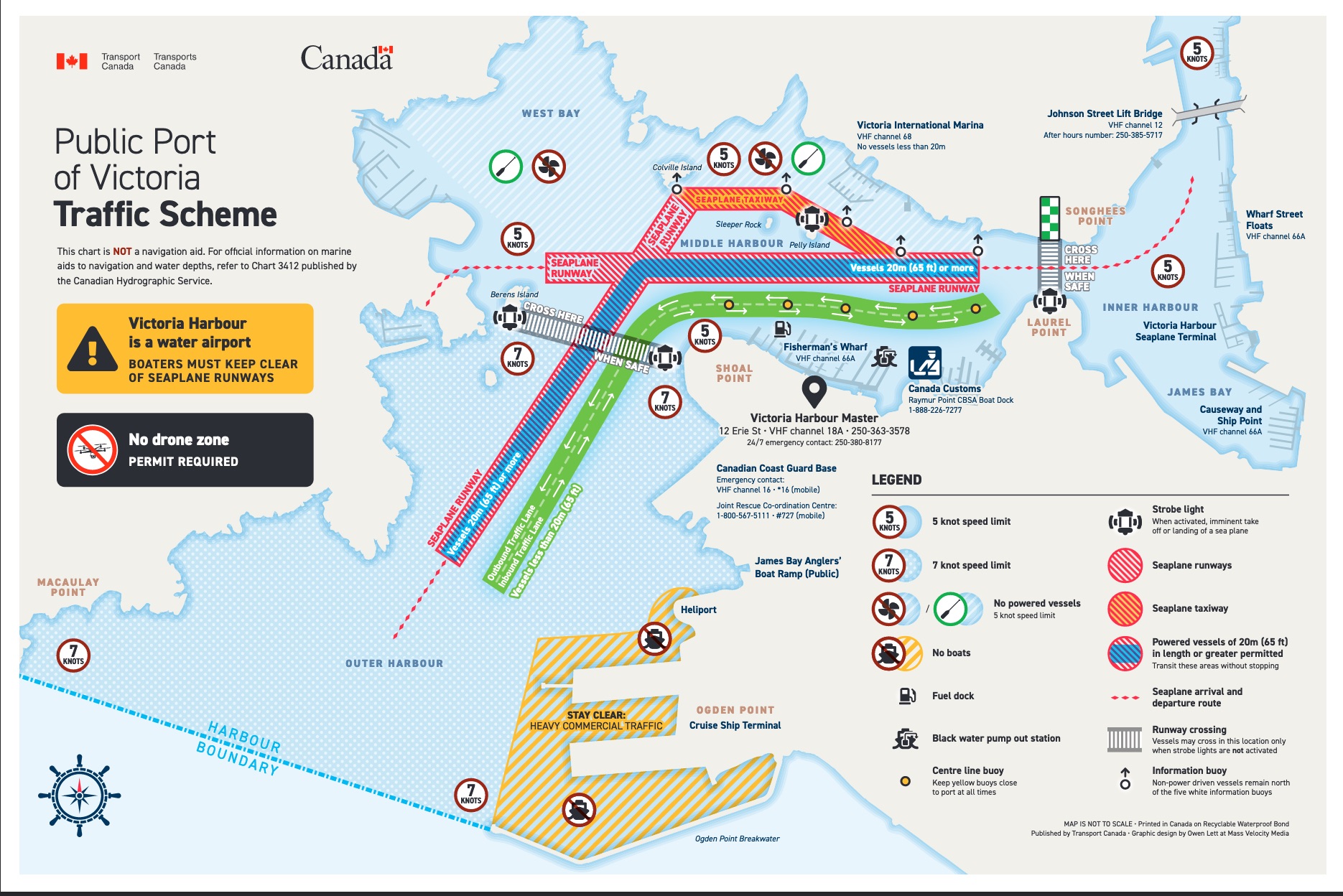
Victoria Harbour Traffic Scheme
There is lots of traffic in Victoria Harbour. Care must be taken, so know and follow the rules!
Paddling Time
The total paddling time including the portage is between 3 and 4 hours (not including a lunch break). This is only an estimate and will depend on how fast you paddle and how much time you spend stopping, socializing, taking pictures, bird watching etc.
Brian and I left the Ocean River Sport’s Dock north of the Johnston St. Bridge at 10:25am. We arrived at the Gorge-Tillicum Bridge at 10:35. Tillicum Narrows was flat but there was about a 2 knot current against us. The upper Gorge Waterway had a slight current against us, around 1/2 to 1 knots. We arrived at the end of Portage Inlet to begin our portage at 11:30. The Portage to the Four Mile Pub took roughly 15 minutes. We had lunch and left at 12:40 pm. We completed the portage and were back in our kayaks at 1:00pm. We then paddled around to Victoria arriving back at the Ocean River docks at 2:30pm. The total time was 4 1/2 hours, including lunch.
The total distance covered was approximately 16.8kms or 9 nautical miles, combining roughly 16kms of paddling with a 750m (800 yd) portage.
Wildlife
Some of the wild life commonly seen includes: River otters, mink,seals, sea lions and even Orcas have been seen in Victoria Harbour! As for birds, depending on the time of year you may see Gulls, Bald Eagles, Oyster Catchers, Harlequin Ducks, Red Breasted Mergansers, Common Mergansers, Hooded Mergansers, Buffle Heads, Cormorants, Great Blue Herons, Common Golden Eyes, American Wigeons, Mallards, Mute Swans, Western Grebes, Horned Grebes, Cormorants, Murres, Pigeon Guillemots, and various shore birds.
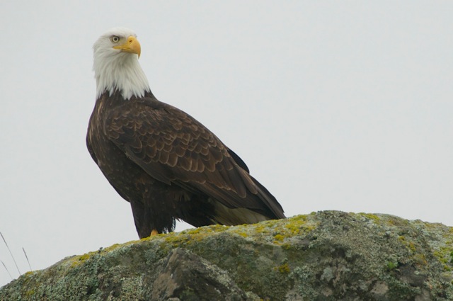
Bald Eagle in Esquimalt Harbour
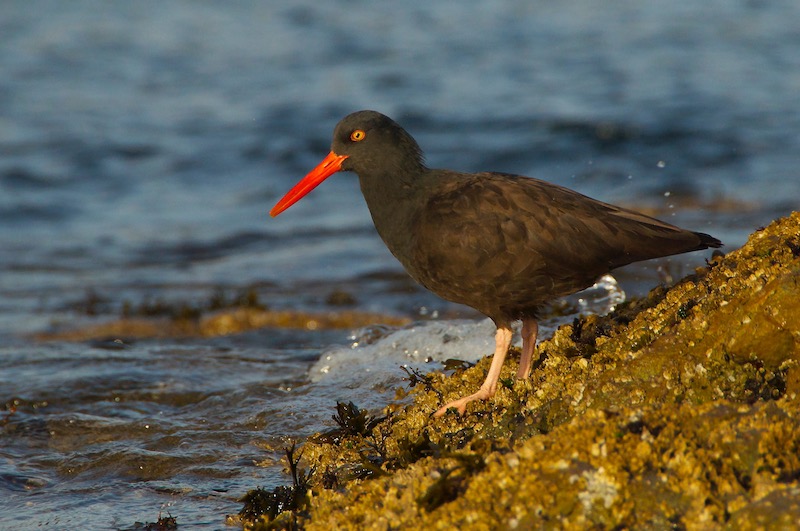
Black Oyster Catcher just off Macaulay Point Park
Trip Planning
Check the weather forecast: Particularly check the winds forecast for the day at the sites posted below. Our recommendation for most paddlers is keep the winds under 10-12 knots or 18 – 24 kph. Check the times and vary the direction of trip depending on the winds direction and speed. If the winds are from the SE, consider doing the trip counter clockwise, leaving Victoria Harbour and paddling with the winds to Esquimalt Harbour. Likewise, if winds are light in the morning but forecast higher in the afternoon, do the more exposed Juan De Fuca section in the morning.
Here are 3 recommended sites for good wind forecasts:
Check the currents at the Gorge-Tillicum Bridge: Here are two methods.
- The easiest way to do this is with a very convenient iPhone app called Aye Tides. Just click ‘Find a Station’ and select Gorge-Tillicum Bridge. If currents are running more than 2 knots caution needs to be exercised. Strong eddylines (the transition between the main current and slower water near the shoreline) can easily capsize unwary paddlers. Ideally time the trip to take advantage of the direction of flow. If you are more experienced you can take advantage of the eddies to work your way up against the current if the flow isn’t too great.
- Using the Canadian Tide and Current Tables. Go to page 140 of the CT&CT and you will find a listing for the Gorge-Tillicum Bridge. This is a little more unusual secondary current station in that the times they give you are based on the Victoria Tide Tables, not a main current reference station. You will note that the Turn to Flood (essentially slack water) occurs 3 hrs + 15 mins after low water (LW) on the Victoria Tide Table. Turn to Ebb occurs 1 hr + 15 mins after high water (HW). Note that times of high and low water in Victoria may vary by as much as 1 hour.
Note: Ebb refers to the water flowing out or going from high tide to low tide, this means the water will be flowing in a easterly direction at Tillicum. Flood refers to water flowing from low tide to high tide or westerly at Tillicum. Tip: Now that I have given you the time differences you can go online to the Fisheries & Oceans Website where the tide table are published online.
All in all this is a great day paddle! There are many other launching points along the Gorge, Portage Inlet, Esquimalt Lagoon and Flemming beach that will also ‘get you in the loop‘! See the map below.
The ‘Epic’ Victoria Circle Paddle Route Map
Photos
To see more images of paddling around Victoria or to purchase images click this link: Paddling Around Victoria