
Kayaking British Columbia’s Beautiful Central Coast
Kayaking from Klemtu to Bella Bella on British Columbia’s beautiful Central Coast has an appeal all of its own. Perhaps it’s the scenery, for some it’s the wildlife, and for others it’s the incredible fishing, but for me it is the amazing untouched nature of this part of the coast and the the feelings of solitude and contentment it inspires. On so much of this coast you can turn in all directions and not see a single soul, not a fellow kayaker, not a boat of any description, no houses, no roads, no power lines and no clear-cut hillsides. In fact, when you first come here you almost don’t realize what is so different about it.
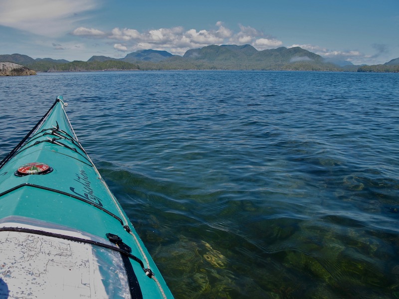
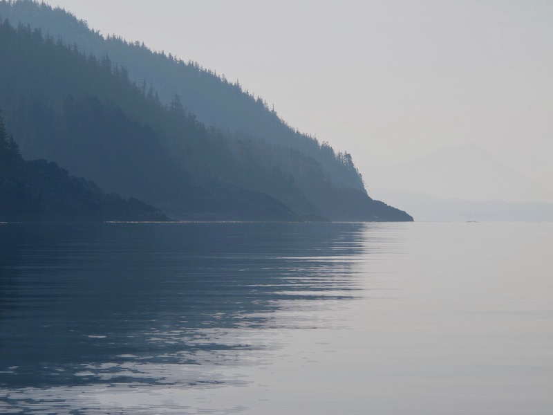
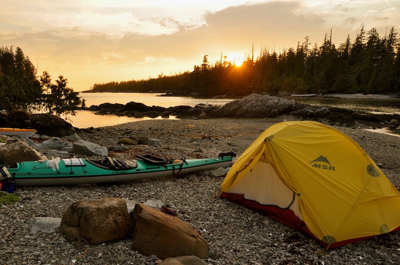
The untouched wilderness of Laredo Sound
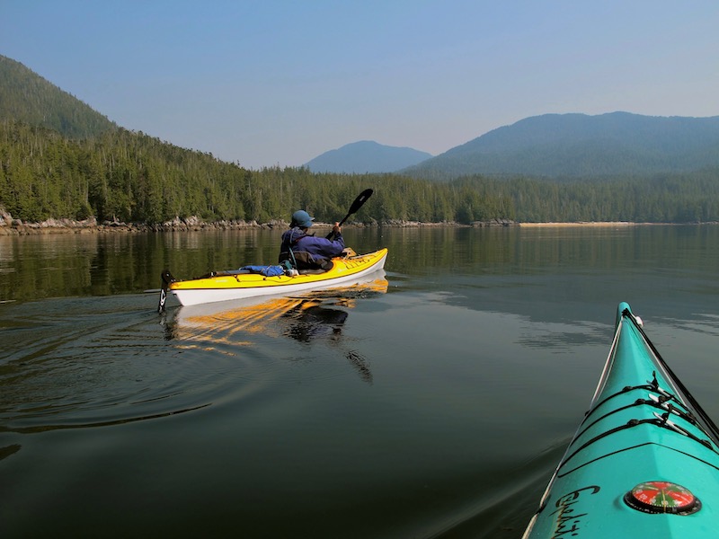
The route we chose for this trip combines some of British Columbia’s famous ‘Inside Passage’ with some stunning, exposed west coast paddling. We paddled from the First Nation’s Community of Klemtu, down some narrow inlets to the coast, south through the Tribal Group of islands and back to Shearwater, a fishing community across the bay from the First Nations village of Bella Bella. This area is sparsely populated and relatively untouched and once you’re on the water it is rare to encounter other people. The sense of being in untouched wilderness is unparalleled.
Klemtu – Dugald Nasmith Photo
Our trip begins with a departure from Victoria on Vancouver Island, where we live, and a 6 hour drive north to Port Hardy where we catch a BC Ferry north to Klemtu. Here we will start the kayaking portion of our trip.
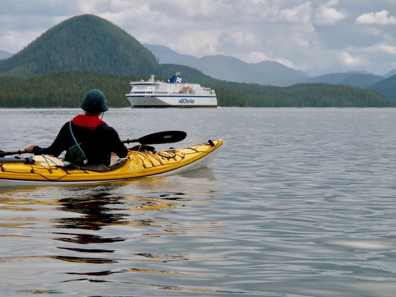
Getting to the Central Coast with your kayak and gear with BC Ferries is very easy. Park your vehicle at the terminal at Bear Cove, just outside of Port Hardy, load your kayaks onto a kayak trailer that BC Ferries supplies, then load all your gear into baggage carts, which are locked after they have been loaded. All that’s left for you to do is walk onto the ferry with whatever personal gear you need with you.
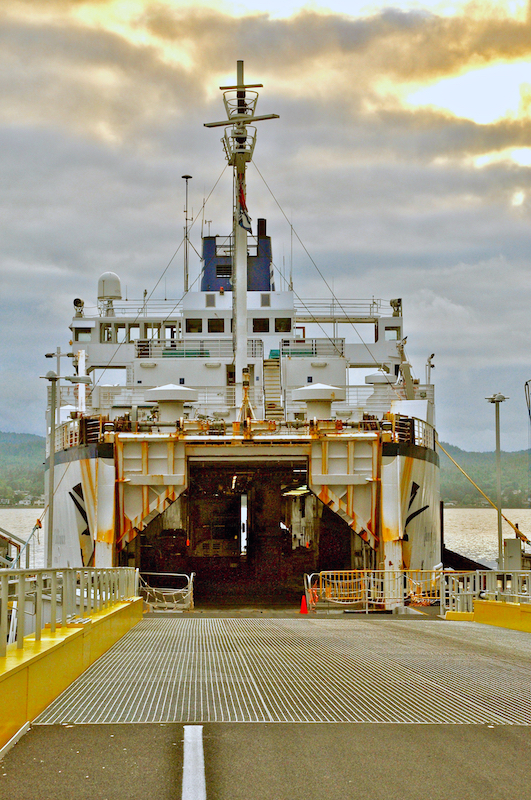
BC Ferries Queen of Chilliwack in Port Hardy
Post Update
At the time of our trip in 2010 we caught the BC Ferries’ ‘Queen of Chilliwack’, an older and relatively small ferry. Today the much larger and much better appointed, ‘Northern Expedition’ makes the Port Hardy to Prince Rupert run up the Inside Passage with stops at Bella Bella and Klemtu. The ‘Queen of Chiliwack’ used to dock at the terminal right in the village of Klemtu, on Trout Bay, and there was a convenient ramp right by the dock to launch kayaks. More recently, BC Ferries has built an upgraded ferry terminal a couple of kilometres north of the village to handle the much larger ‘Northern Expedition’. Now you will only be able to glimpse the village as you sail by and sadly, the kayak launch at the new terminal is sub-optimal. The carry from the unloading area down a steep embankment to the shore is difficult, and the shoreline is comprised of large, sharp, blasted rock used in the construction of the terminal. We made the challenging launch from here on our Fiordland paddle in 2019. Check out our post which has some pictures here: KAYAKING FIORDLAND IN THE GREAT BEAR RAINFOREST
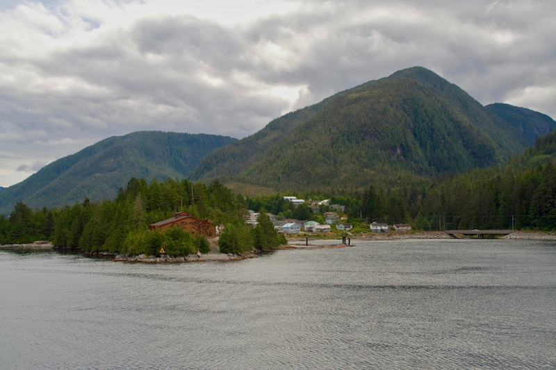
Klemtu
Our arrival in Klemtu was delayed for about 30 minutes while the crew tried to get the loading ramp unstuck. The curse of aging boats. While we wait, a Pacific Coastal Airlines ‘Grumman Goose’ lands in front of the ‘Bighouse’. This spectacular Kitasoo/Xai’xais bighouse is an important place of cultural learning and revitalization and is used for potlatches, feasts, gatherings, and tourism.
Kayak Trailer coming off the Queen of Chilliwack in Klemtu
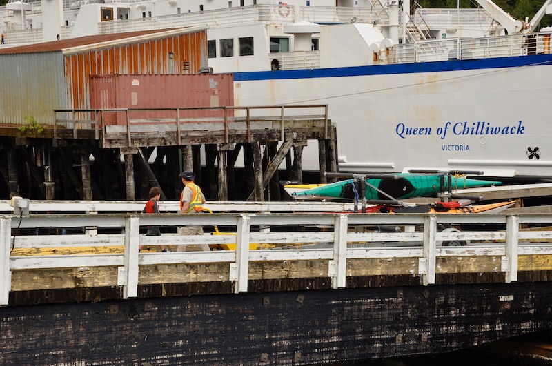
Once the loading ramp was fixed we walk off the ship and wait for the kayak trailer and luggage carts to be wheeled off. The arrival of the ferry is s a relatively popular event, as many of the locals came on board to take advantage of the ferries food services while it sits at dock. A kind of mobile restaurant service.
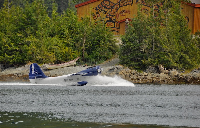
Pacific Coastal Airlines Grumman Goose landing at Klemtu in front of the Bighouse
Departure from Klemtu
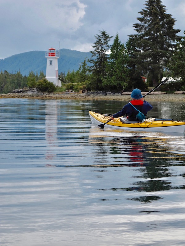
The only other kayaker we saw on this entire trip is launching at Klemtu with us. We all launch in the late afternoon and head up Hunter Channel passing by Boat Bluff, a light station on the southern tip of Sarah Island. Being tucked deep inside these inlets it seems an odd place for such a large and elaborate lighthouse, but it is located at major junction of the Inside Passage where ships turn from Finlayson Channel into Hunter Channel. From here they turn into Tolmie Channel to continue their passage north to Prince Rupert and beyond. Boat Bluff is also the source of local weather information.
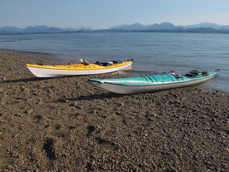
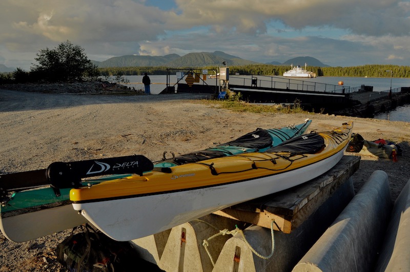
Kayak Launch in Klemtu
Boat Bluff Light Station in Hunter Channel
Meyers Passage – The Route to the West Coast
We paddle roughly 5 nautical miles (nautical miles or nm = 1.15 miles or 1.85 kilometers) to Split Head, rounding the tip, and turned left into Meyers Passage, a long L-shaped passage that separates Swindle Island to the south from Princess Louise Island to the north. This passage provides us a route to the coast. Just around Spit Head we encounter a Humpback whale feeding in the inlet. After a few minutes watching the whale hoping for a better photo opportunity, we continue our paddle south down Meyers Passage. It is another 2.5 nm to our first nights campsite on a gravel spit, about half way down the southern leg of the passage. Not a lot of mileage for our first day, but it is getting dark by the time we set up camp and get dinner on the go.
Rounding Split Head into Meyers Passage
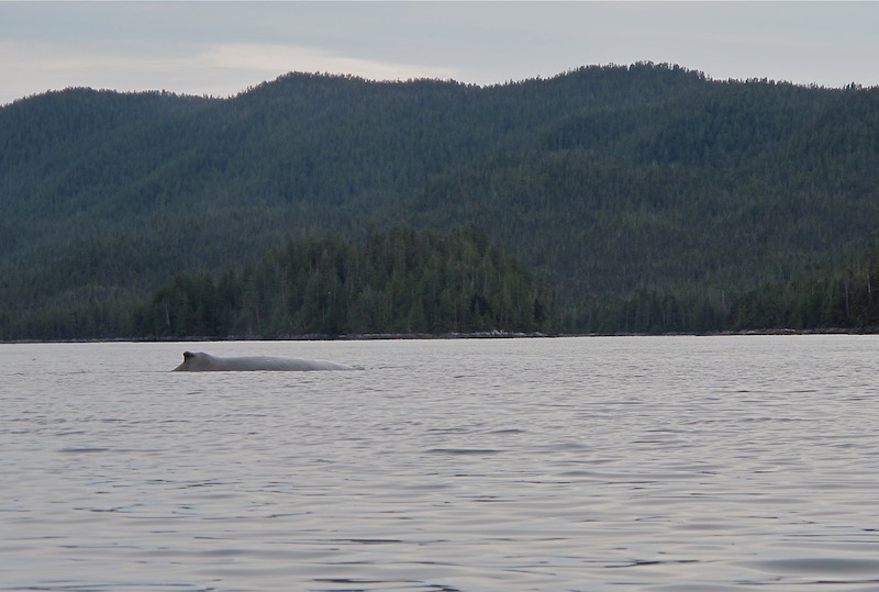
Humpback Whale in Meyers Passage
Meyers Passage – First Night Campsite
Early morning fog in Meyer’s Passage at our first nights campsite
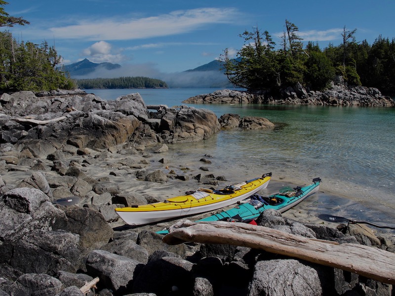
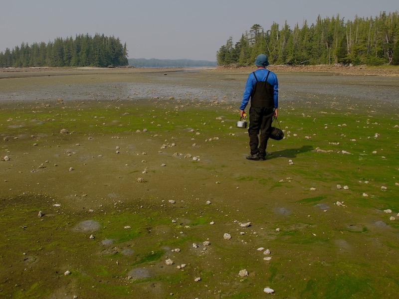
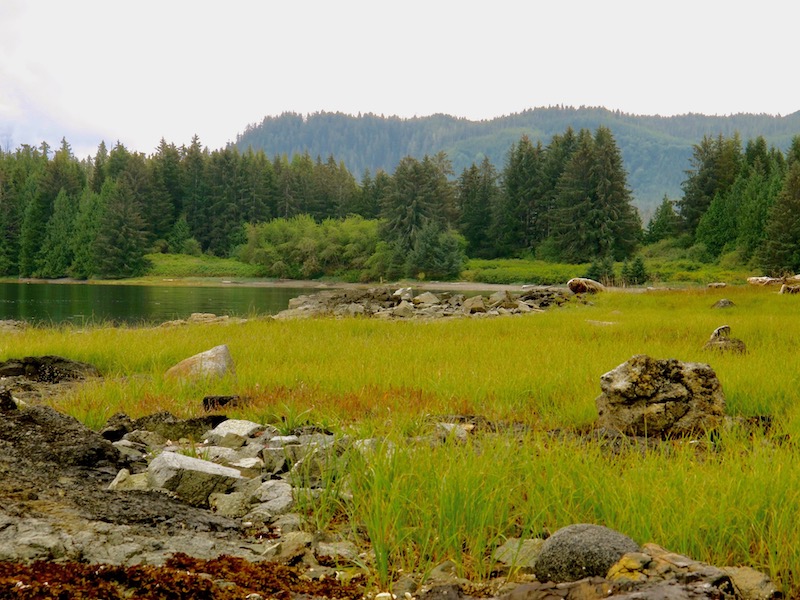
We depart on an overcast and foggy morning to continue south down the passage, eventually following it west towards the coast and Laredo Sound. Entering the sound we turn north towards a campsite located on the northwest tip of Milne Island. Here we will set up camp for a couple of days to allow us some time to explore the sound. Milne Island has a good campsite up under the trees and a decent but rocky beach to land on. At some point, someone has moved the largest rocks aside creating a channel up the beach, allowing you to land boats a little further up the beach at low tide levels. This could have been done by early First Nations people who used this site. Milne Island has one of the few campsites around Laredo Sound as there are few beaches to be found on the black granite shores found here.
Kayaks on the beach at Milne Island – note the cleared passage through the rocks on the beach
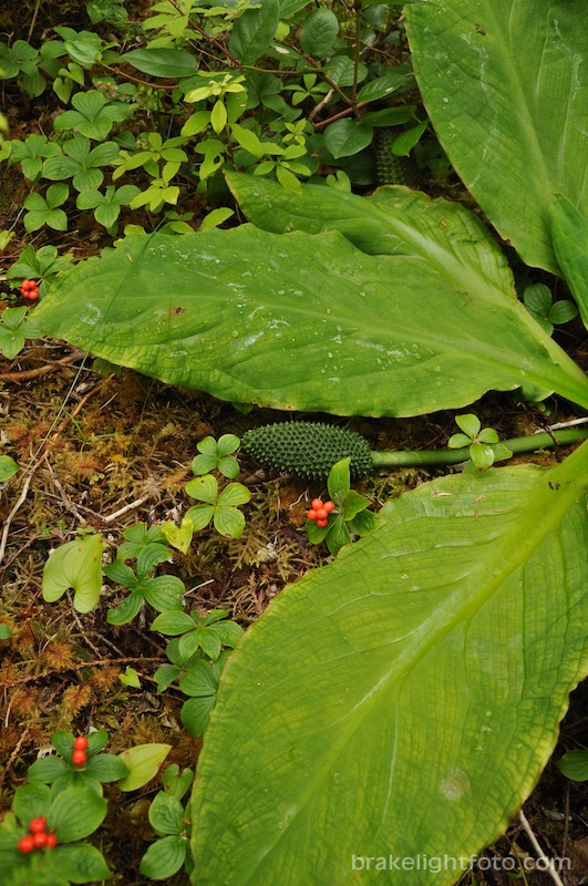
Skunk Cabbage – Milne Island
Laredo Sound
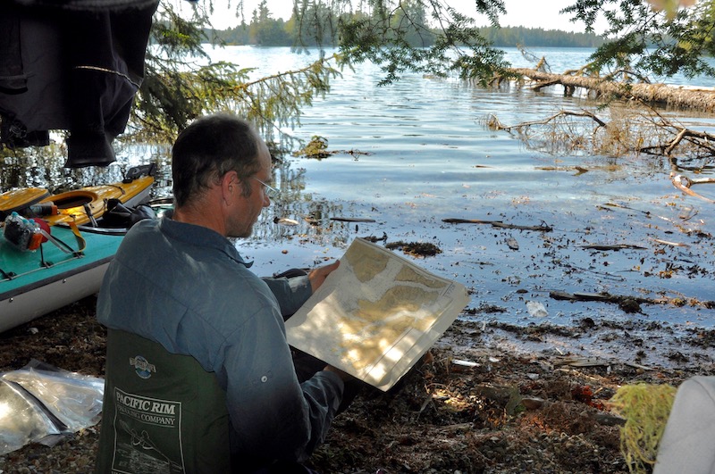
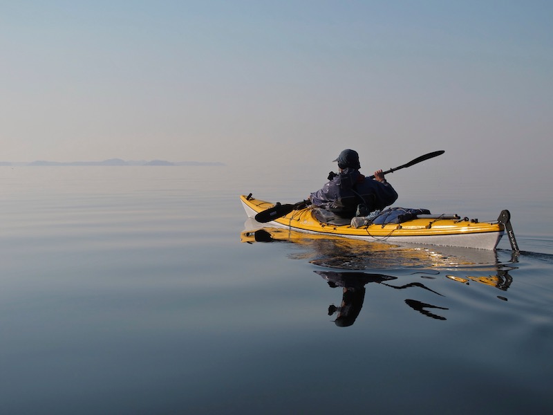
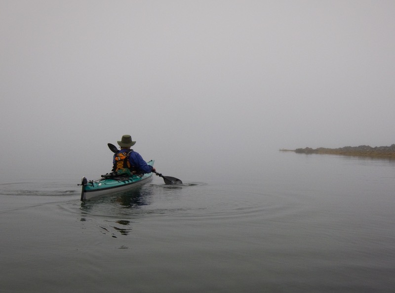
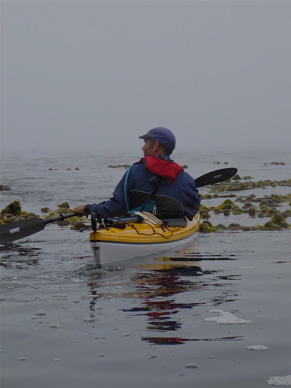
The following day we set out with empty kayaks for a little exploration of Laredo Sound. We leave camp and head up the west coast of Hastings Island in thick fog. Paddling in the fog is always interesting and a bit surreal. You miss out on the surrounding scenery, but it is beautiful in a different kind of way. You definitely need good charts and compass in these conditions! We also carry a GPS equipped with marine charts, which is great for monitoring paddling speed and confirming exactly where we are, but we never rely on the GPS as our sole source of navigation equipment. They can and will fail.
Tip: Always carry your GPS, and other electronics, in a waterproof case. Even though manufacturers may rate them as waterproof, long term exposure to saltwater will take its effect. My Garmin 76Csx handheld marine GPS is rated as waterproof and will float if dropped in water. After my first trip with this unit, not using a case, I noticed there was some corrosion in the battery compartment. I called Garmin to see what they had to say when I told them my waterproof GPS seems to leak. The response of the customer service rep was, and I quote, “The GPS is waterproof, but the battery compartment isn’t.” WTF! Doesn’t that kind of make the whole GPS not really waterproof? Any way, from then on my GPS is always in a waterproof case and has continued to work fine for many trips. Check out our post Is a GPS Necessary for Kayaking Tripping?
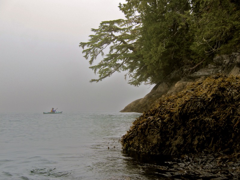
Thick Fog off Hastings Island – Dugald Nasmith Photo
As the morning progresses the fog begins to lift. Now, we could finally see the spectacular beauty of Laredo Sound! Near the north end of Hastings Island we start across to Croft Island and from there we continue on to the Laidlaw Islands. On the way we decide to try our hand at fishing, and within a few minutes I hook a decent sized salmon! Not bad for a hand line! We stop for lunch in the Laidlaws and clean our salmon. After lunch and under sunny skies we head due south across the sound, passing through the Aitken Islands and back to our camp on Milne Island. We would enjoy a delightful salmon dinner that evening!
Lunch stop in the Laidlaw Islands, Laredo Sound – still some fog lying around
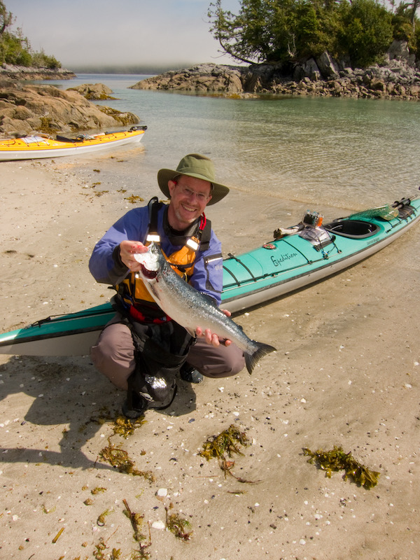
Showing off my salmon in the Laidlaw Islands, Laredo Sound – Dugald Nasmith Photo
South to Kitasu Bay
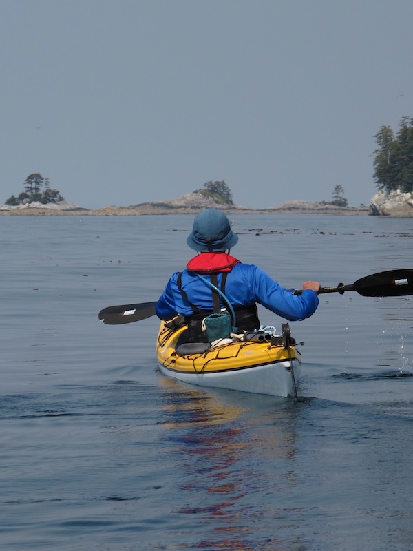
The next morning we pack the kayaks and head south towards Kitasu Sound. We like to leave early to take advantage of the generally calm wind conditions experienced in the mornings. Winds on the west coast often begin to rise as the day progresses due to convection. This occurs as the land warms during the day warming the air which then rises and draws air in from offshore. However, on this day the winds rise significantly from the northwest as we explore Cann Inlet just south of Jamieson Point. Our plan was to cross to the other side of Kitasu Bay to a campsite just south of Wilby Point. As we stick our noses around Jamieson Point we find ourselves facing huge waves rolling down the bay and winds blowing around 20 knots!
Huge waves and high winds off Jamieson Point in Kitasu Bay
After slipping out into the waves to see what it was like out there, we decide that discretion is the better part of valour and decide to turn back into the sheltered waters behind the point and begin a search for an alternative campsite. Just at the head of Cann Inlet we manage to find a sheltered bay where we can pull the boats out of the water on to a sedge grass flat.
Once we have the boats out of the water, we’re able to locate a couple of dry spots where we can set up our tents. I set my tent up on a rocky point with a great view out the inlet and a decent ledge that provides balcony seating for the evening meal!
That night, unfortunately, I leave a collapsible water bottle I was experimenting with outside my tent. In the night a mink decided it was a good thing to play with and dragged it down into the water. I find it floating in the bay the next day, nicely perforated by small teeth and quite useless. I have since gone back to using rigid water bottles.
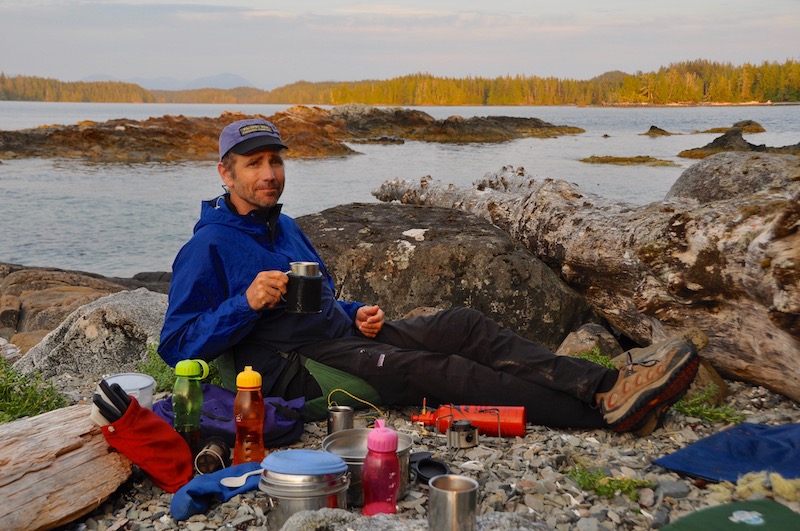
Evening coffee on the ‘balcony’ in Cann Inlet
This morning the winds are still howling which will prevent us from crossing Kitasu Bay again, so we leave our camp set up and paddle up a narrow inlet running north/south just inside of Jamieson Point for a little exploration. We find a nice little tidal rapid dropping into another small inlet, which makes for a pleasant lunch stop. As we eat, we watch the tide continue to drop.
After lunch we decide to run the rapids and go explore the small inlet. By the time we get back to the narrows, the tide has risen enough and the current slackened sufficiently for us to paddle back into the main inlet.
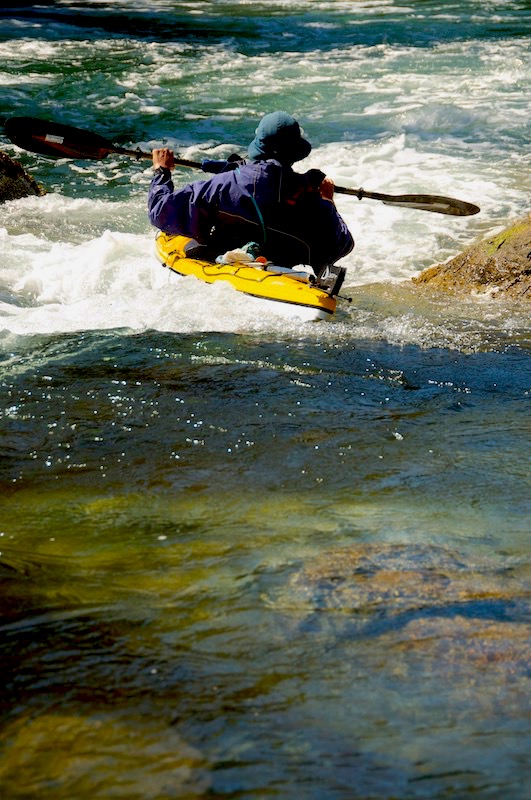
Dugald running the tidal rapid
Preparing to run a Tidal Rapid – Dugald Nasmith Photo
The forecast looks great for the next morning so we plan to pack up early and get on the water. We have an easy crossing of Kitasu Bay under sunny skies and calm winds. Just before Wilby Point, we stop for a break and to check out the campsite we had planned to stay at the day before. We don’t plan on staying here, however, as the day was still young. As we approach Wilby Point we throw out the fishing lines and are rewarded with another beautiful salmon that will give us fish for another 3 meals!
Stopping for a break just south of Wilby Point in Laredo Sound
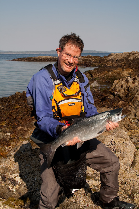
Our second salmon, caught of the tip of Wilby Point – Dugald Nasmith Photo
Rounding Wilby Point, we continue south down the west coast of Swindle Island and entered a large bay just south of Larkin Point. The bay is studded with small islets and passages where we find a beautiful, sheltered shell and sand beach, a perfect place to land and have lunch. Of course, fresh salmon fillets are on the menu!
Fresh salmon for lunch on an beautiful islet south of Larkin Point – Dugald Nasmith Photo
Higgins Passage
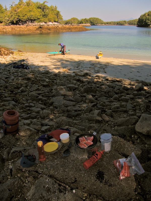
Our plan for the day is to find a campsite near the head of Higgins Passage which runs between Swindle Island to the north and Price Island to the south. The campsite we find is beautifully situated under a grove of huge Sitka Spruce. The beach is composed of gravel and mud and pretty much disappears at high tide and turns into an expansive mud flat at low tides.
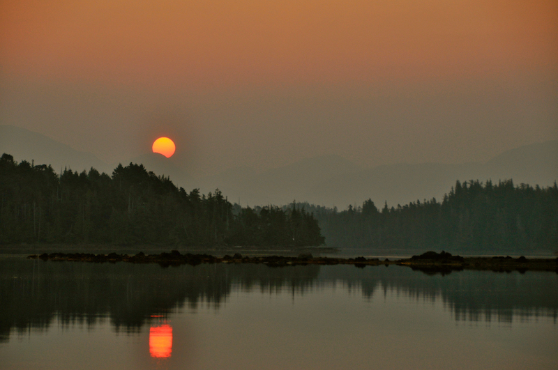
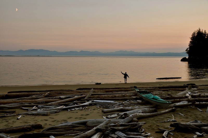
Our stay here coincides with a change in the weather which brings hot, sunny, calm conditions. This change also begins to draw smoke from forest fires that were burning on the mainland, which make for some surrealistic conditions. The warm temperatures and the smell of the smoke in the air make it feel like we were no longer on the Central Coast. However, it does make for some spectacular sunrises and sunsets.
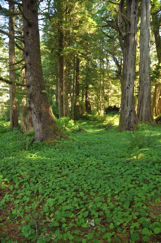
Sitka Spruce Grove in Higgins Passage – Our campsite
High tide at our Higgins Passage Campsite
Higgins Passage Sunset
Exploring Price Island
Higgins Passage is such a good campsite, we decide to spend an extra day here. This also allows us the time to head south a little ways down the west coast of Price Island for some exploration. Conditions are ideal. Warm, sunny and flat calm as we set out in the morning. The west coast of Price Island has a very rough rocky shoreline, strewn with reefs and rocky islets. It can be a very inhospitable place when conditions are bad, but on a day like this, the multitude of rocky islets and reefs and crystal clear water, make for some great exploration!
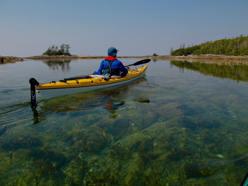
Crystal clear water and flat calm conditions on the west coast of Price Island
Slightly smokey skies along Price Island
Returning to camp in the afternoon we are able to lounge around enjoying the beautiful weather. During dinner we here some loud bugling calls from somewhere in the inlet. It turns out to be the very distinctive call of the Sandhill Crane. We hike back into the inlet, around the corner from our camp, and are able to spot a pair of these amazing birds!
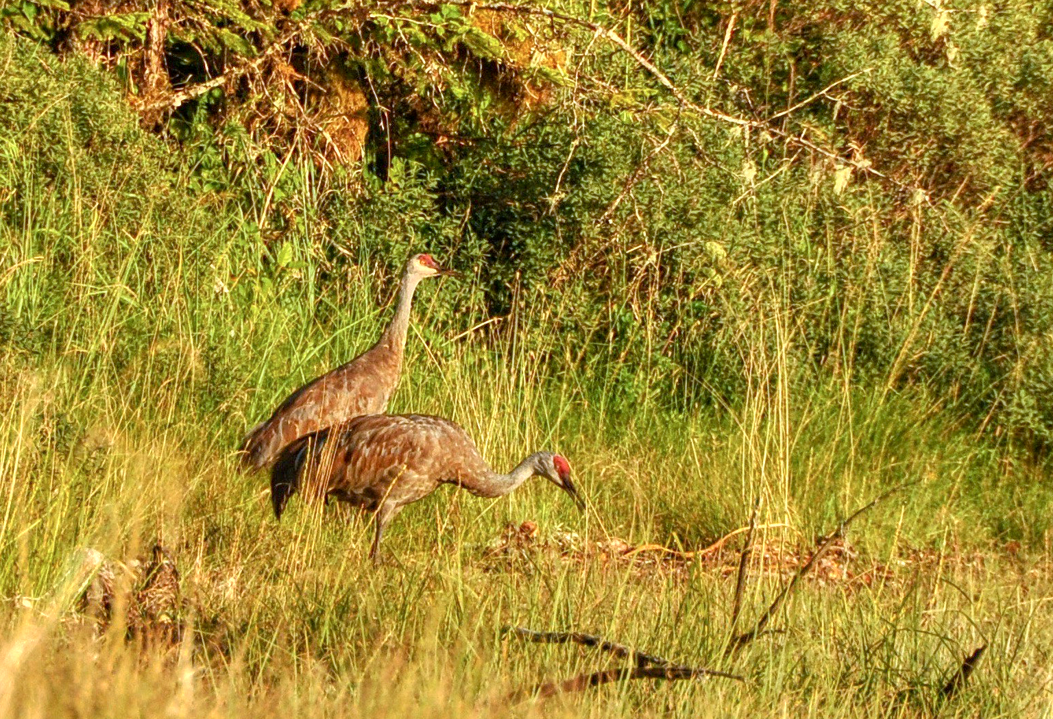
Sandhill Cranes in Higgins Passage
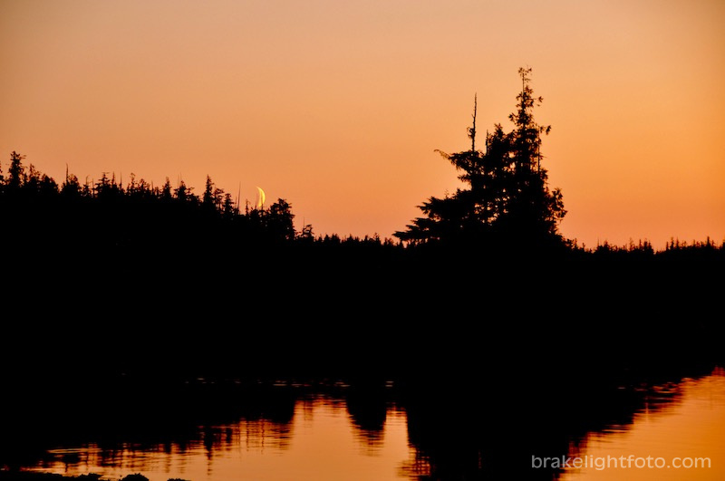
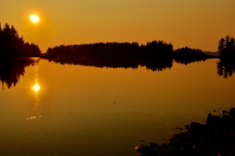
Sunset & moonset over Higgins Passage
We wake up early to another spectacular, calm, and very smokey morning. It is a perfect opportunity to catch the sunrise as it rises over the mountains to the east. After breakfast we pack up camp and head east down Higgins Passage. Higgins Passage is a winding, convoluted channel with a very low shoreline and is dotted with reefs, islets and coves. It makes for some very interesting paddling. We see another group of Sandhill Cranes in the passage and a black bear on the beach as we approach the eastern end.
Smokey Sunrise over Higgins Passage
A perfect morning to paddle through Higgins Passage
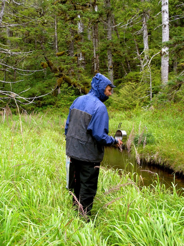
Our intended campsite for the night on Milbanke Sound doesn’t have a water source, so before we arrive there we need to resupply. We find a creek estuary near the end of the Higgins Passage that looks promising. Unfortunately our arrival here at low tide means we have very a long walk over the tidal flats to get to where the fresh water is running. However, we are successful!
Hiking back to the kayaks with fresh water in Higgins Passage
Higgins Passage to Milbanke Sound
Higgins Passage eventually leads into Milbanke Sound on the south end of Swindle Island. The BC Ferries turn north at Ivory Island on Seaforth Channel, and cross Milbanke Sound as they head north towards Klemtu and Prince Rupert. We make for a bay inside Pidwell Reef on the south shore of Swindle Island. The beautiful sand beach is ideal to land on, especially on this calm day. The rest of the north shore of Milbanke Island is steep and rocky with no place to pull out at all, so transiting the sound does require some caution as it is very large and very exposed to westerly winds.
Approaching the beach on Swindle Island just inside Pidwell Reef
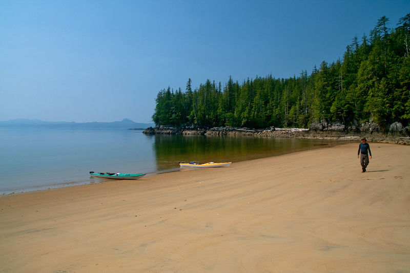
The beach on Swindle Island, Milbanke Sound – Dugald Nasmith Photo
Evening skies over Milbanke Sound
Milbanke Sound to the Roar Islets
This morning’s paddle will take us across Milbanke Sound towards the south end of Dowager Island and the entrance to Moss Passage. It is another perfect day, other than the smokey skies, with not a trace of a breeze. As we paddle along, there are hundreds of tiny fish surfacing all around us and Bonaparte’s Gulls are everywhere, swooping down to snatch them from the water.
Swindle Island’s steep rocky south shore
Crossing Milbanke Sound on a perfect day!
After crossing Milbanke Sound, we stop on a beach on Dowager Island to take a break and to clean a Red Rock fish Dugald has caught on the way in. Our route will take us down Moss Passage into the southern end of Mathieson Channel. We will have to pass through Percival Narrows, which is just 160 meters (523 ft) wide and currents there can run up to 5 knots. There is also the potential of large swell, so care must be taken when passing through here. Fortunately for us, our passage is uneventful. We continue across Mathieson Channel towards the northern tip of Cecelia Island and turned south down Reid Passage, eventually spilling out into Blair Inlet. We set up camp on one of the Roar Islets, just off the southern tip of Cecelia Island.
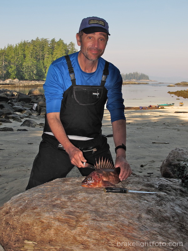
Dowager Island – Red Rock fish on the menu for lunch
Our Roar Islets campsite is the epitome of west coast kayak camping! Beautiful gravel beaches, rockweed covered rocky shoreline, and spectacular views in all directions. Since we feel fairly isolated on the island and are separated from Cecelia Island by a fairly good size channel we decide not to hang our food in the trees. This is something we always do to prevent the risk of loss to bears or other critters.Let’s just say we got lucky that night! In the morning, right near the bow of my kayak, there is a huge pile of fresh bear dung! We never heard anything that night and nothing was touched. It was as if the bear was telling us, “I’ll let you off this time, but here’s a warning!” It certainly could have spelled disaster for the continuation of the trip if things had gone differently.
Enjoying evening coffee on the Roar Islets
Sunset at the Roar Islets campsite
The morning brings thick heavy fog. You literally can’t see a thing. Such is life paddling on the west coast! We pack up, check the charts and set our compass headings and set out east across Blair Inlet working our way through the passages between the islands out to Seaforth Channel. We continue east towards Fisher Point, the most southerly point of the Don Peninsula. From here, the narrowest point, we will make our crossing of Seaforth Channel.
There is a totem standing high up on Fisher Point that is just visible from the water. Hoping to give time for the fog to lift we decide to land and see if we can find a trail out to it, but the forest undergrowth has grown up over time and has made it impassible.
Leaving the Roar Islets, crossing Blair Inlet in thick fog – Dugald Nasmith Photo
Back in out boats we make ourselves ready to make the roughly 2 nautical mile crossing of Seaforth Channel. It is a bit unnerving because the fog still hasn’t lifted and Seaforth Channel is the main passage for BC Ferries, cruise ships and other vessels working their way up and down the Inside Passage. We definitely want to make our crossing as quickly as possible to reduce the risk of getting run over. It is rather eerie sitting on edge of a passage like this listening for the rumble of ships engines in the distance.
Kayakers do not show well on ships radars, if anything we may appear as logs in the water and I’m sure if they hit us, they probably wouldn’t even notice. I have made the longer crossing of Johnstone Strait on the northeast coast of Vancouver Island, in similar conditions. For that crossing I stuffed a loose space blanket inside a large plastic garbage bag and strapped it to the rear deck of my wife’s kayak to make a crude radar reflector. I don’t know whether it actually worked or not, but we did make it across without incident.
Totem pole, just visible, near the center of the photo, at the tree line on Fisher Point
Listening for ships before crossing Seaforth Channel
It is only a few minutes after successfully crossing Seaforth Channel with our butt cheeks clenched that we here the ominous rumble of ships engines in the distance. Sure enough, a large cruise ship looms out of the fog!
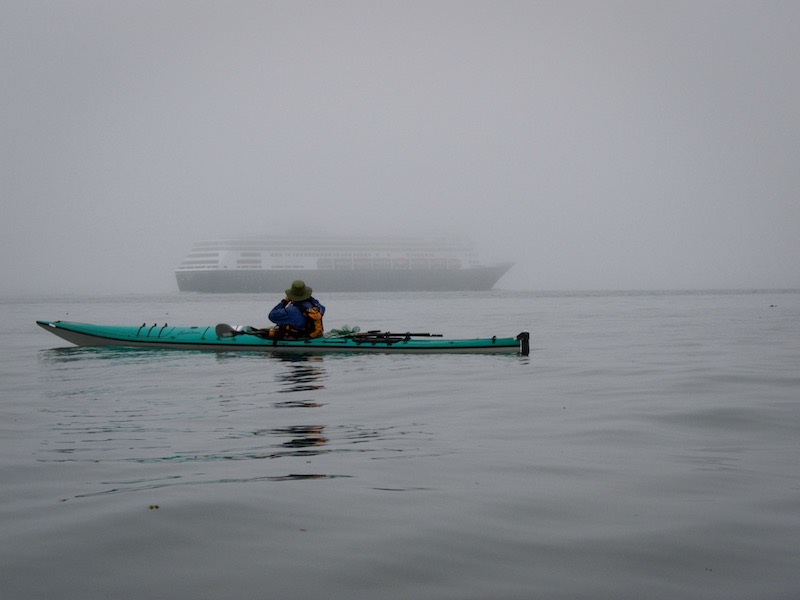
We had just crossed Seaforth Channel when a cruise ship loomed out of the fog – Dugald Nasmith Photo
We hug the north shore of Athlone Island, heading west, and begin to encounter large swells as we approach Cape Swain at the northwest corner of the island. This is the beginning of Seaforth Channel and the point where we will turn south down the exposed west coast of Athlone Island. Fortunately, even though the fog persists, the winds continue to remain calm.
This isn’t always the case with sea fog, which can be associated with high winds, unlike radiation fog experienced inland. We continue south toward a passage between Athlone Island and smaller Wutele Island where the fog is finally beginning to lift. Near the north end of Wutele Island we see our first real signs of civilization as we pass a floating fishing lodge with a steady stream of small boats coming and going and float planes readying to land.
Fog and swell off the west coast of Athlone Island
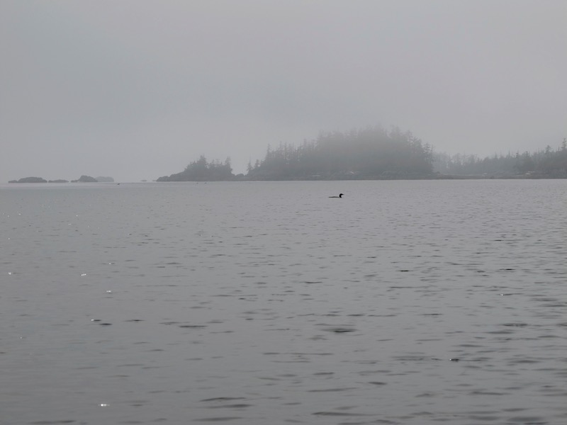
A loon in the passage between Athlone and Wurtele Islands…the fog is just beginning to lift
We swing around the southwest tip of Athlone Island, through a small channel and into a large bay where we find a spot to camp on a beautiful sand beach. This will become our base camp for the next 2 days which will allow us to do some exploration of the area.
The sun is beginning to shine as we approach the Athlone Island campsite
Our Campsite on Athlone Island
The remainder of the day we enjoy sunny skies and warm temperatures. The sun is so hot we actually need to set up our tarp to provide some shade! The next day we want to do some exploration, but we also will need.to track down a water source as there is none at this beach.
The next morning we set out on our day paddle and head out of the bay moving west in a light rain. We poke our bows into some small inlets and passages as we go. There are some very interesting rock formations and some very gnarly trees on this edge of the coast. The small, quiet inlets make for great exploration.
Searching for fresh water
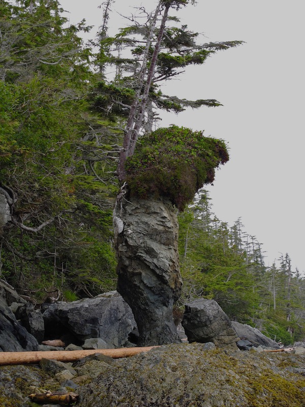
Interesting rock formations on south end of Athlone Island
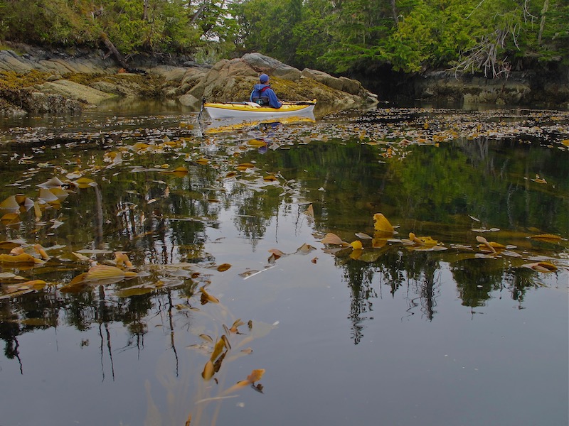
Exploring a small inlet on the south end of Athlone Island
Lunch stop on a sheltered inlet on Athlone Island
The following morning we pack up camp and set off west along the south shore of Athlone Island and head for Waskesiu Passage. This will bring us to Dufferin Island where we will turn northeast and head towards Joassa Channel, our passage north back to Seaforth Channel. At the very northern tip of Potts Island, at Quinoot Point, there is a small unnamed island with an excellent sheltered cove. Inside the cove is a long gravel beach and just behind it is a Heiltsuk cabin and a clear area for setting up tents.
Paddling into the cove north of Quinoot Point
Heilsuk cabin & campsite on unnamed island at Quinoot Point
Our Final Day
It’s great to have decent weather for your final day on the water, and our luck holds as we prepare to depart. It is calm with only a thin layer of broken cloud. We set out into Joassa Channel, which is a narrow meandering passage making for an interesting paddle. Joassa Channel eventually spills us back into Seaforth Channel at the north end of Horsfall Island. Here, we turn east towards Bella Bella and Shearwater and the end of our trip.
Joassa Channel
The BC Ferries ‘Northern Expediton’ in Seaforth Channel
We stop for lunch at Kynumpt Harbour, a large, beautiful bay on the northern tip of Campbell Island. The harbour was a traditional summer camp used by the Heiltsuk people for gathering berries and harvesting potatoes.
Lunch stop at Kynumpt Harbour on Campbell Island
Continuing along the north shore of Campbell Island we eventually come upon Driad Point and the beautiful lighthouse marking the entrance to Lama Passage and the route south to Bella Bella and beyond.
Approaching Driad Point
Shearwater
We are actually meeting the ferry at Shearwater rather than McLouglin Bay, which is the ferry terminal just south of Bella Bella where we began our Bella Bella to Port Hardy trip a couple of years previously. We make this choice because the ferry stops at Shearwater first before carrying on to Bella Bella later in the evening. This allows us to board and get settled before dark.
Shearwater was originally built in 1941 as an Royal Canadian Air Force antisubmarine and reconnaissance post and was abandoned in 1944. A large portion of the property was sold and developed into a fishing resort in 1947. Today, the hub of Shearwater is still the Shearwater Marine Resort where there is a general store, a marine store, accommodation, showers, laundry, post office, banking and the Fisherman’s Bar & Grill. There is moorage, yacht charters and marine services available here as well.
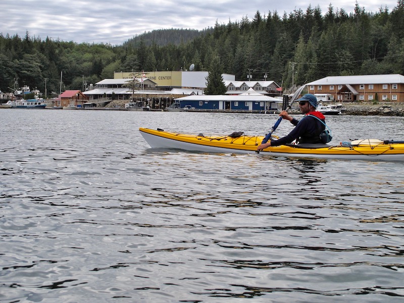
Passing Shearwater
The ferry terminal is on the far eastern edge of the resort and there isn’t much there except for the ferry dock itself. We land just east of the terminal, in an industrial area, on a concrete ramp used for bringing logs ashore. Since we have time to spare after getting the boats and gear ready for loading onto the ferry, we take a stroll through Shearwater to have a look around.
The Queen of Chilliwack approaching the Shearwater ferry ramp
Heading Home
Once the ferry is underway, we stand on deck for a bit and watch the sun as it slips over the horizon. Eventually we find a place to layout our sleeping bags so we can try to get some sleep during the overnight run to Port Hardy where are vehicle waits, roughly 11 hours away.
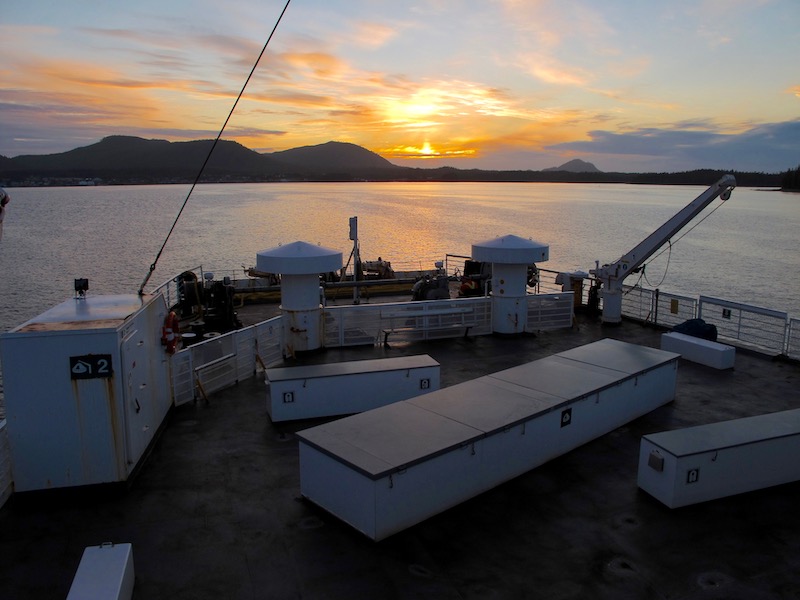
Sunset from the Queen of Chilliwack as it departs Shearwater
Map
More Photos
For more images of this trip or to purchase images for articles, websites, display etc, please check out our “Klemtu to Bella Bella” gallery at our sister website: Brakelightfoto
More Kayaking Posts
For more posts on our kayaking adventures click this link: Kayak Adventures
Another great account with superb photos!
Inspiring!
Think we might attempt the same route this summer!
Thanks fellow-kayakers.
Thank you! I hope you get out there, it’s well worth it!