
A Paddling Trip from the Yukon River Bridge to Schwatka Lake
I was really looking forward to paddling this portion of the Yukon River and kayaking Miles Canyon, a short, but incredibly beautiful and historic stretch of the river just a few miles southeast of Whitehorse.
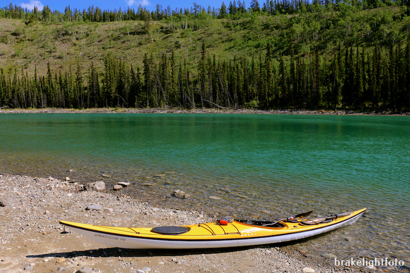
The paddle begins at the Yukon River Bridge, where Highway #1, the Alaska Highway, crosses the Yukon River, about 30 km southwest of Whitehorse. There is a pull-off here and a boat ramp making access to the river easy. My only concern was the Lewes flood control dam just downstream from the put in, which I was expecting to have to carry around. I really didn’t have any idea how I was going to accomplish. I didn’t even know which side of the river was best. To make matters worse the whole approach was completely obscured in heavy fog.
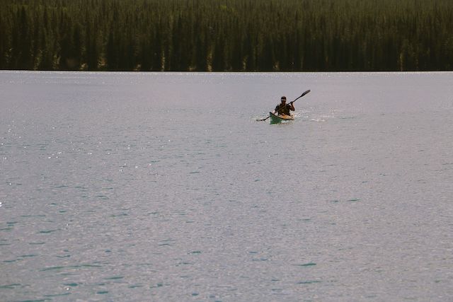
In spite of that, I set off, paddling in stunningly beautiful, perfectly flat calm conditions. Fortunately, the fog began to burn off as I approached the dam and as I got closer I could see that the water was flowing right through the structure. It turned out to be just fast moving water with no drop so, as it turned out, there was nothing to worry about. That brought the tension level down and from there, the current slowed down with the average speed running around ½ to 1 nautical mile per hour (.93 to 1.85 kmph).
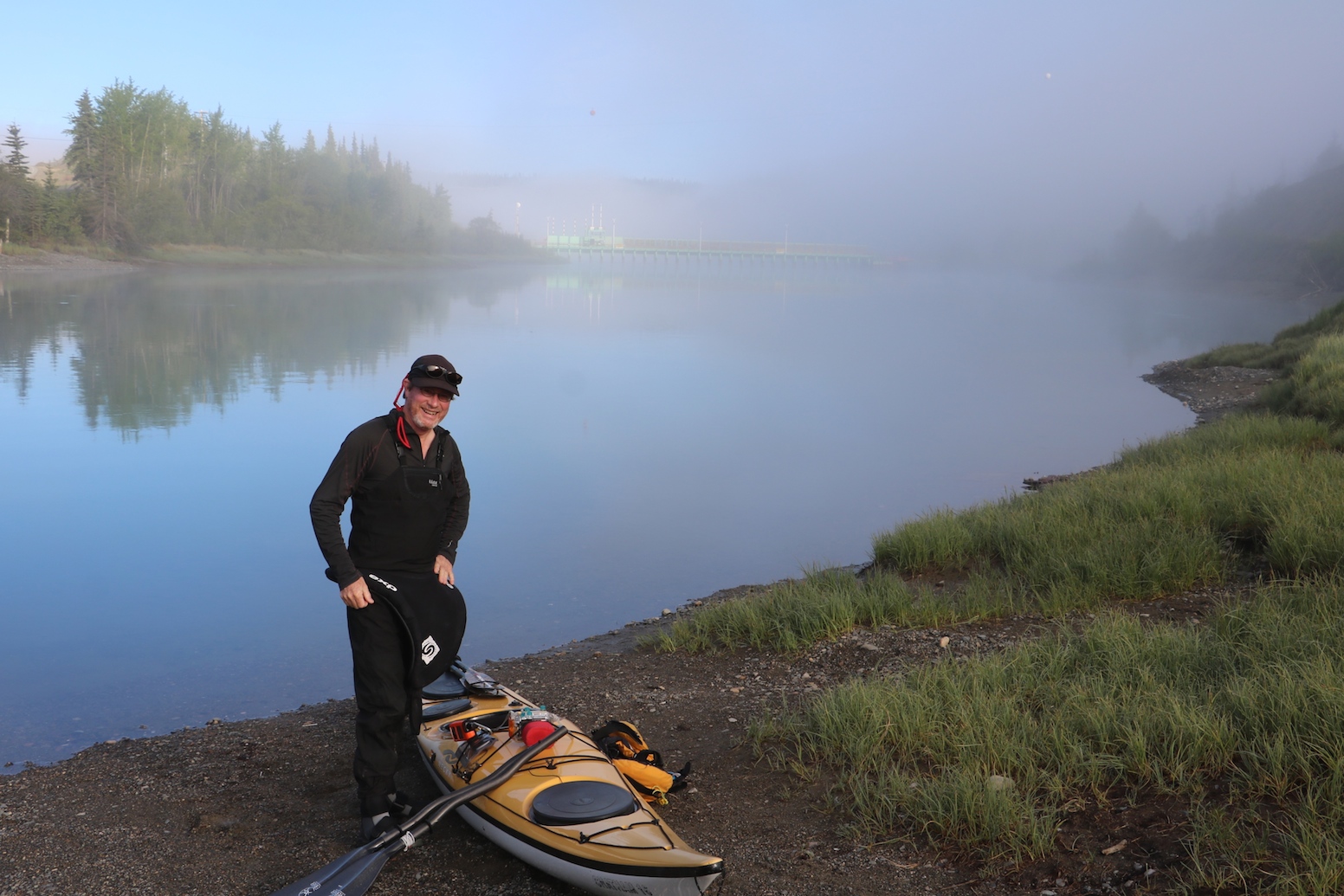
The foggy put in at the Yukon River Bridge on Highway #1
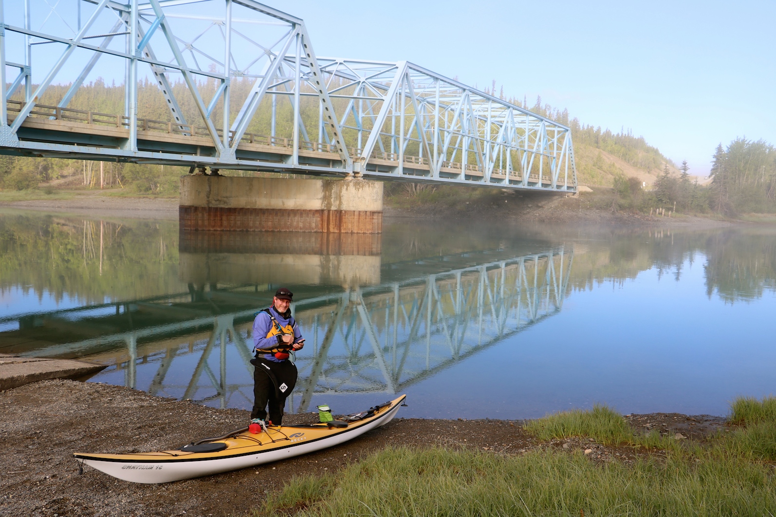
The Yukon River Bridge
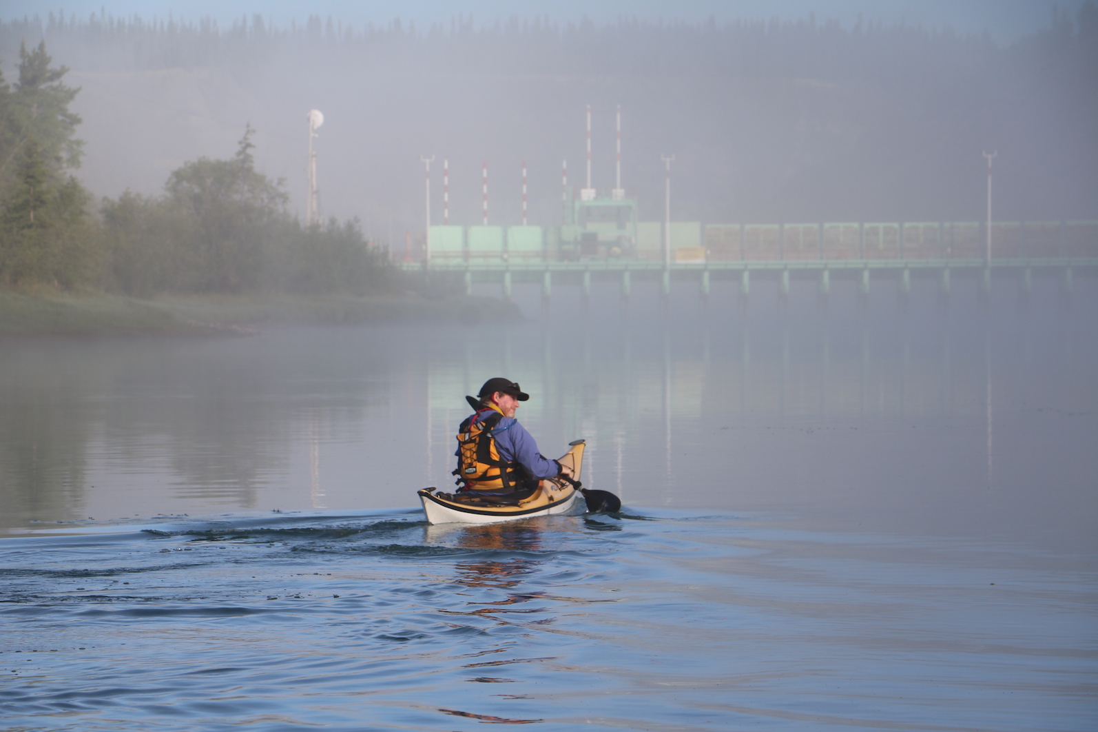
Heading towards the Lewes Dam
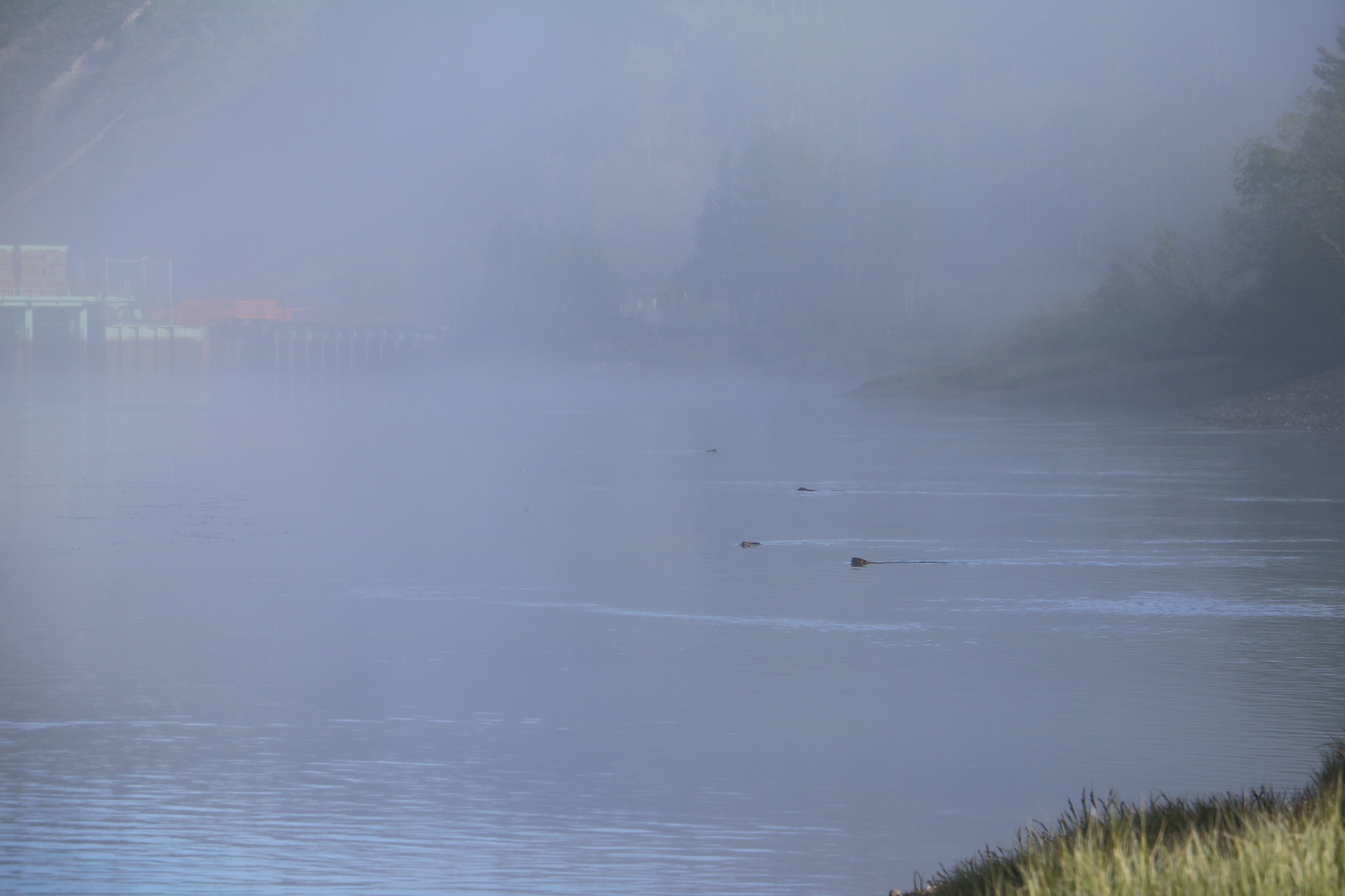
Curious Beavers swimming out to check me out as I paddle past
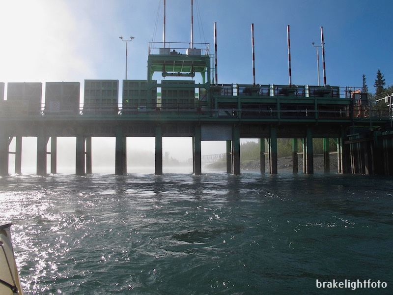
The Lewes Flood Control Dam from the downstream side
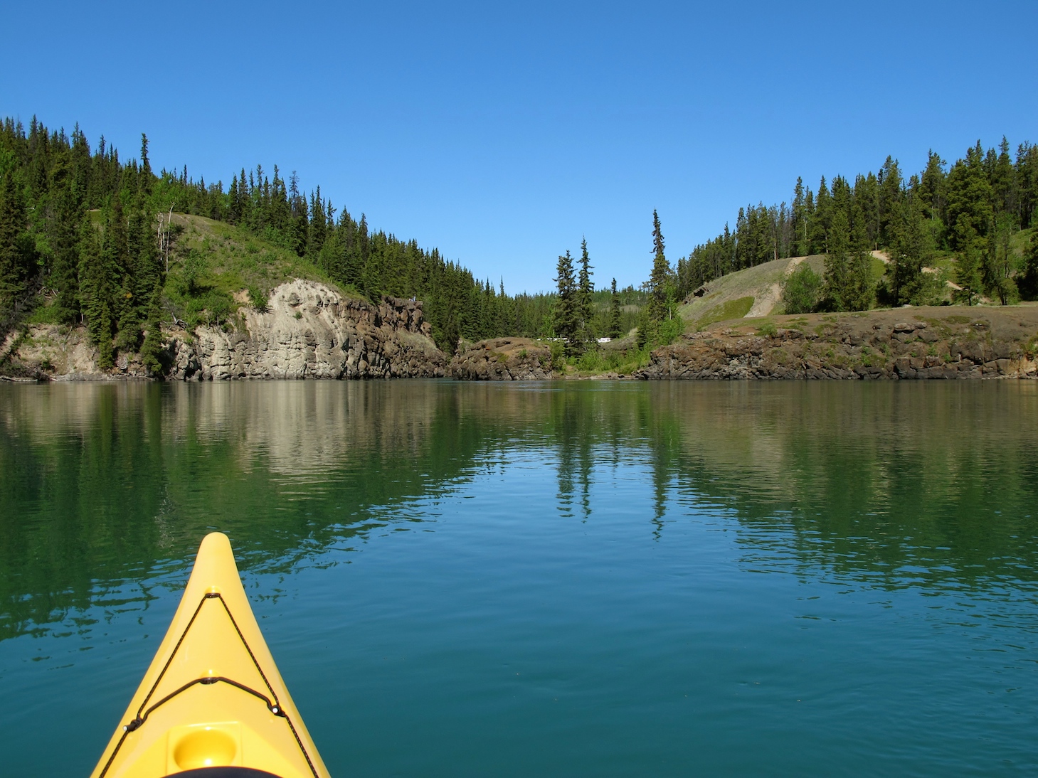
The waters of the Yukon gently meander through the landscape, carving through high sandy bluffs and the boreal forest. The waters during the summer are a silty green grey but when the angle of the light is right they reflect a beautiful emerald green. Around every corner of the river there are spectacular vistas of distant mountains, some snow capped. I was hoping to spot some wildlife, but other than a few beavers coming out to check me out and a few Golden Eyes and Buffle Heads, that was it.
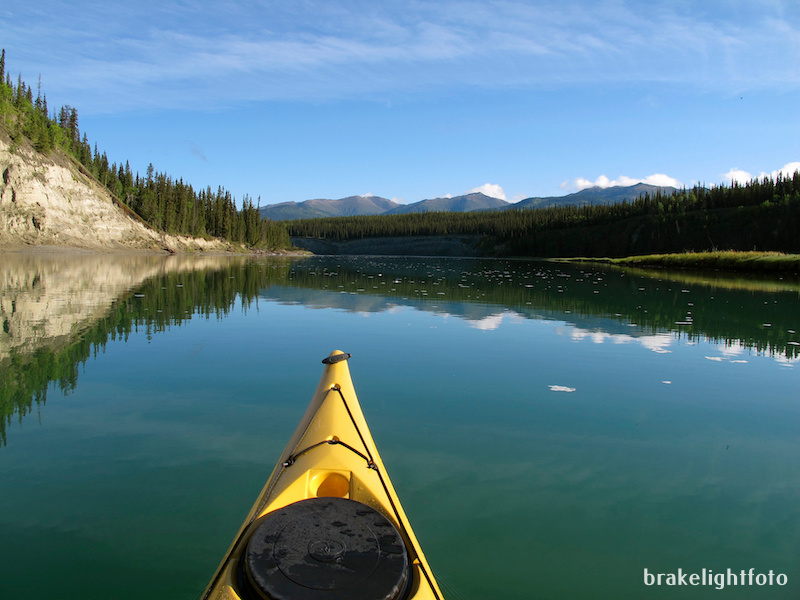
Perfectly calm waters and stunning views
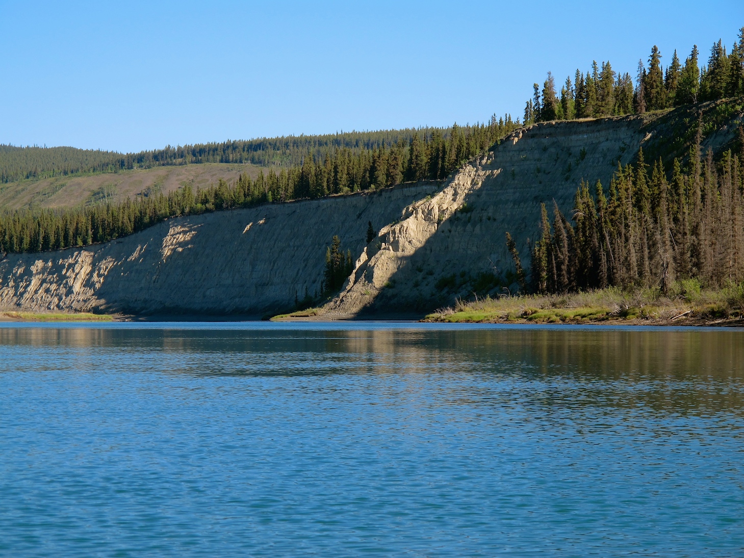
Large Sandy Bluffs
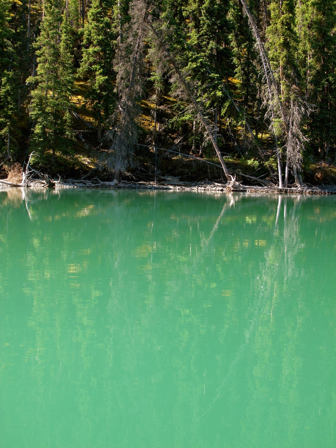
Silty Grey Green Waters
Lunch Stop at an old Paddle Wheeler Firewood Loading Station
I stopped for a lunch break not far above Miles Canyon, at a spot where the paddle wheel steamboats used to stop to take on firewood. There is still an old steel bollard where they would tie up the ship and a series of well tagged, concrete bunkers where the firewood was stored.
Lunch stop at the paddle wheeler firewood bunkers
One of the firewood bunkers
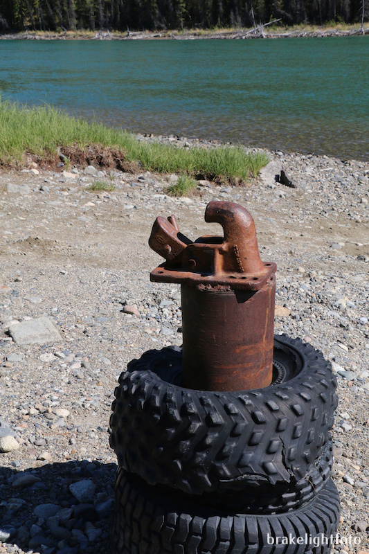
Bollard for tying up paddle wheelers
Canyon City
During the gold rush of 1897, stampeders on their way from Skagway via the Chilcoot Pass, found themselves on the shores of Bennett Lake. Here they had to build boats or rafts to carry them down the series of lakes eventually draining into the headwaters of the Yukon River. After gently flowing for approximately 20 miles the river eventually lead them down through the treacherous waters of Miles Canyon and the White Horse Rapids, from which Whitehorse would eventually derive its name. Due to numerous accidents and a few deaths, the Northwest Mounted Police stepped in and required anyone running the rapids to hire a qualified pilot. They also established a checkpoint for contraband and collecting duties. The results were a congestion of boats and people at clearing just above the rapids and the creation of a tent city known as Canyon City.
Canyon City today
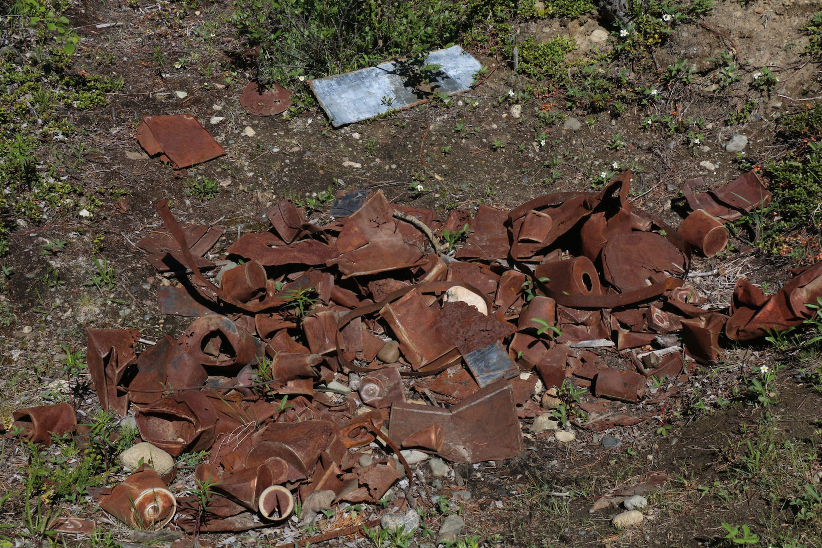
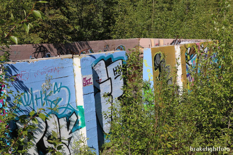
Tin Can Midden Excavation
In 1897, two entrepreneurs from Victoria, BC capitalizing on the obstacles presented by Miles Canyon and the rapids, built a log tramways on either side of the river. For a fee, their mule-drawn tram-cars carried goods and small boats around the rapids for those unwilling to risk their goods or lives. A roadhouse and a saloon provided lodging and refreshments to the tens of thousands of gold seekers on their way to the Klondike. Just three short years later the gold rush was over and Canyon City was abandoned and the buildings moved downstream to the new town of Whitehorse. Today there is nothing left of Canyon City beyond the flat spot where it was established with some information signs, a tin can midden, and a display of one of the log tramways.
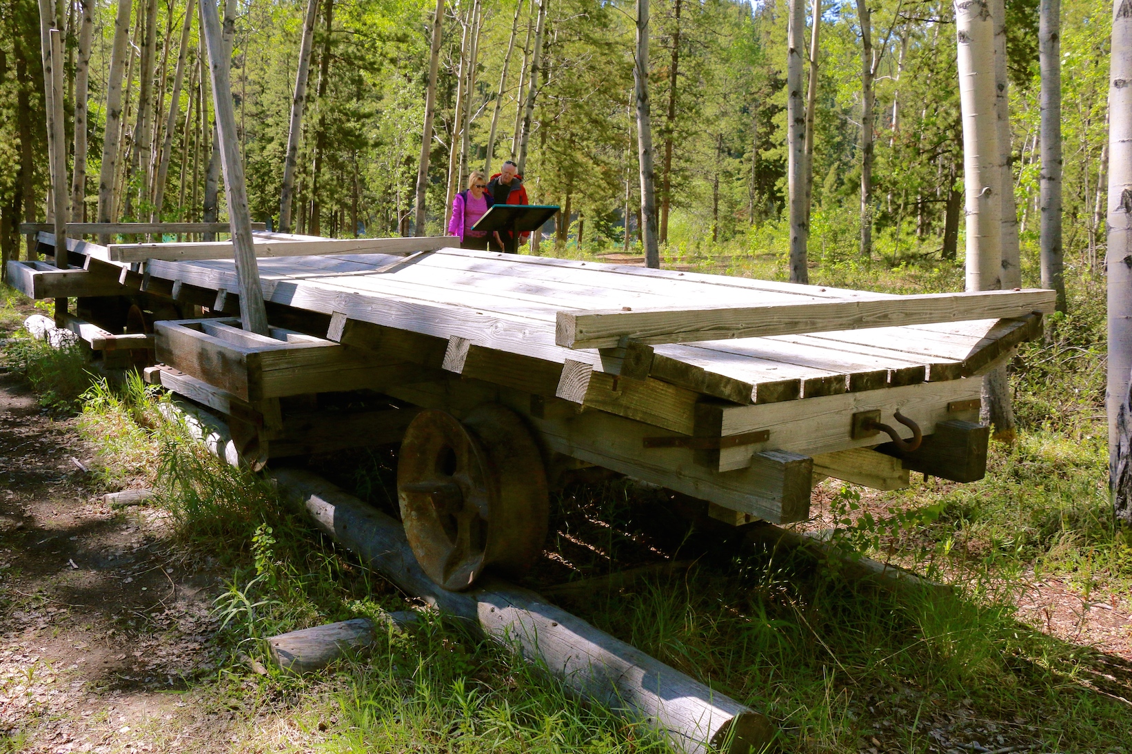
Log Tramway at Canyon City site
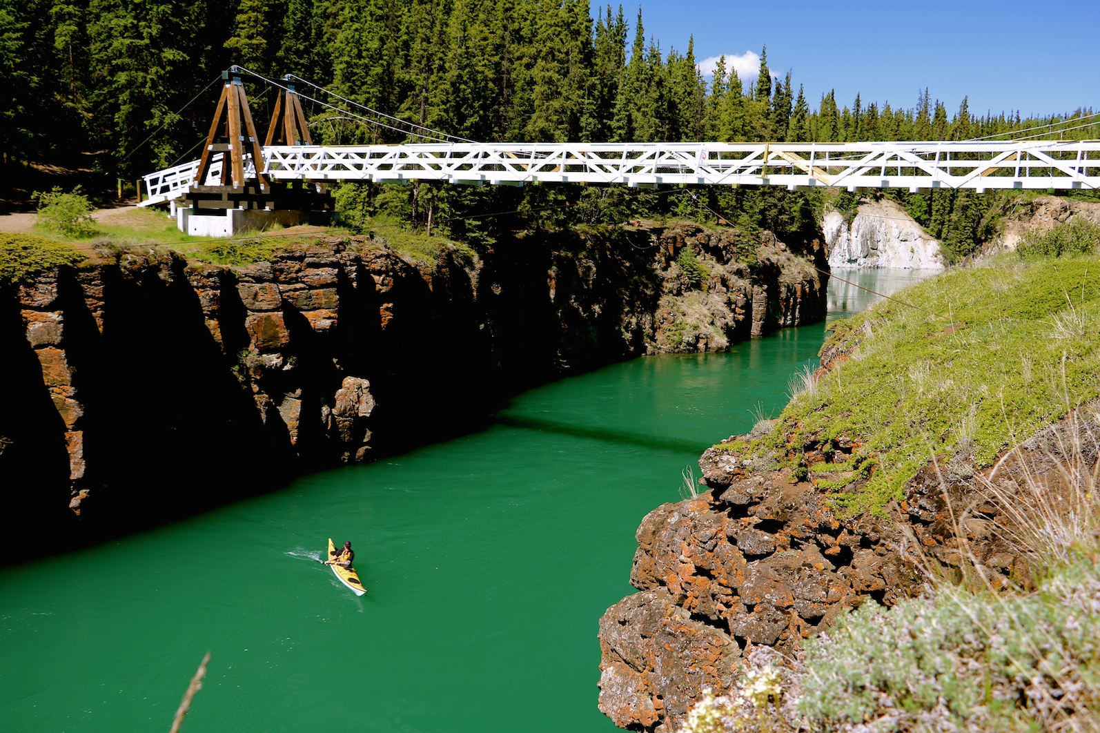
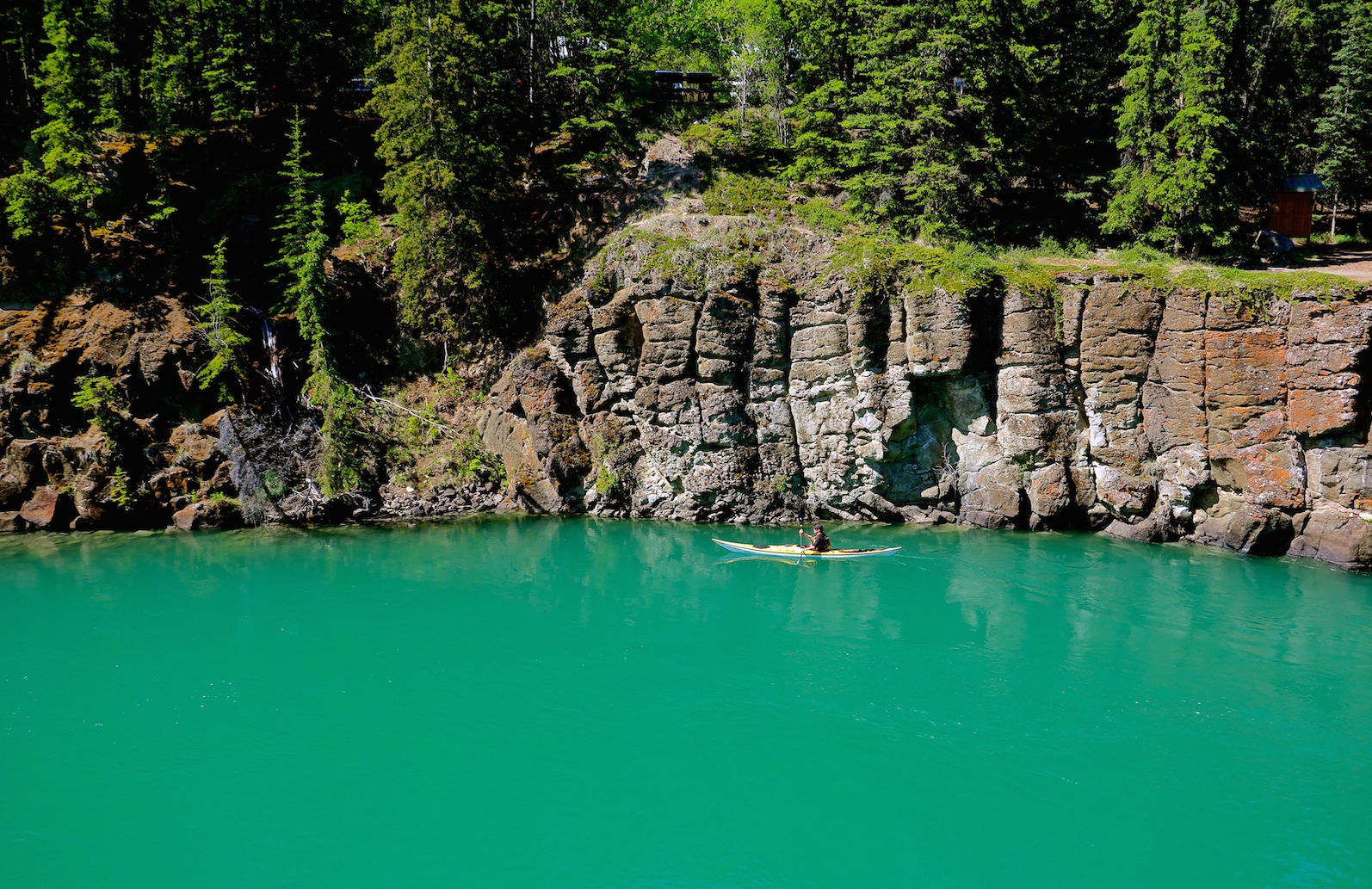
Miles Canyon
Miles Canyon was the highlight of the trip. The river swings around a sharp corner and the canyon comes into view, narrowing considerably as it is pushed through the 50 foot columnar basalt walls. During the days of the gold rush these walls were much higher as the water level was much lower and the canyon was a raging white water rapid. Sadly, at least from the perspective of an old white water paddler, the construction of the Whitehorse hydro-electric dam in 1958 tamed Miles Canyon and has replaced the once treacherous White Horse Rapids with the Schwatka Lake reservoir. Today, even novice paddlers can enjoy the gentle drift through the canyon with current speeds running round 2 – 2 ½ knots.
Thanks to my beautiful wife, Linda for meeting me at the canyon and taking some awesome photos! This is where our inReach satellite messenger came in really handy. I was able to contact here and let her know when to rendezvous with me at the canyon, even when I didn’t have any cell signal.
Approaching Miles Canyon
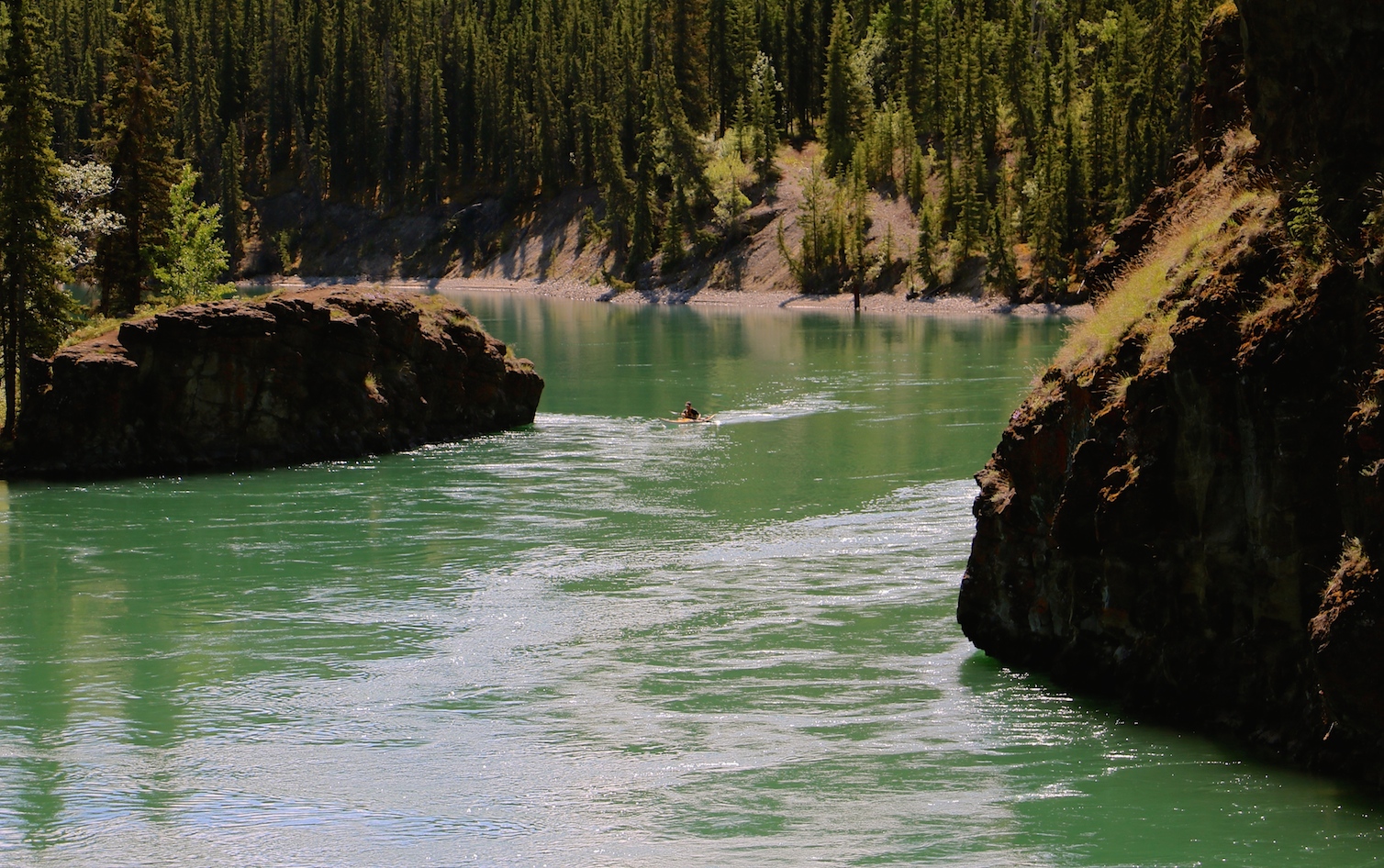
Entering Miles Canyon
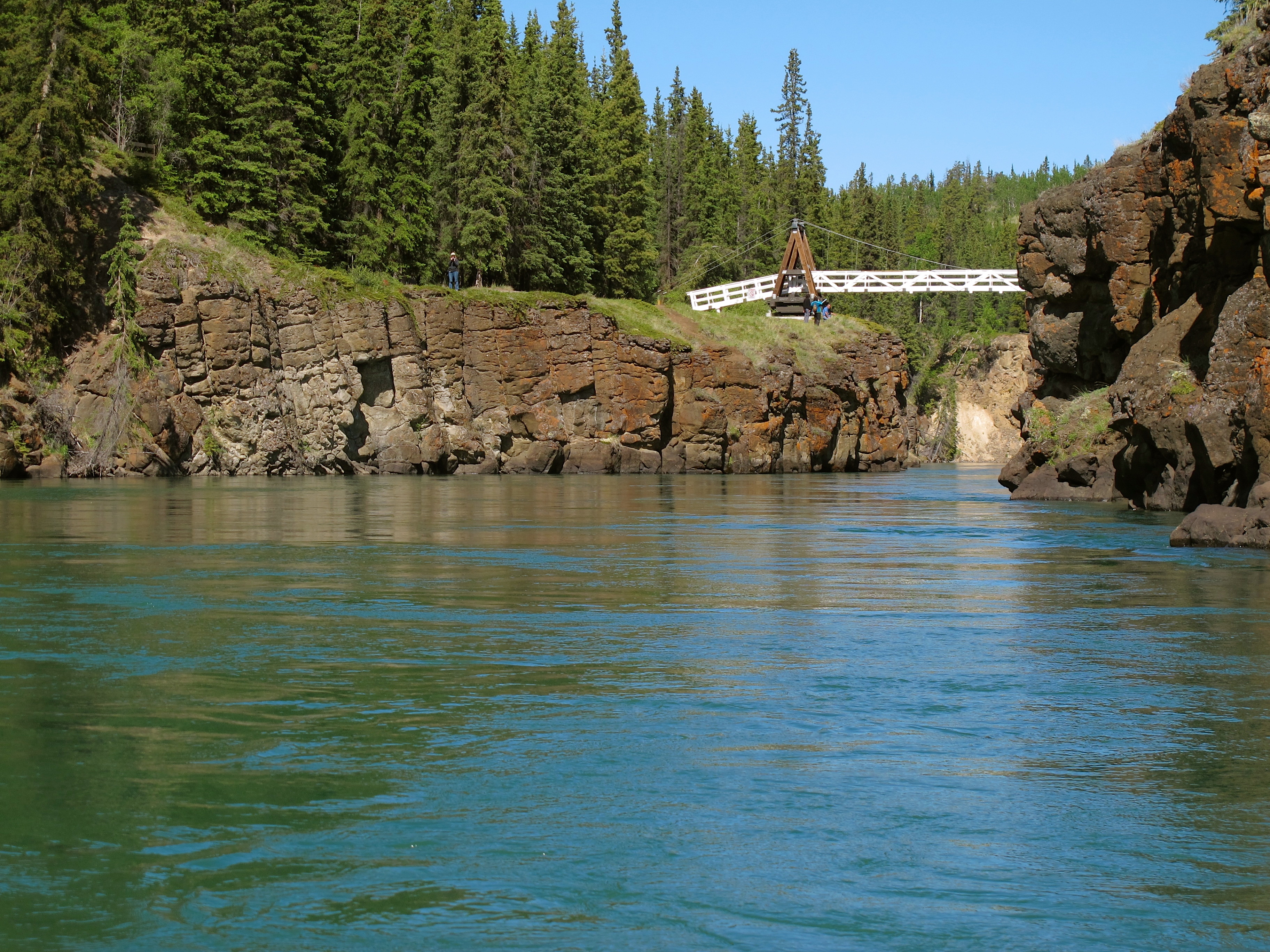
The Robert Lowe Suspension Bridge comes into view
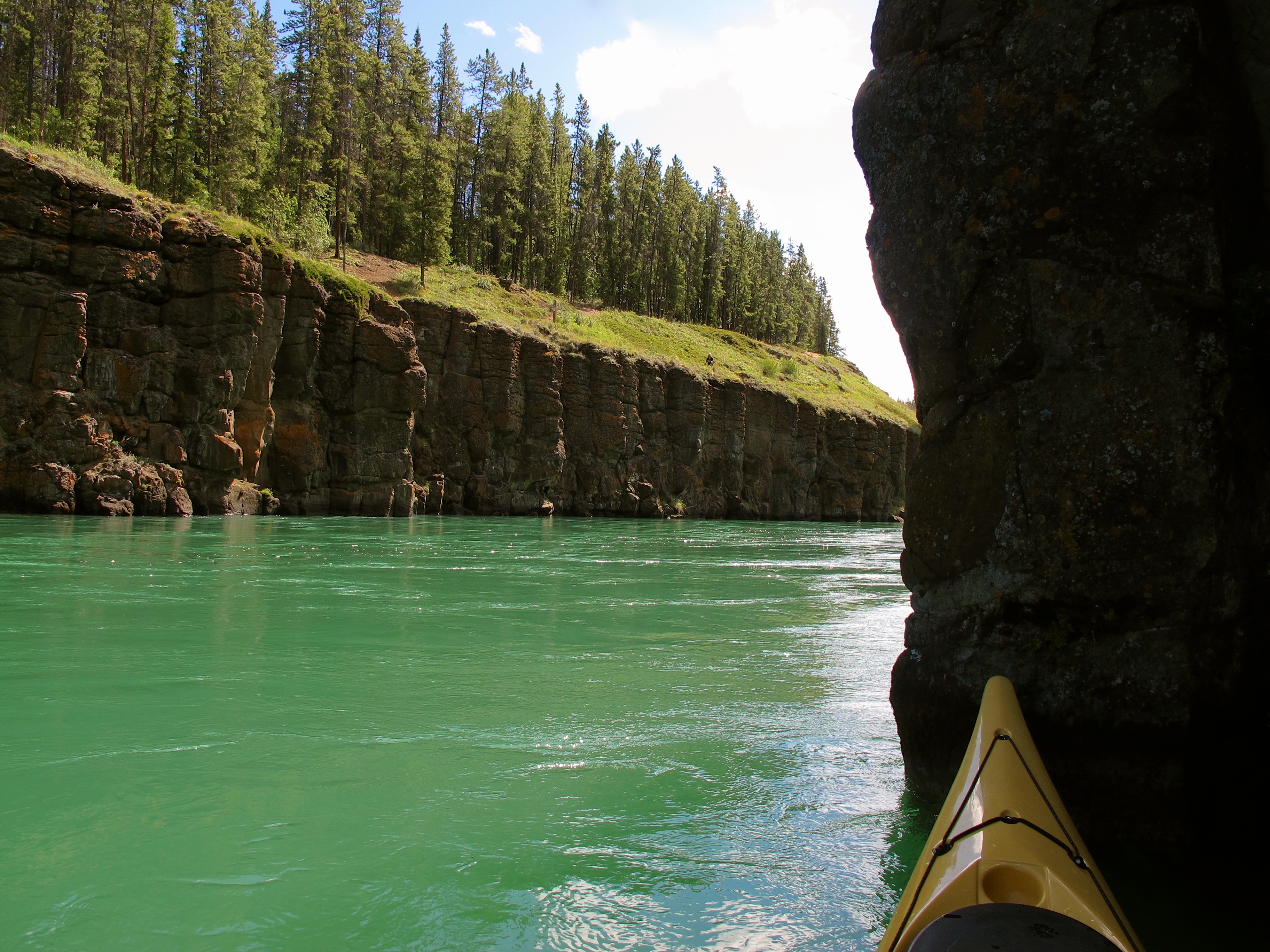
The 50 foot columnar basalt walls In the canyon
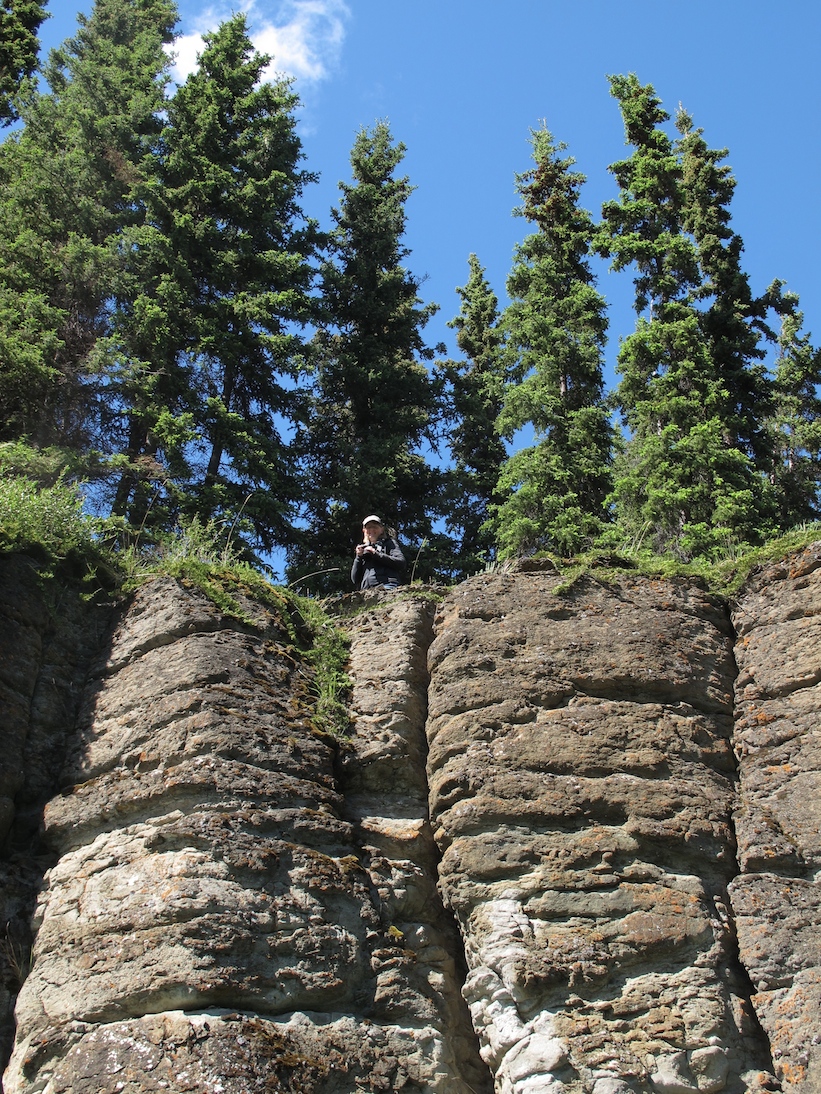
Linda photographing from the cliffs
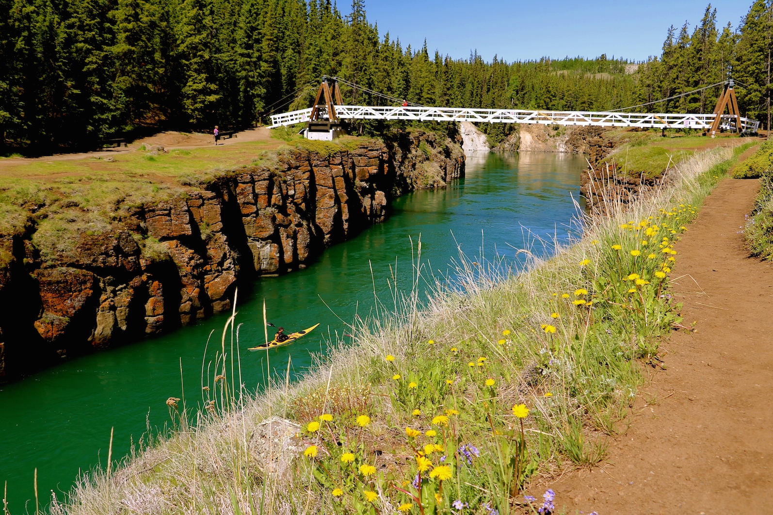
Photo opportunities abound
Playing in the Canyon
Miles Canyon
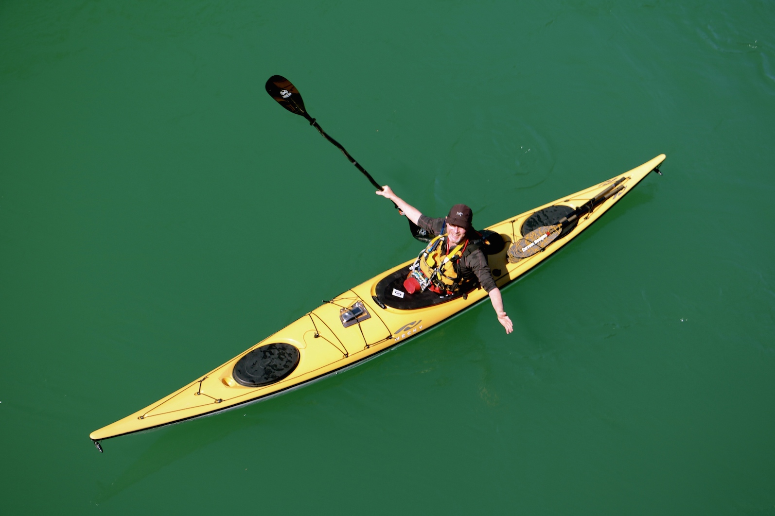
Oh Yeah!
Schwatka Lake
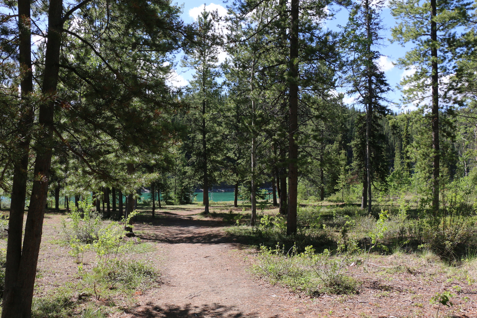
Once you are clear of Miles Canyon, you enter Schwatka Lake and it is just a short paddle to the take out, which is just before the seaplane base. There is a good wide pull off area in front of a gated road with room to park vehicles. The total trip length was 16 nm (29 ½ km). If you want a shorter trip and just want the opportunity to explore Canyon City and paddle Miles Canyon there is a put in off a dirt road not far above Canyon City and the canyon.
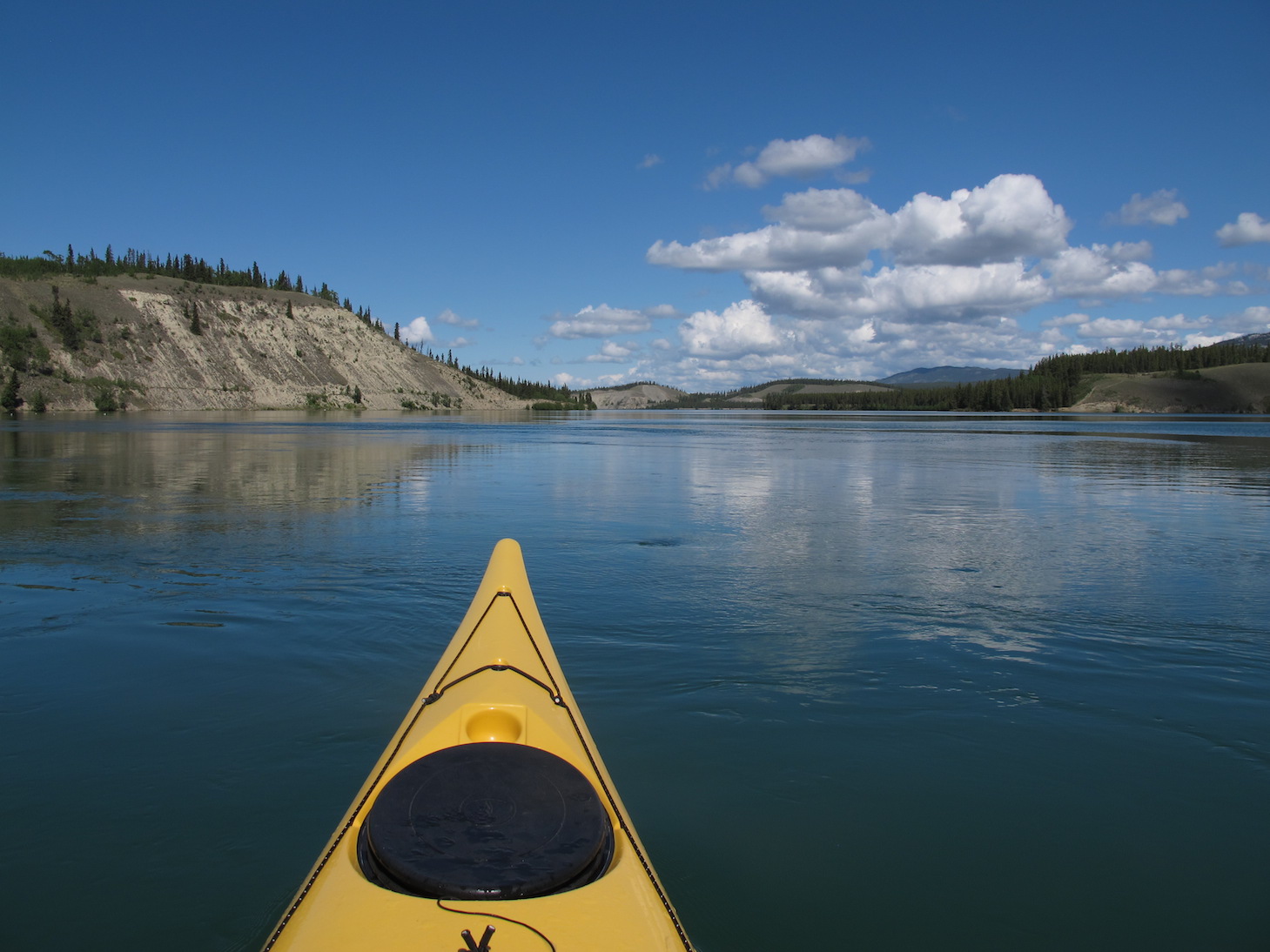
Entering Schwatka Lake
Crossing Schwatka Lake to the takeout
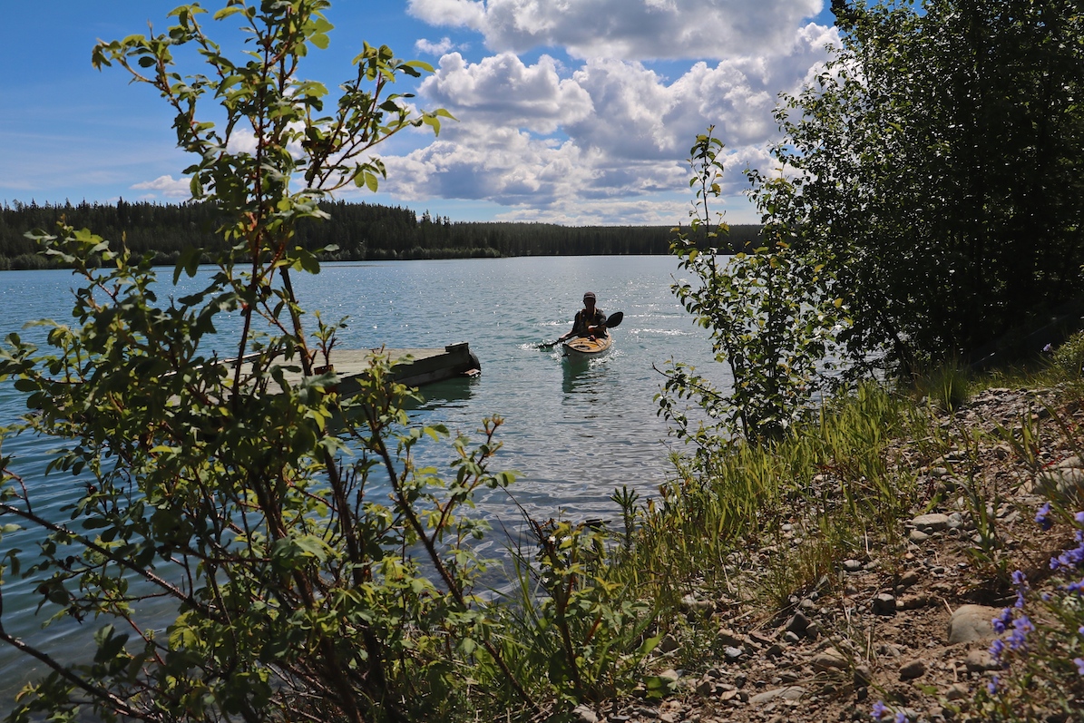
The Take Out

Yukon River Bridge to Schwatka Lake Trip Map
To Purchase Photos
To see more images or purchase images seen in this post, check out our sister website by clicking this link: Photos of the Yukon River
Leave A Comment