
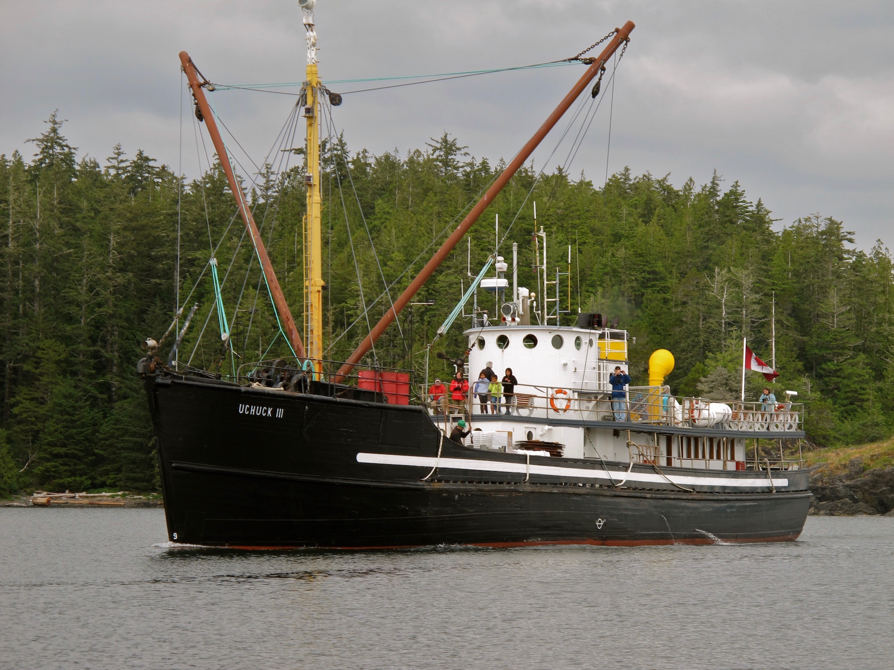
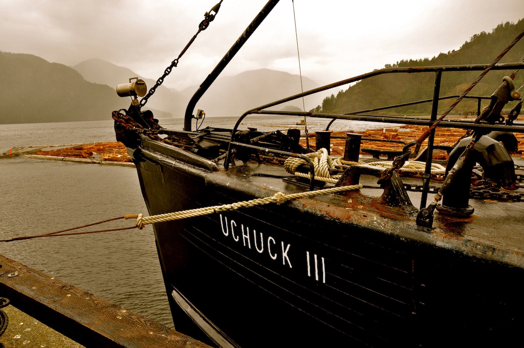
The Uchuck III
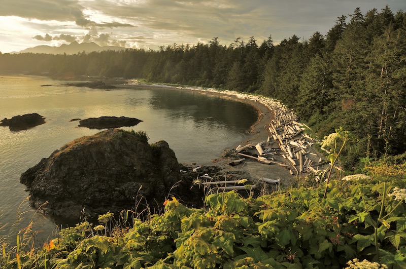
Kayaking From Kyuquot to Nootka Sound
I have been to Kyuquot Sound off the central coast of Vancouver Island a few times, but when my good friend and paddling buddy, Dugald, suggested we do a one way trip leaving from Kyuquot and take out in Nootka Sound, I jumped at the chance.
The Uchuck III – A Great Way to Get You & Your Kayak to the West Coast
The trouble with locations like Kyuquot Sound and Nootka Sound is they are very remote and there is no road access to them. The closest you can get to Kyuquot is Fair Harbour, about 12 nautical miles (22 km) away by water and the trip from Gold River to Yuquot in Nootka Sound is about 22 nm (40km) away. Both are long runs up steep tree lined inlets that don’t make for interesting paddling and they will add a minimum of a day each way to your trip.
What makes this particular trip interesting and unique, is that we will use an antique coastal freighter, the Uchuck III, to access and depart the coast. This has a three-fold advantage. First, we eliminate a daunting two car shuttle, leaving one vehicle at the dock in Gold River and the other one in Fair Harbour almost 5 hours away. Secondly, we avoid the long, boring inlet paddle from Fair Harbour to Kyuquot and the even longer run from Yuquot (Friendly Cove), up Muchalat Inlet, back to Gold River. Thirdly, and best of all, we get to ride a very cool and historic coastal freighter on a working freight run through some incredible west coast scenery.
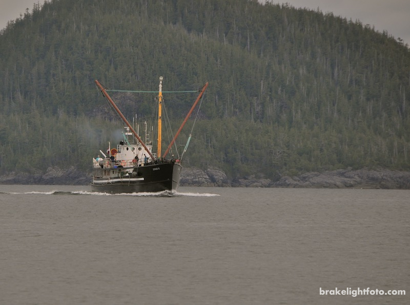
The Uchuck III
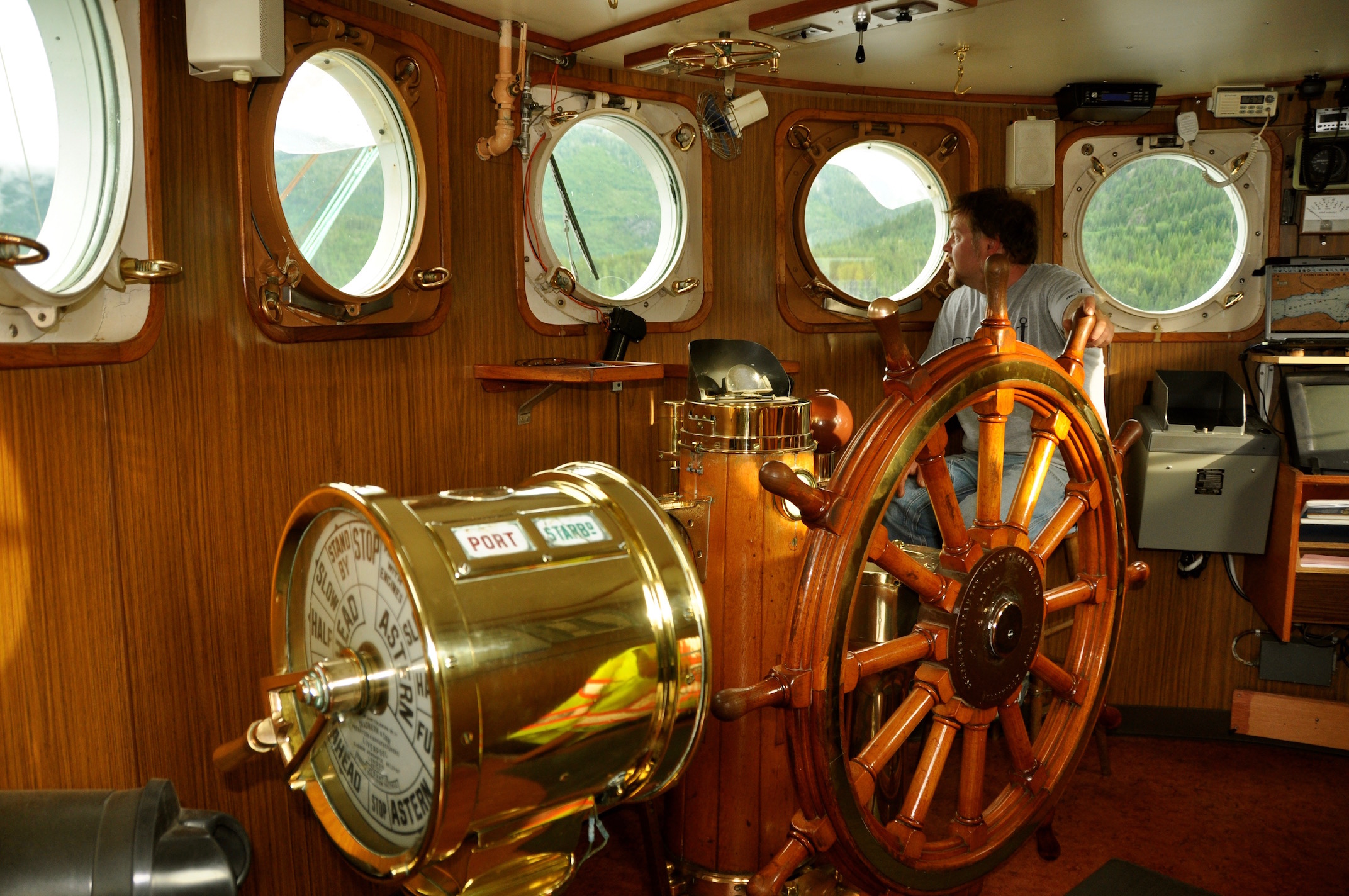
Uchuck III Bridge – ‘don’t touch the brass!’
The Uchuck III is a World War II minesweeper built in 1942, which was converted to a coastal freighter designed to accommodate 100 passengers and cargo. Her name comes from the West Coast First Nations Nootkan word for “healing waters” and she has been serving the coast of Vancouver Island for over 50 years. This historic vessel has been carefully reconditioned with a comfortable wood-finished lounge, coffee shop, and spacious seating on the open-air upper deck.
If you are ever on the Uchuck, make sure to check out the bridge, but don’t touch the brass! I made that mistake! Stops are made along the route at fish farms, logging camps and settlements to deliver supplies and passengers or to drop off paddlers and their boats. You get to see a working coastal freighter in action. The Uchuck III is run by Get West Adventure Cruises, which also offer day and overnight cruise packages, a wonderful way to see some of this remote coast if you’re not a paddler.
The Uchuck III at Gold River
The History
Kyuquot is a settlement and First Nations community located on Kyuquot Sound. The Ka:’yu:’k’t’h’/Che:k:tles7et’h’ (Kyuquot & Checleseht) First Nations people were part of a trade network that ran up and down the west coast and stretched to the east side of Vancouver Island and most likely, much further.
One of the more interesting things about Kyuquot Sound is that sea otters were first reintroduced to the coast of Vancouver Island just north of here. Sea otters had completely disappeared from the coast due to over hunting by European fur traders and native hunters in the late 18th and early 19th century. Between 1969 and 1972 approximately 100 sea otters from the the Aleutians were brought into Checleset Bay as an experiment to see if their populations could be restored. The project has been a great success as Sea Otter populations have rebounded up and down the coast of the island.
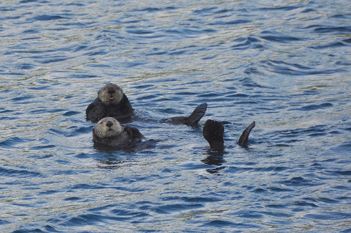
Sea Otters in Nootka Sound
At the other end of our trip is Yuquot or Friendly Cove with a population of about 25 people. In the past, as a summer home of Muchalat people, it housed approximately 1500 people in 20 traditional longhouses. There is a lot of history in this part of Nootka Sound. This is where Captain James Cook became the first European to set foot on British Columbia soil in March of 1778. The only Spanish settlement ever established in Canada, was maintained near here between 1789 and 1795 and Bligh Island, the largest island in the sound, is named after the much maligned British Naval Captain who was here with Captain Cook in 1778.
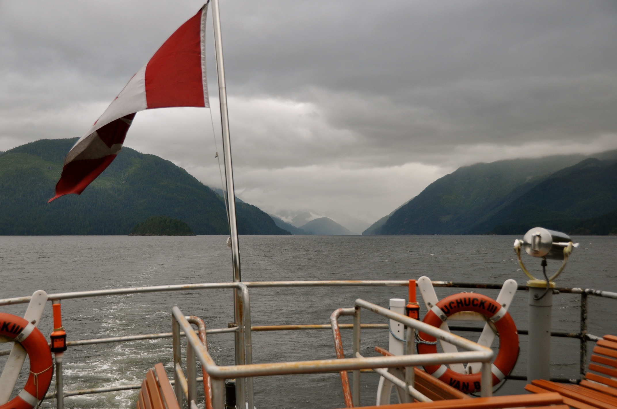
The Uchuck III – Gold River to Kyuquot
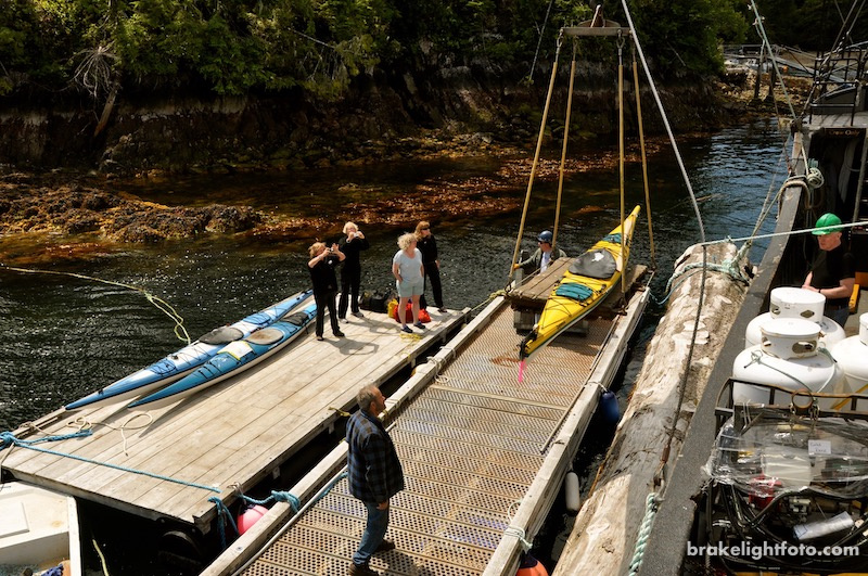
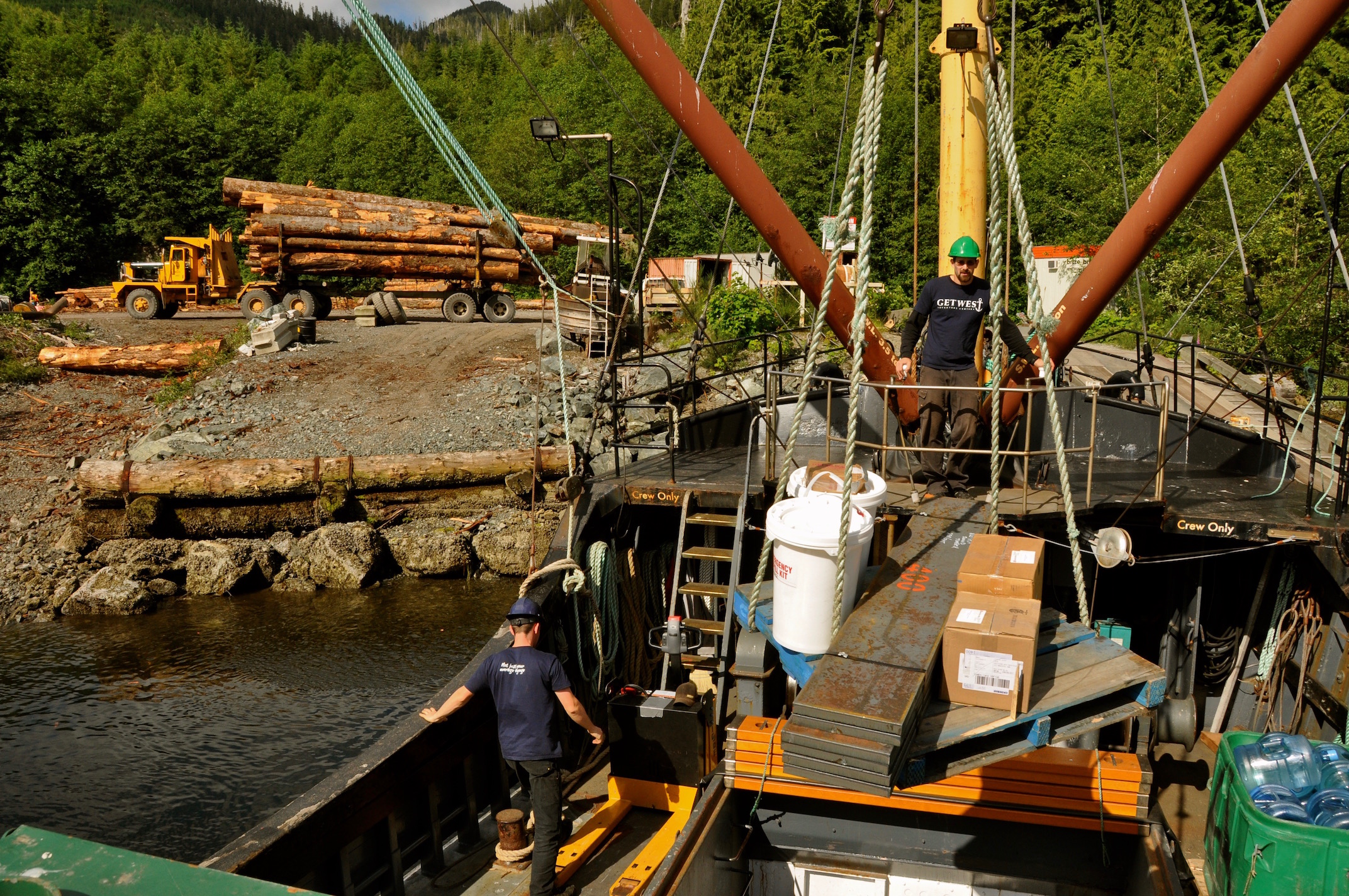
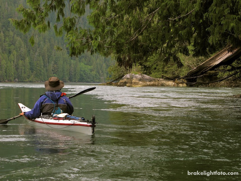
After checking in with Get West Adventures, we load all of our gear into a large wooden crate that will be lifted onto the Uchuck by the ships cargo winch. We carry our empty kayaks on board and stow them on the deck. They are blocked and secured so they don’t roll around if we hit rough seas off the west coast. We depart Gold River at 7 in the morning and head down Muchalet Inlet. We make our first stop at a fish farm to unload fish food and supplies. At the end of Muchalet Inlet, a roughly 25 km run, we turn right into Hanna Channel and work our way up Tahis Inlet, on the east side of Nootka Island.
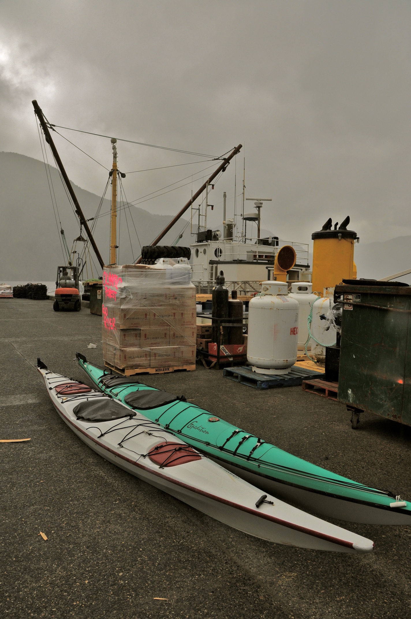
Ready to load in Gold River
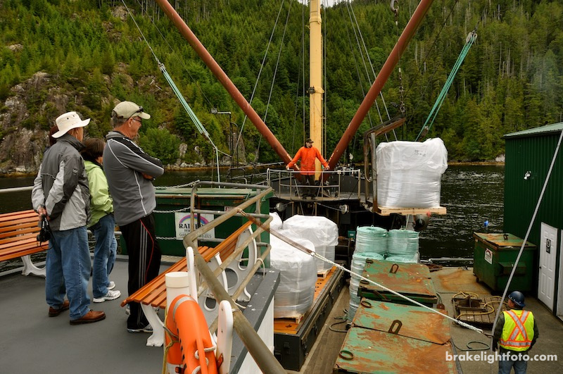
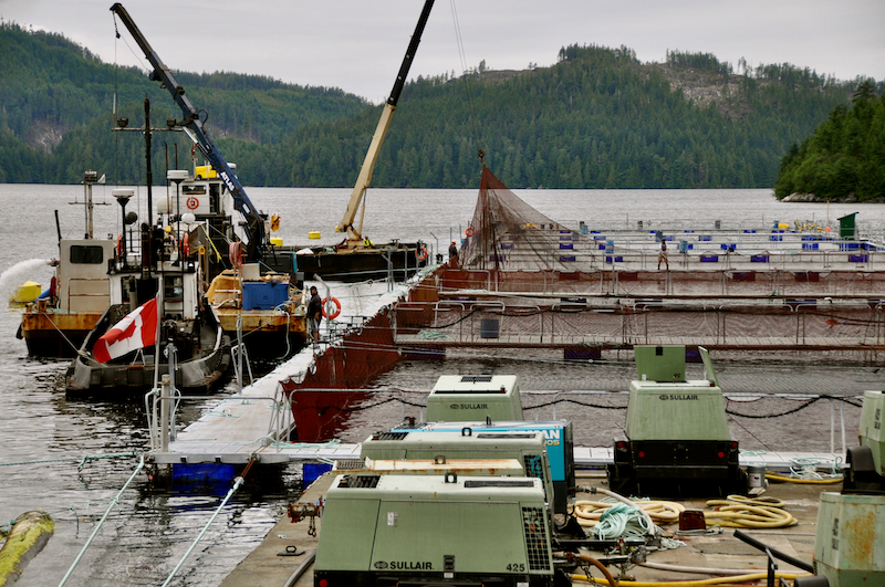
Uchuck III unloading supplies at a fish farm in Muchalat Inlet
At the north east end of Nootka Island we make we turn into Tahsis Narrows and work our way up Hecate Channel before turning west into Esperanza Inlet. We will drop off a group of kayakers, who plan to paddle Esperanza Inlet and the Nuchatlitz Islands, at Garden Point near the north west end of Nootka Island. From here we will cross the inlet to Port Eliza and drop off some supplies at a logging camp.
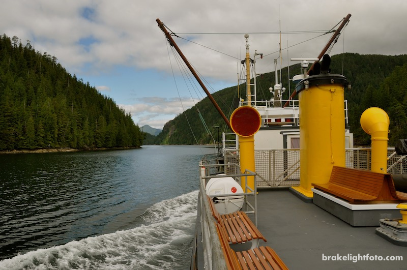
Uchuck III in Tahsis Narrows
Unloading Kayaks and Paddlers at Garden Point, Nootka Island
Logging Camp Delivery in Port Eliza
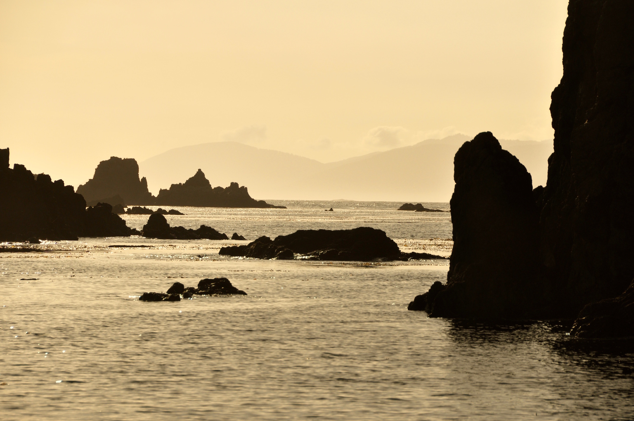
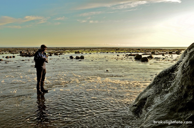
Leaving Port Eliza we turn west and head out of Esperanza Inlet onto the open west coast to begin our northward leg to Kyuquot. As anticipated we plunge through large rolling swells as we approach the coast and then take them on the beam as we make our way up the coast. This makes for an interesting, but rough ride and results in a couple of cases of sea sickness with our fellow passengers.
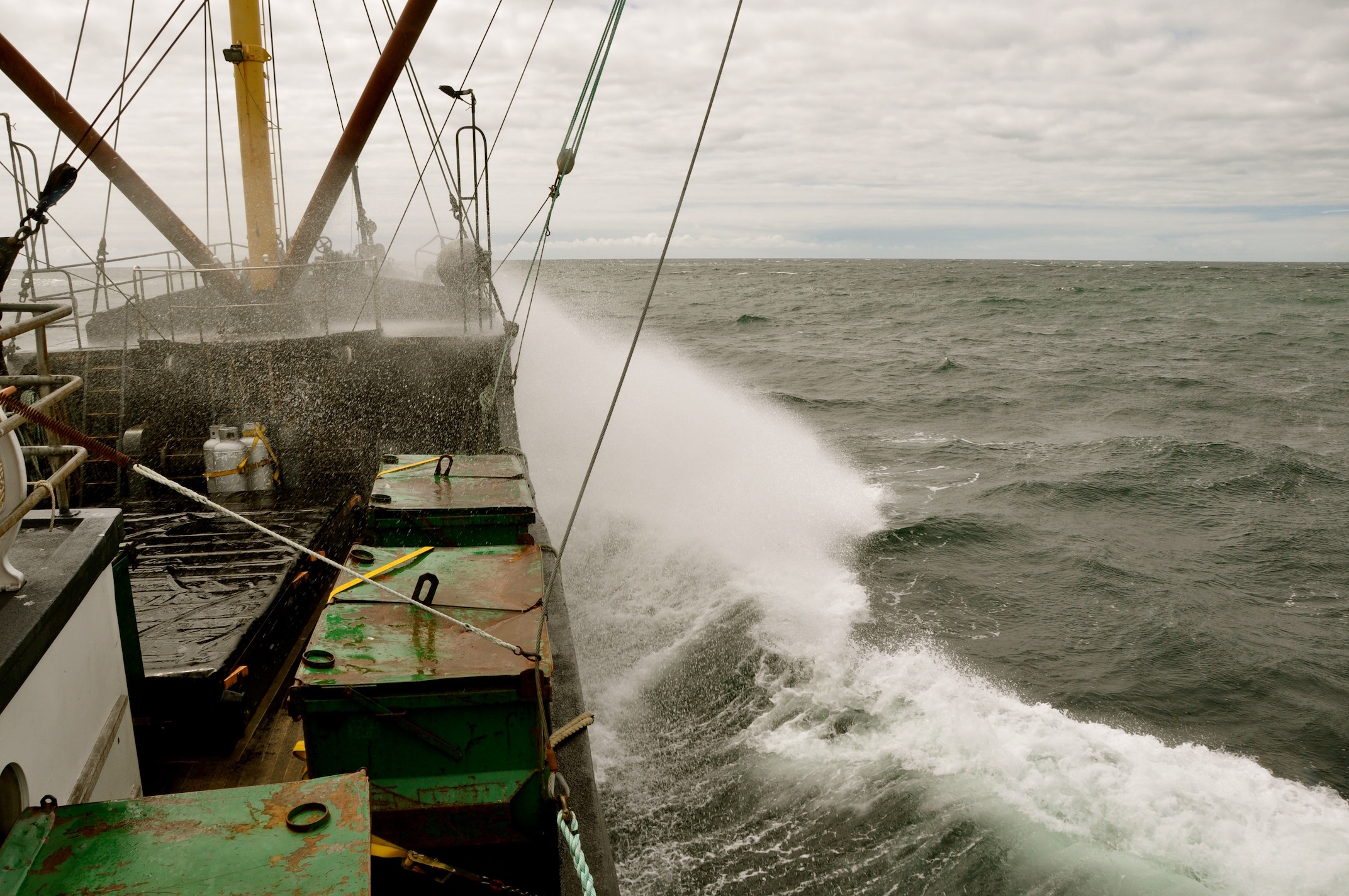
Rough Seas off Esperanza Inlet
Kyuquot
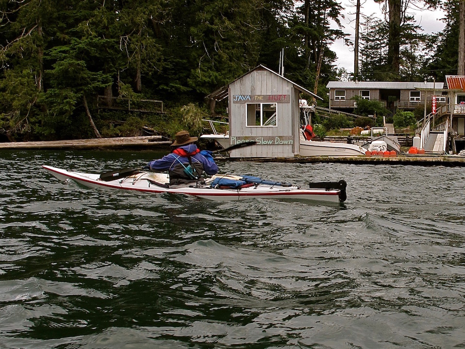
We tie up at the dock in the village of Kyuquot around 5 pm. Kyuquot is home to a population of around 300 First Nations people and others. Kyuquot was once primarily a fishing village but in recent years, tourism has become a more viable alternative for many residents. It has a bed and breakfast, coffee shop, a motel and restaurant, general store, Red Cross medical clinic, phone service, boat charters and a water taxi service. Voyager Water Taxi is another alternative for kayakers getting to and from Fair Harbour.
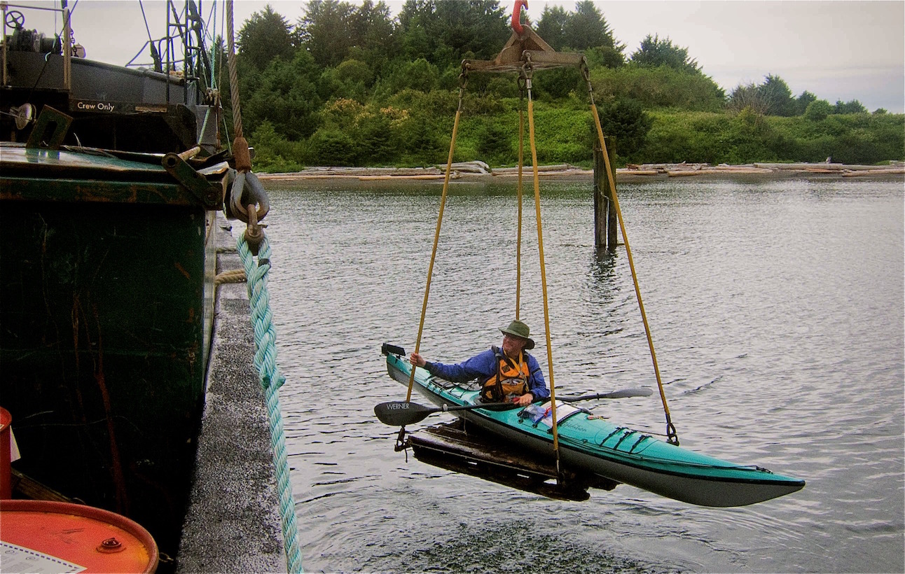
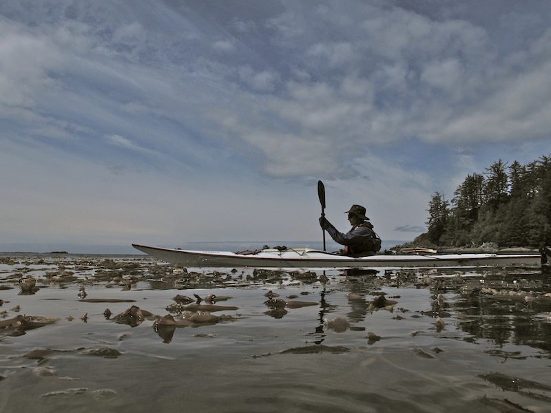
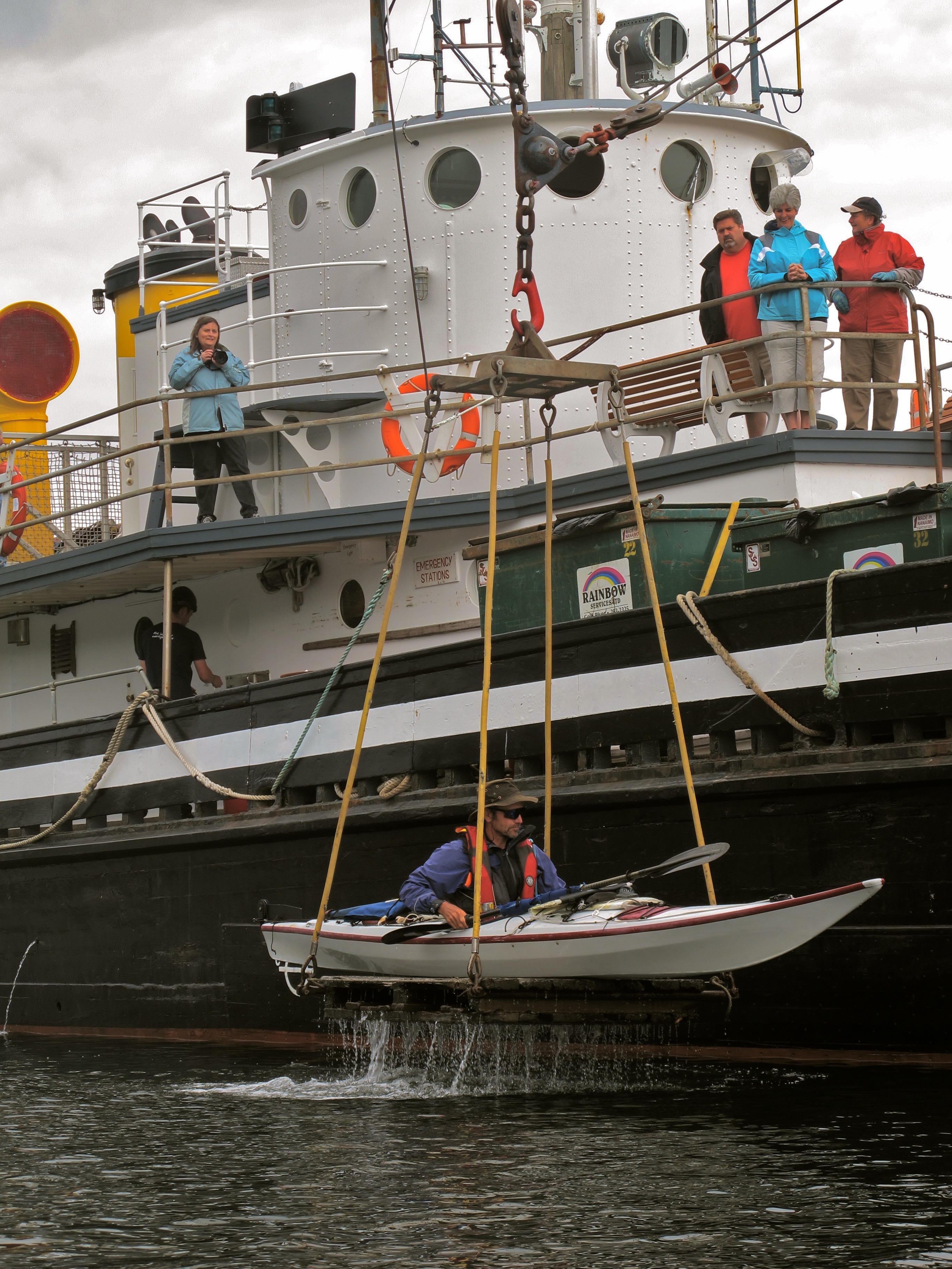
We were launched off the Uchuck directly into the water using the ships lifting platform. This takes you, while sitting in your fully loaded kayak, and winches you over the side. The platform sinks just below the surface and you just paddle away. It just doesn’t get easier than that!
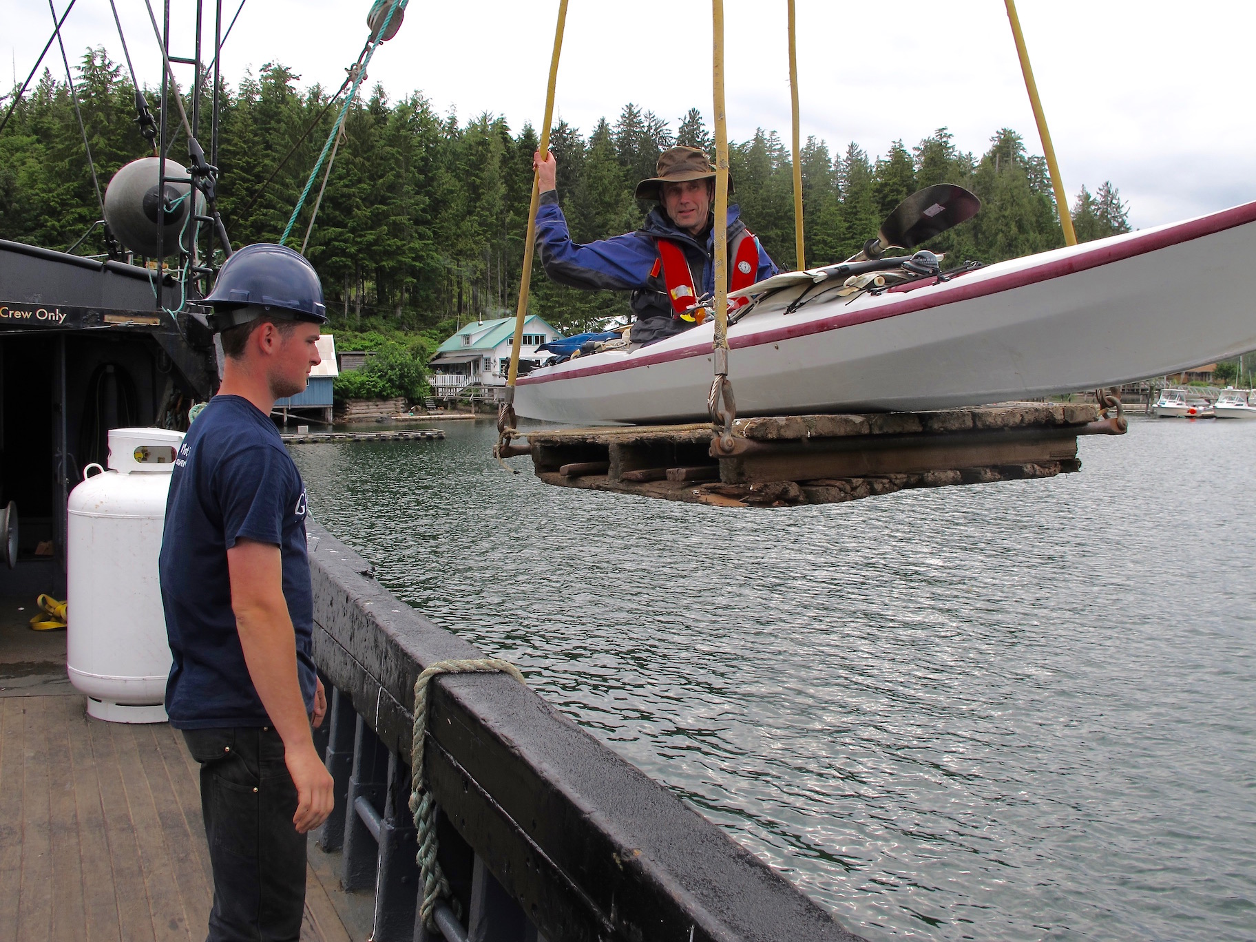
Dugald being unloading in Kyuquot
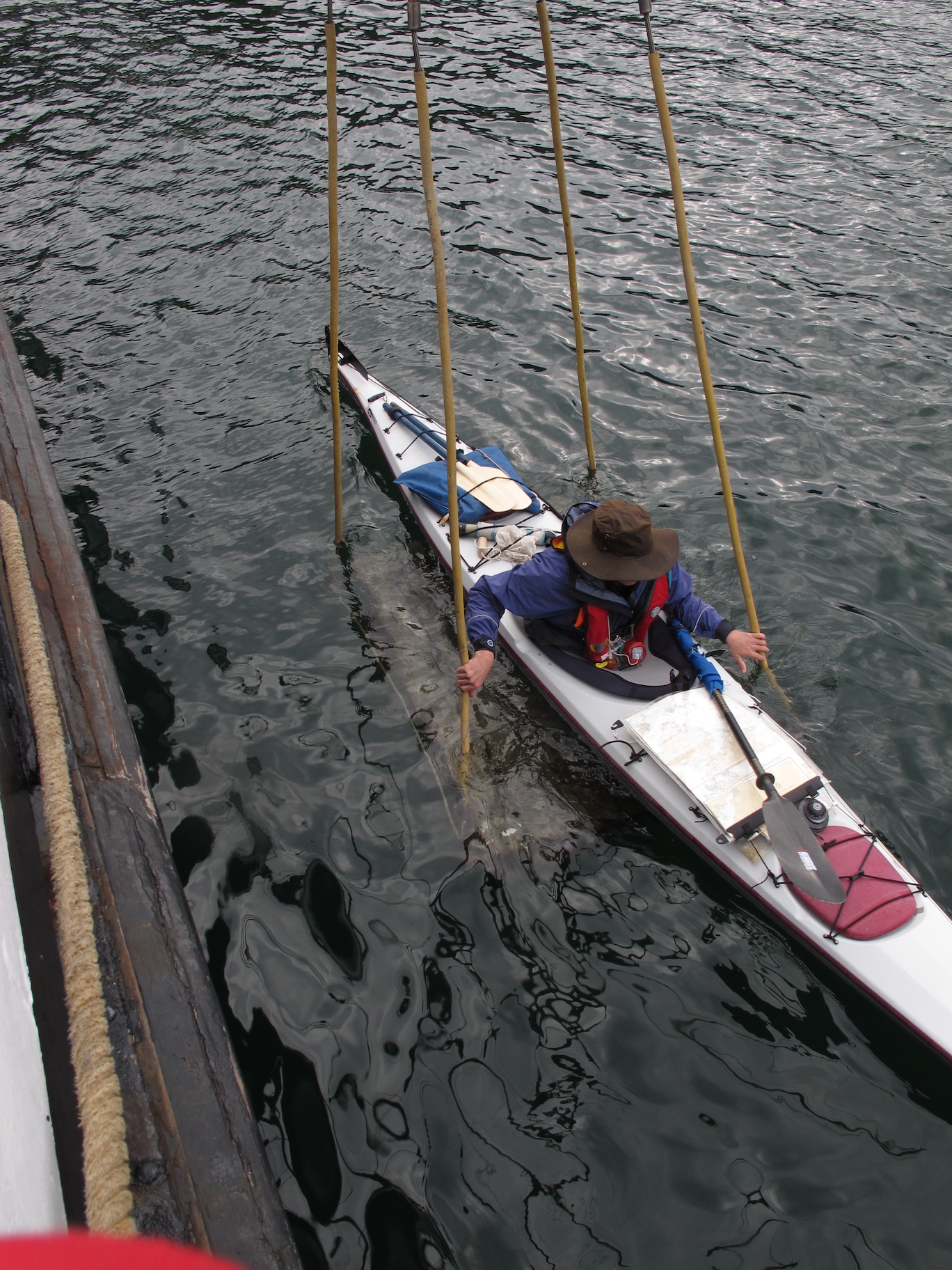
The Wet Launch
Paddle Through Coffee Shop, Kyuquot Style!
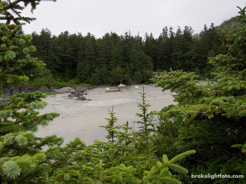
Spring Island
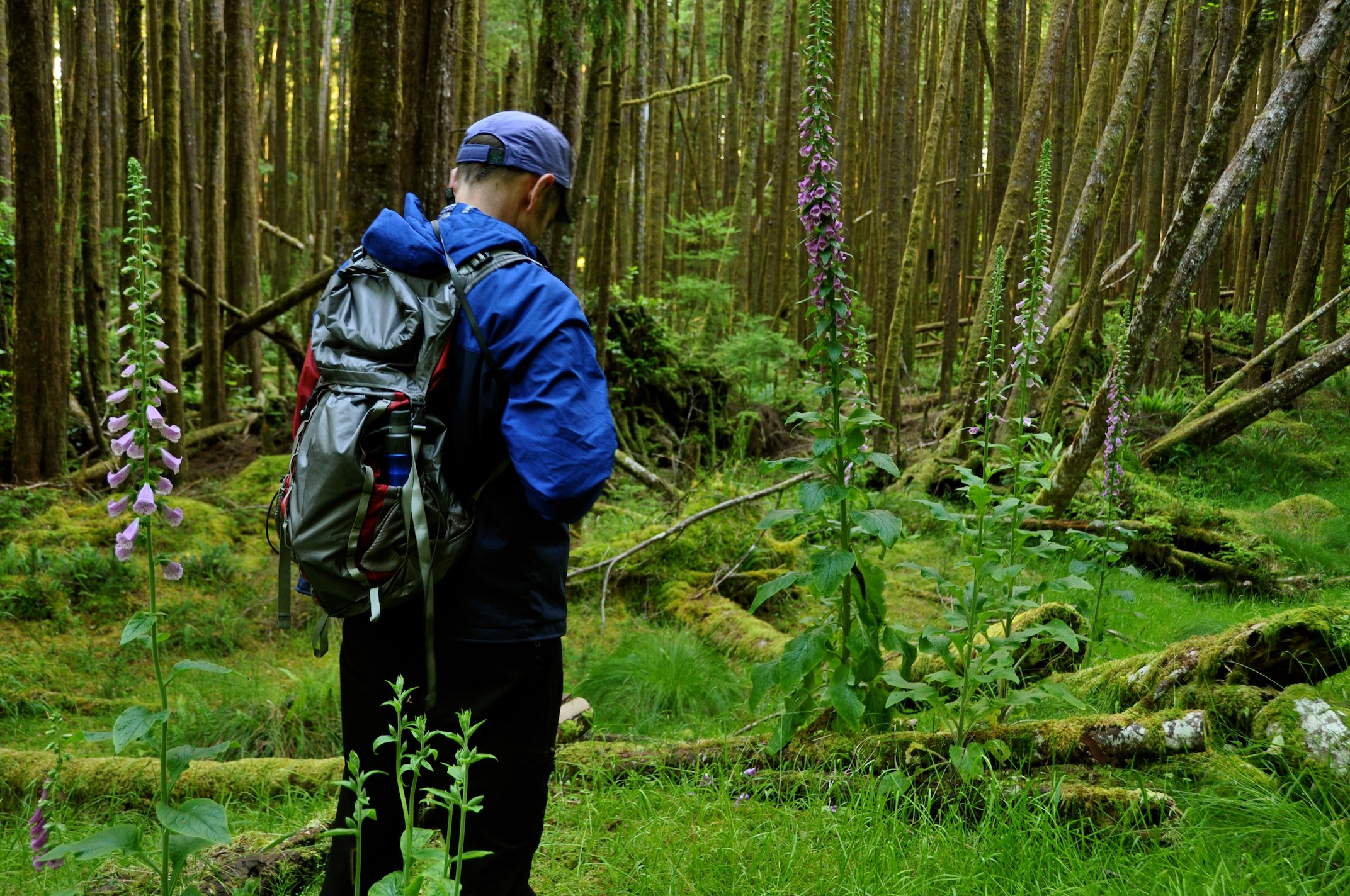
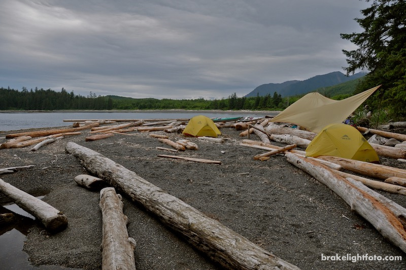
From Kyuquot we paddled the short distance west to Spring Island, just off the coast, to spend a couple of days exploring Kyuquot Sound. Spring Island is a great place to set up camp and use as a base to explore the area. You can hike across the island to access some spectacular west coast vistas and explore an old World War II Radar Site still equipped with a basketball hoop and ball!
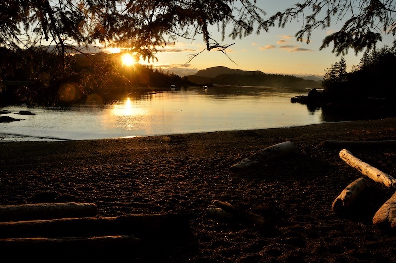
Sunrise at Spring Island Campsite
Hiking across Spring Island
Spring Island, looking southeast
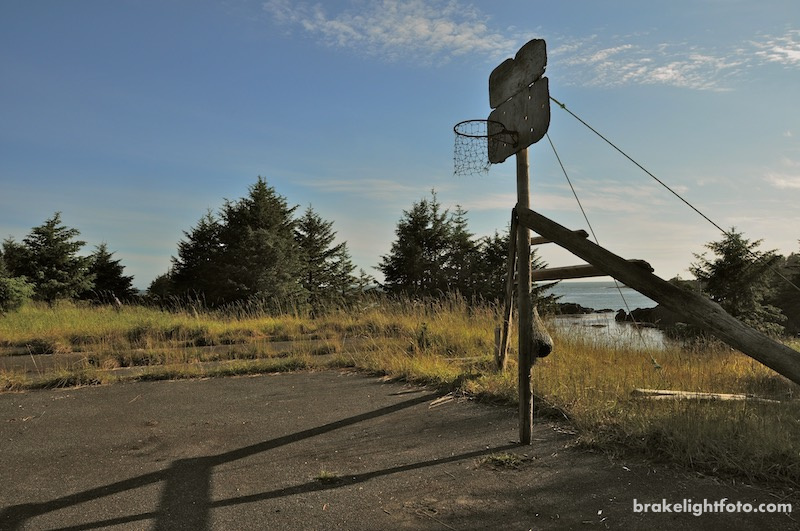
Basketball court at the old WWII radar site on Spring Island
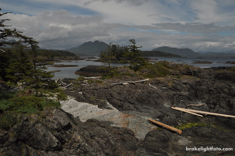
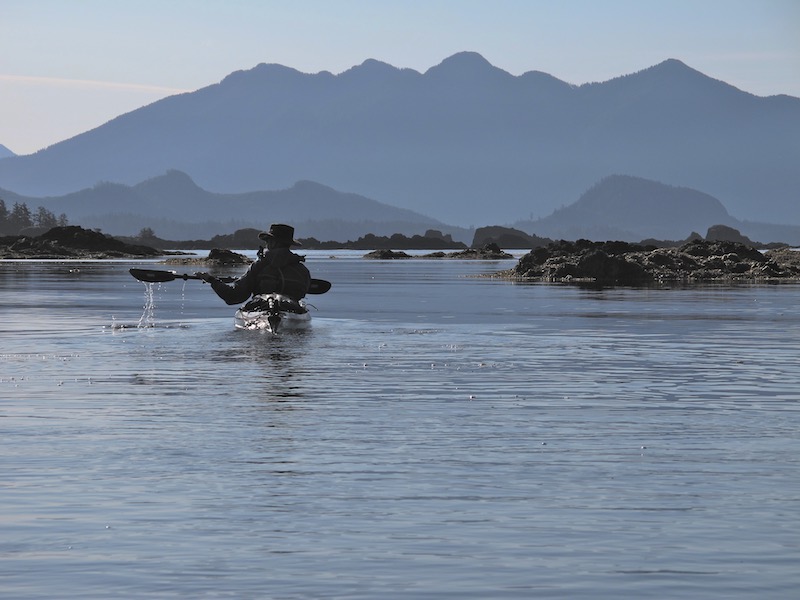
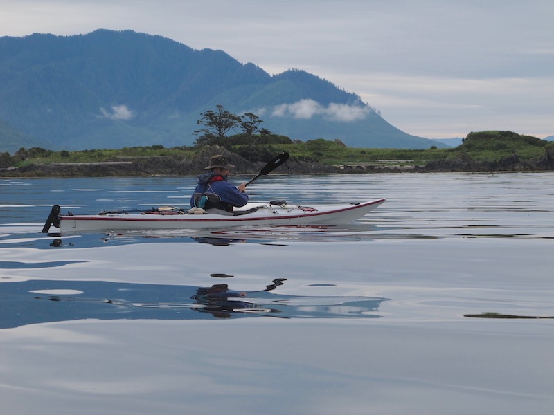
The following day we set off to explore the Mission Islands, which are the group of Islands sitting between Kyuquot and Spring Island. We paddled from our campsite out around the west coast of Spring Island, winding our way through the myriad of reefs, small islets and kelp beds that make up the Mission Group. Once around Spring Island we headed east towards McLean Island, which lies just off Vancouver Island north of Kyuquot. We finished the trip by skirting past Kyuquot and circled back to our campsite.
Heading out around Spring Island for our day exploration
Crossing Kyuquot Sound towards McLean Island
If you are not up to planning your own trip to this spectacular part of Vancouver Island you may want to consider taking a tour. West Coast Expeditions is a kayak touring company run by long time friend and past fellow kayak instructor at Ocean River Sports, Dave Pinel. They have their base camp located on Spring Island. You can still ride the Uchuck III to Kyuquot and have them meet you there. You can get more information about their excellent tour offerings by visiting the West Coast Expeditions website.
Update: In 2022, Dave completed his owership transition of West Coast Expeditions to the Ka:’yu:’k’t’h’ / Che:k:tles7et’h’ First Nations’ Group of Businesses. They will be looking forward to welcoming guest and carrying on the great adventures offered by West Coast Expeditions!
Sunset from Spring Island
Spring Island to Rugged Point
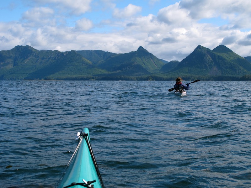
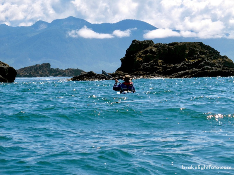
Leaving Spring Island on a spectacular sunny morning, we headed southeast across Kyuquot Sound towards Rugged Point Provincial Marine Park. Passing through the islands and reefs of the Mission Group, the route there is really interesting, but certainly needs to be planned for good weather.
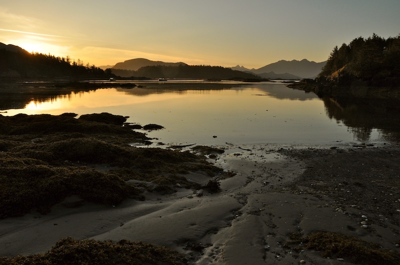
Sunrise from our Spring Island Campsite
The Mission Group Islands, Kyuquot Sound
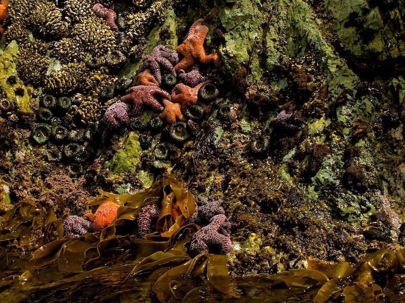
Colourful sealife around Rugged Point
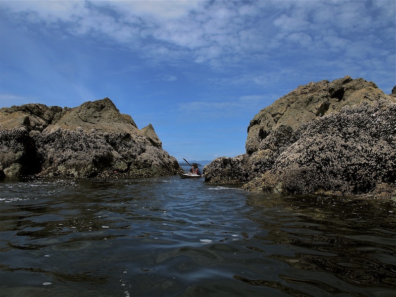
Threading through some rocky islets off Rugged Point
Rugged Point Provincial Park
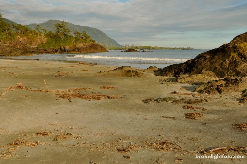
Rugged Point is a Provincial Marine Park and a great place to camp and explore with its long sandy beaches and rocky headlands. You have a choice of camping on the north side of the point within Kyuquot Sound, which is a more sheltered beach with protection from the west coast swell, or if conditions are good and the swell not too large, you can choose to land on the exposed west coast beach as we did. There are trails over and around the points making for some good exploration.
West Coast beach on Rugged Point – looking south
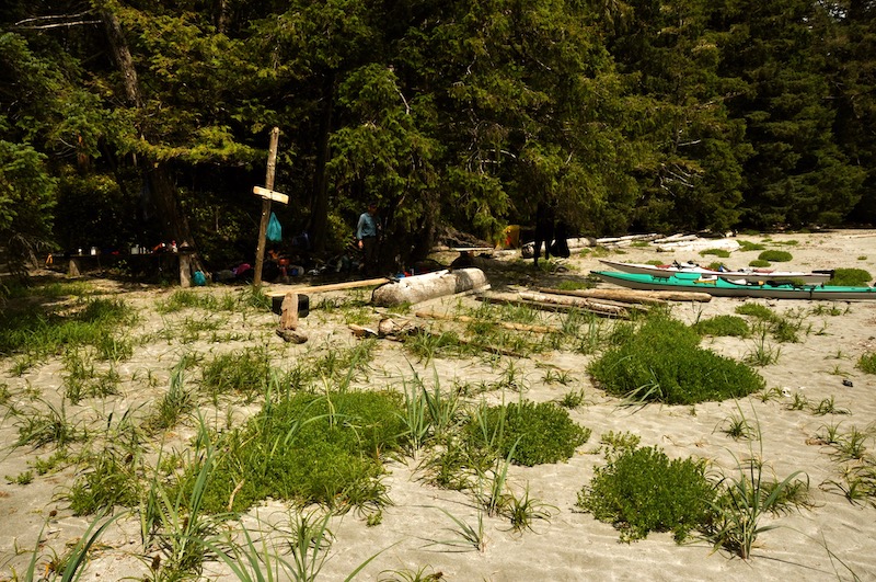
Kayak campsite at Rugged Point Provincial Park
Hiking the Rugged Point trails
Looking across Kyuquot Sound from Rugged Point’s north beach
Rugged Point to Esperanza Inlet
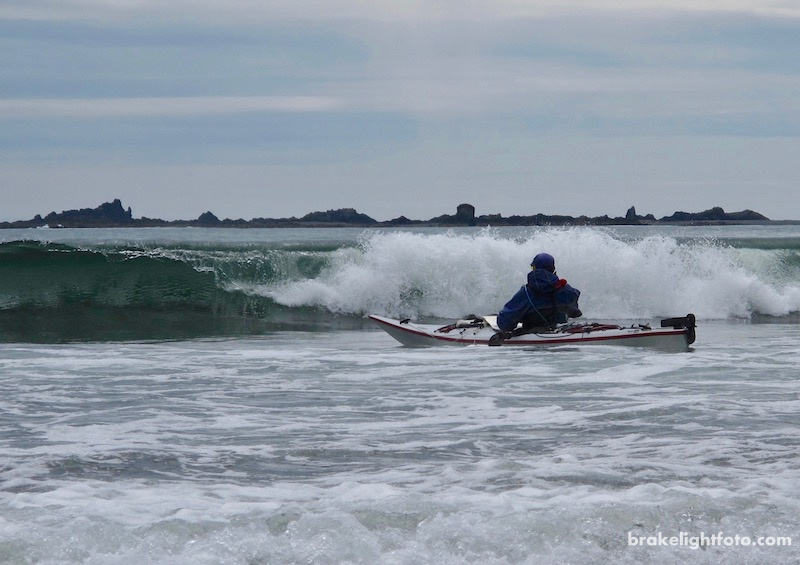
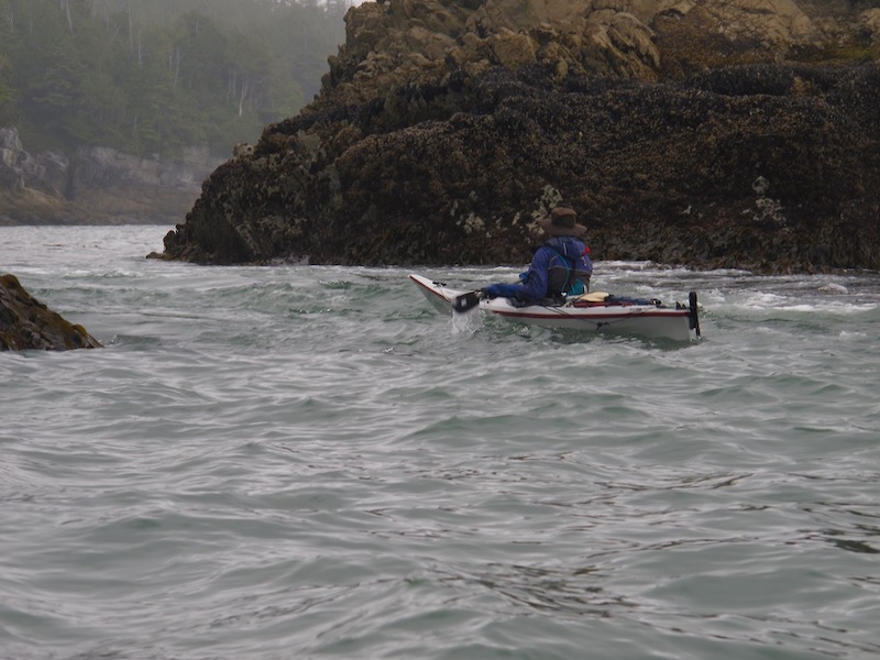
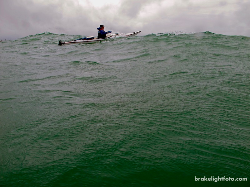
The section of coast from Rugged Point south to Tatchu Point at the entrance to Esperanza Inlet is spectacular. It is also a very exposed portion of the coast with lots of offshore reefs and small islets. Depending on the weather it can be a very challenging section of the coast to paddle. We were lucky to have calm day, but the swell was large, so some care and attention was needed!
Passing by aptly named, Grassy Island
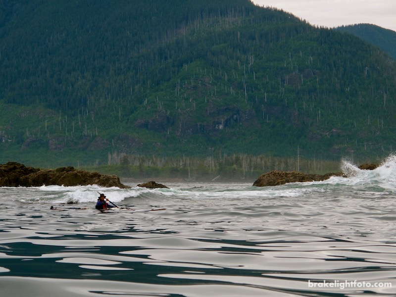
Calm conditions, but large swells were breaking on the reefs as we head south towards Esperanza Inlet
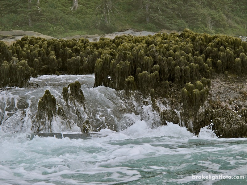
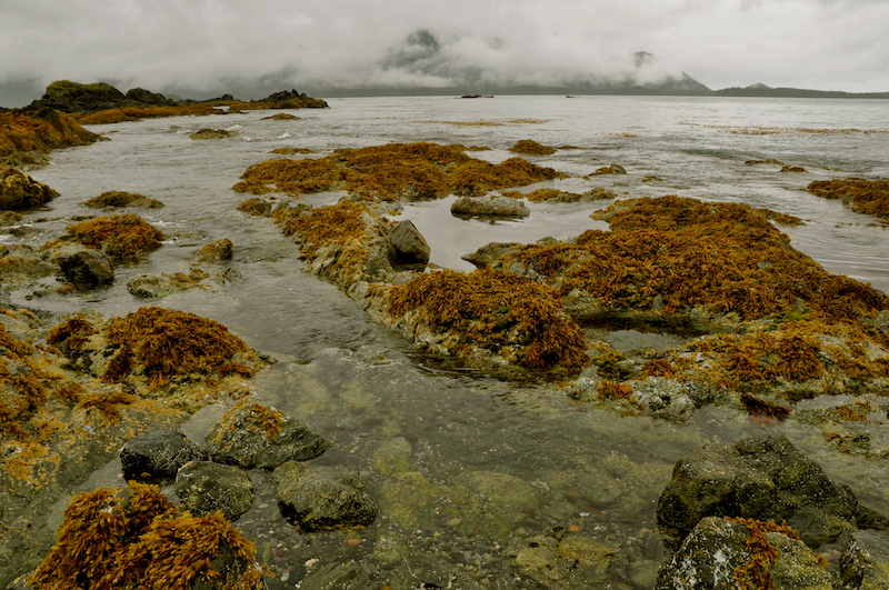
Sea Palm – only becomes exposed at very low tides
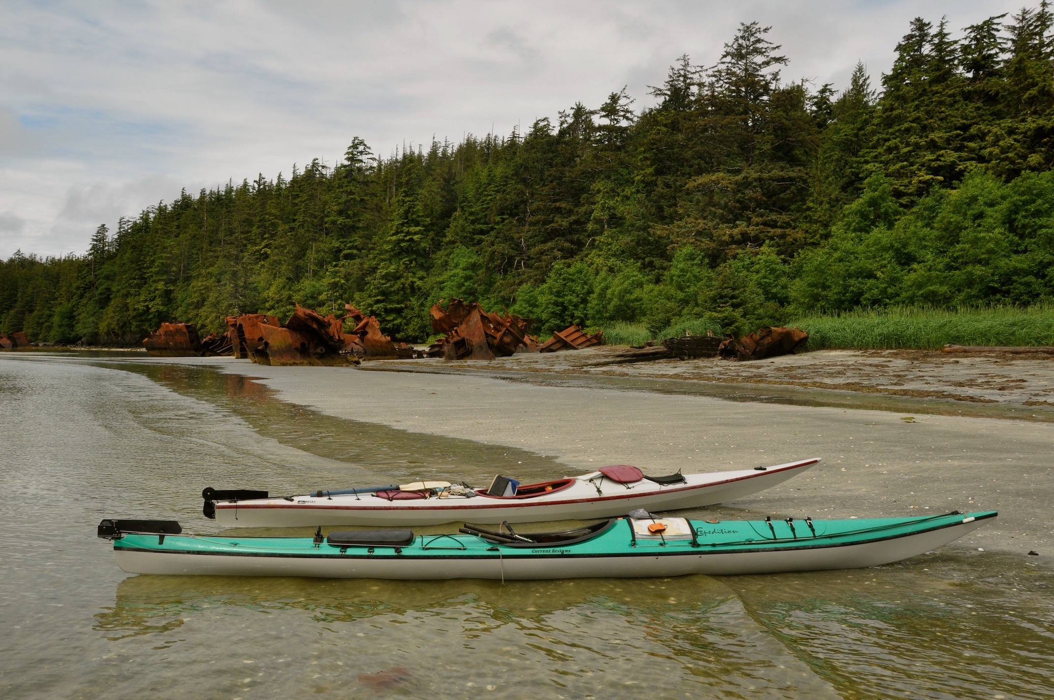
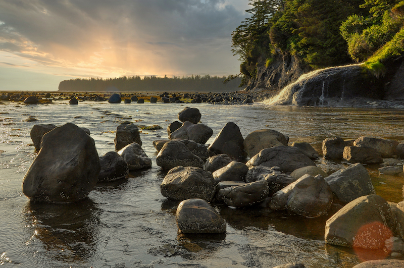
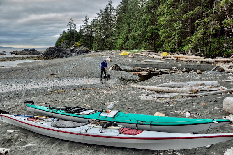
After rounding Tatchu Point we found a nice gravel pocket beach we could pull out and camp just inside of Yellow Bluff. Once camp was set up we paddled around the point to collect fresh water from a stream flowing into Yellow Bluff Bay. This proved a bit more of a challenge than anticipated because of the surf rolling into the bay, but no lives were lost!
Yellow Bluff Campsite at Esperanza Inlet
Preparing to break out through the surf after picking up water at Yellow Bluff Bay
Yellow Bluff Campsite, Esperanza Inlet
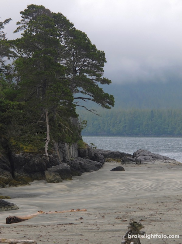
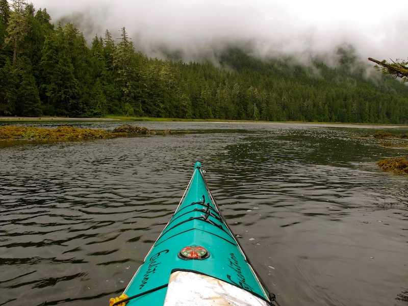
The Nuchatlitz
Leaving our camp at Yellow Bluff we crossed over to Catala Island Provincial Marine Park, which does have a couple of campsites, and paddled into the Nuchatlitz Provincial Park. This picturesque park encompasses the northwest tip of Nootka Island with a large number of small island groups surrounding it. The choice of exposed coast and protected paddling in and around the multitude of quiet coves and beaches has made the Nuchalitz a popular destination for kayakers and canoeists. The Uchuck III drops paddlers off at a dock at Green Point, just south of Centre Island.
Campsite in Nuchalitz – you can just see the tents on the beach in the distance
Sunset in the Nuchatlitz
There is la lot of exploring to be done in the Nuchatlitz Inlet, so we planned to spend at least a couple of days here. On our first day, after setting up camp, we worked our way across Port Langford to the shoreline under Mount Rosa.
Crossing Port Langford
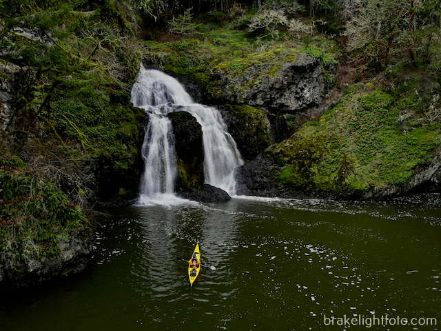
Paddling under the rocky cliffs toward Benson Point, we passed a waterfall dropping strait into the ocean. There are also some small sea caves along this shoreline. At Benson Point, there is a very large sandy spit with a good camping area. We stopped here for a break and to have a look around. We had considered camping here, but we were pretty happy with the spot we were at.
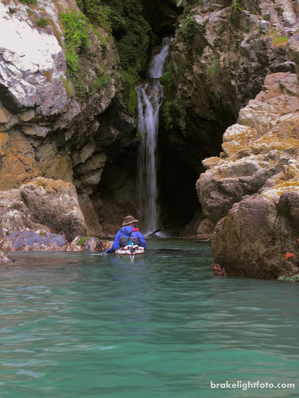
Waterfall in Nuchatlitz Inlet
Benson Point, Nuchatlitz Inlet
We continued around Benson Point into Mary Basin where we encountered a large male sea lion fishing for salmon. At first I thought he was just a log, but then he moved and popped up to check us out. Just past Narrows Island there is a tidal rapid which required a little caution and planning on our part so we could get back out of Inner Basin after a short lunch break.
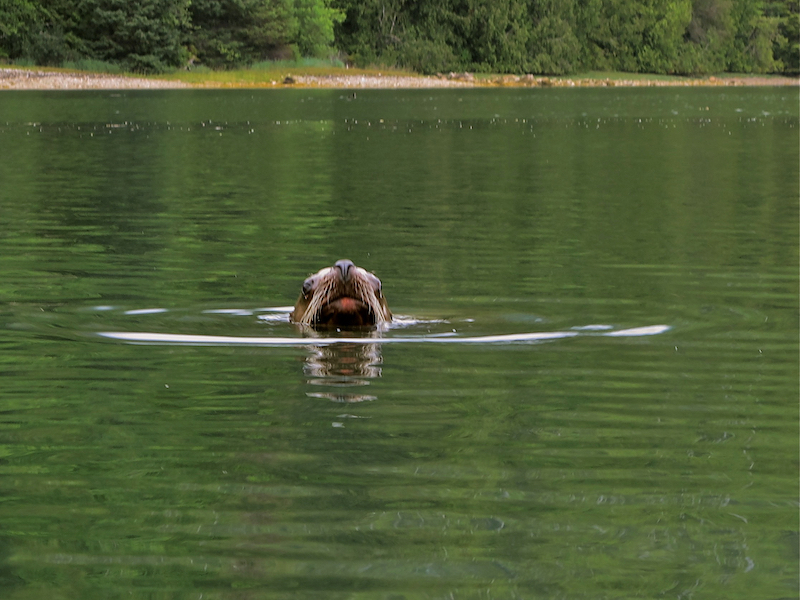
Sea Lion in Mary Basin,
The narrows constricts the waters flowing from Mary Basin into Inner Basin
The next day we would spend on our beach huddled under our tarp watching the rain pour down across the inlet. So far we had been pretty lucky with the weather, so we really couldn’t complain and the rain certainly has a beauty all of it’s own.
Looking south across Nutchalitz Inlet from our campsite on a rainy day
The following morning we would cross Nuchatlitz Inlet to the southwest, with Louie Bay as our destination. Just inside of Tongue Point at the western edge of the bay you can still see the remains of a shipwreck. This was the Greek freighter, ‘Treis Lerarchi,’. The ship was partially salvaged, which explains why there are so many large broken pieces scattered along the beach. This was a good place to stop for lunch and have a look around.
Ship Wreck of the ‘Treis Lerarchi,’ at Tongue Point
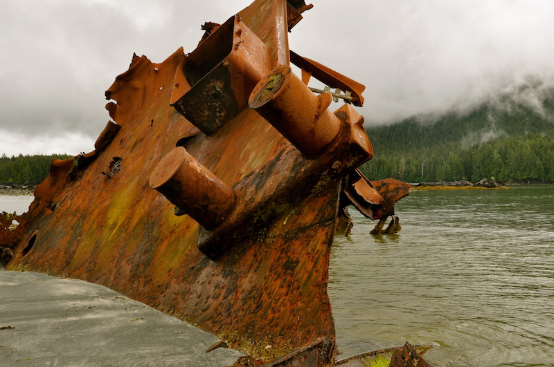
Ship Wreck at Tongue Point
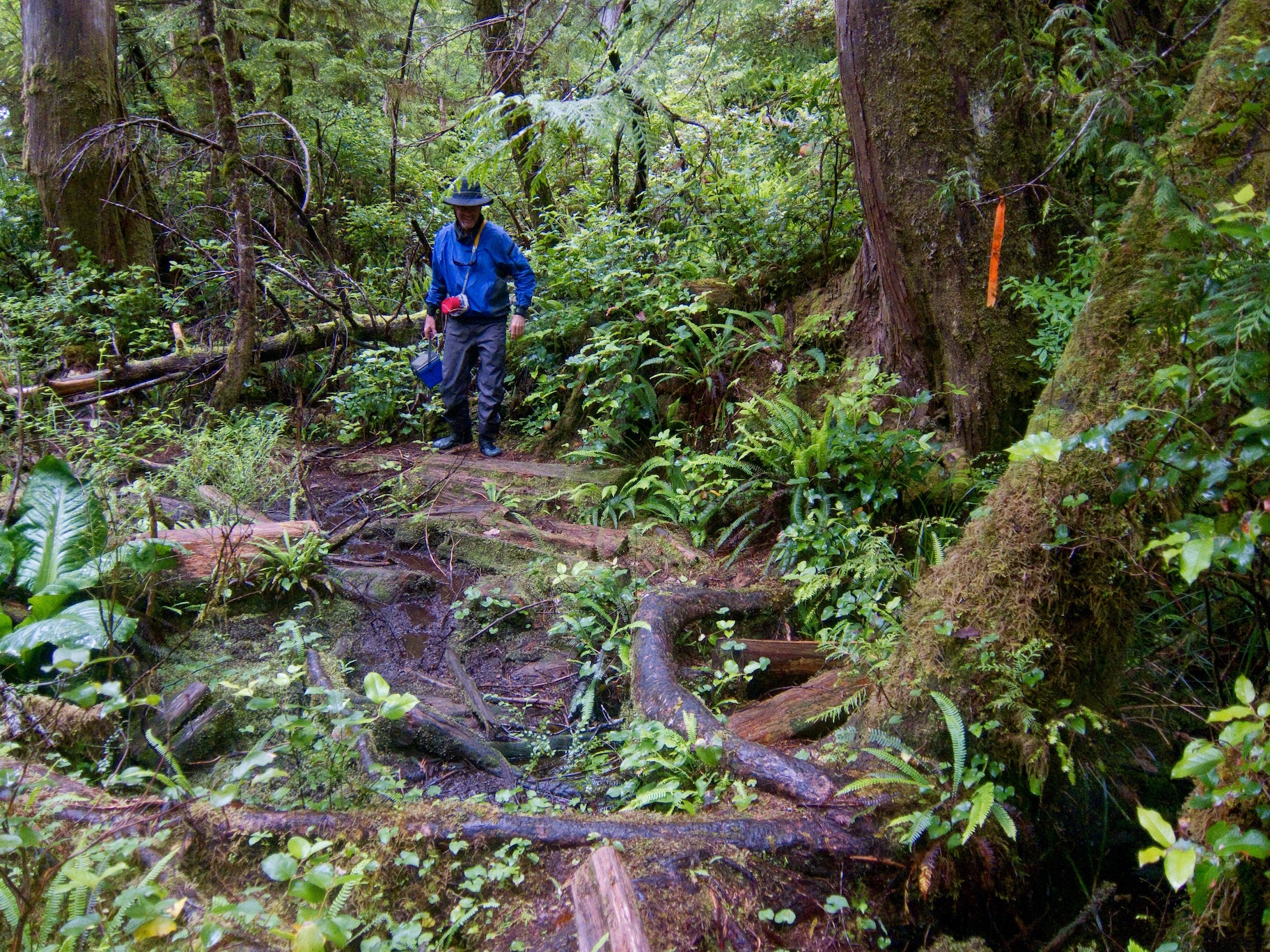
If the tides are right you can paddle up Starfish Lagoon, a narrow passage about 1.5 nm long, which runs off Louie Bay. This will take you to the starting point of the Nootka Trail. The lagoon is aptly named as there actually are lots of starfish in the lagoon. Charter seaplanes land in the lagoon to drop off hikers wanting to challenge the rugged 40 km, 5 days or so hike to Yuquot (Friendly Cove). If you’re kayaking this area and manage to get up into the lagoon, it is well worth taking the short hike over to Third Beach for a taste of what hiking this challenging west coast trail is all about.
Heading up Starfish Lagoon to the start of the Nootka Trail.
Hiking to Third Beach from Starfish Lagoon on the Nootka Trail – Dugald Nasmith Photo
Exiting the Nootka Trail at Third Beach
Nuchatlitz to Third Beach, Nootka Island
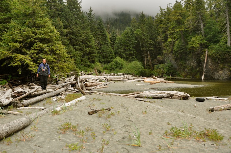
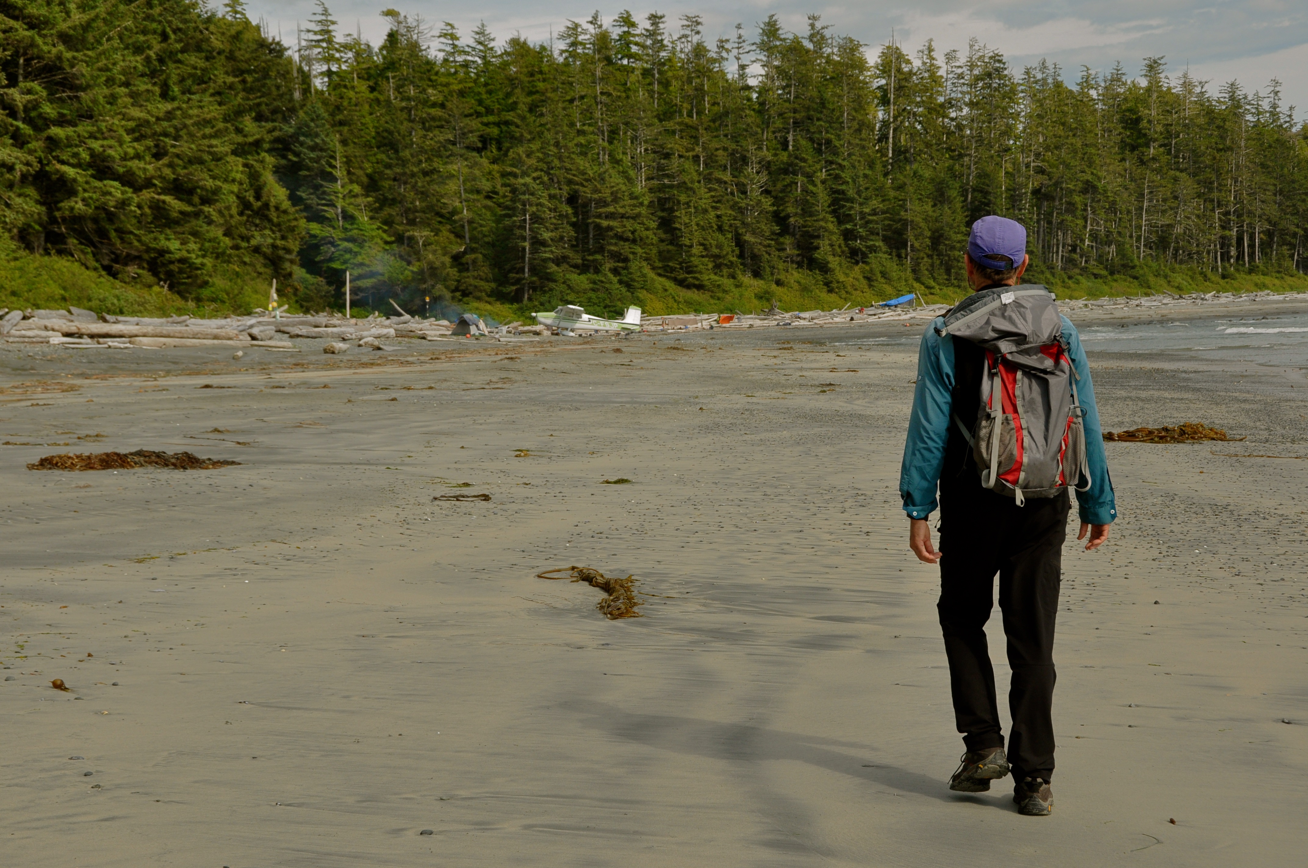
Leaving our Nutchatlitz campsite the following day we headed out of the inlet through a good sized swell and turned around Ferrer Point on our way to Third Beach, not far around the point. Third beach is the traditional first night’s camp for hikers and the most developed campsite along Nootka Island. We would eventually paddle into this bay to camp and then spend another day waiting for the weather to improve. During the night we were visited by some wolves who left their footprints in the sand all around our tents.
Our campsite at Third Beach
Third Beach to Calvin Falls, Nootka Island
The waters on the outside of Nootka Island can be intimidating. There are lots of shallow reefs creating breakers well off shore so, once again, some care and attention is required when paddling this section of the coast. Our destination on leaving Third Beach was Calvin Falls, midway down the island, nestled at the back of a very large bay surrounded by sandy beaches.
Big Seas off Nootka Island
The beaches here are big! Big enough to land airplanes on. This actually happened! A Cessna 172 came in low over our heads and landed on the beach while we were standing there. It turned out to be a couple of guys from the mainland getting away for a couple of days of camping. Certainly a novel way to do it, and bold landing on sand! I have to admit though, we were a bit selfish and got up a little earlier than normal to make sure we were well away from this beach before they tried to take off. We didn’t fancy ourselves helping to dig that sucker out of the sand if it did get stuck!
Other than airplanes on the beach, Calvin Falls is one of the scenic highlight of the area. It is a fairly large water fall pouring over a wide, sloping rock ledge into a channel carved in the gravel and sand.
Cessna at Calvin Falls
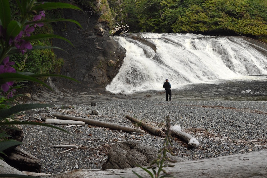
Calvin Falls
Walking the beach just to the norht there is another unique little water fall. A small creek rushes out of the forest and spreads out across a prominent rock before splashing onto the beach. Well worth checking out!
Walking on water! – a small stream dropping onto the beach north of Calvin Falls
The unusual waterfall north of Calvin Falls
Calvin Falls to Maquinna Point
The next day we set off on a beautiful calm sunny morning paddling over large gentle swells towards Maquinna Point near the southwest tip of Nootka Island. This is another very rugged section of the coast with spectacular rocky cliffs, sea caves, sea arches and pocket beaches. Conflicting currents around Maquinna Point created some interesting water conditions, but without any wind, passage around the point presented no problems.
A perfect day off Nootka Island as we left Calvin Falls
Rounding Maquinna Point
Yuquot or Friendly Cove
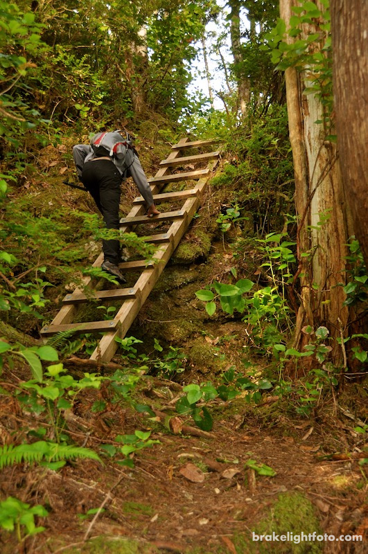
There is a good campsite, with a small stream running past it about halfway between Maquinna Point and Yuquot (Friendly Cove). Once we had set up camp, we hiked back along the Nootka Trail to where there are some spectacular viewpoints, sea caves and sea arches to explore. We also hiked the opposite direction toward Yuquot and had opportunity of watching some hikers struggle to fiord the outlet stream of the tidal lagoon here. The Nootka Trail is certainly not for the faint of heart!
Our Campsite at Maquinna Point

Sea cave near Maquinna Pt
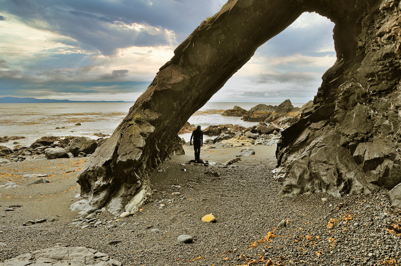
Sea Arch at Maquinna Point
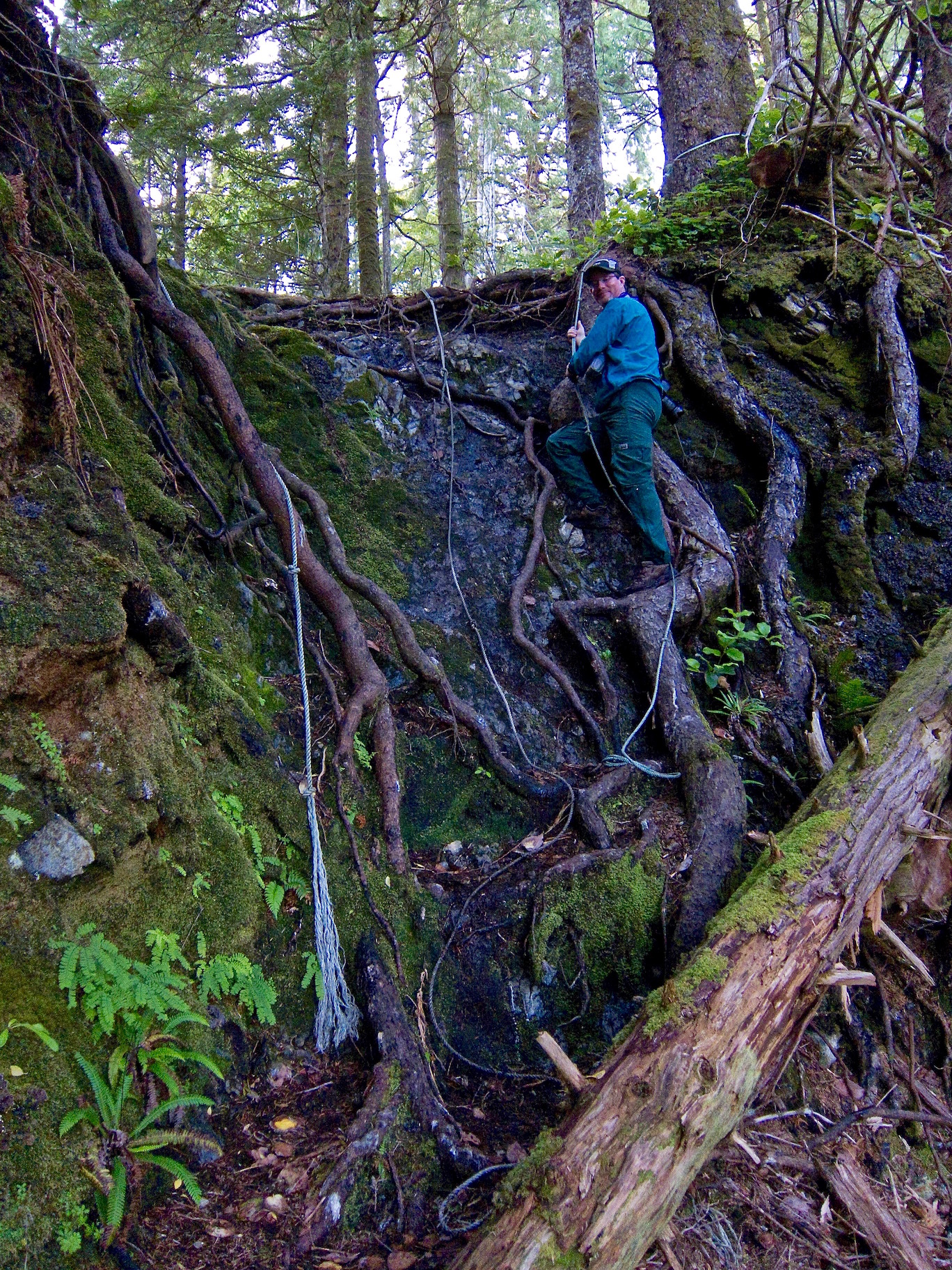
Gnarly hiking on the Nootka Trail – Dugald Nasmith Photo
Hikers on the Nootka Trail transiting a treacherous rocky point and preparing to ford a tidal stream
Yuquot or Friendly Cove
The weather forecast for the next few days was not looking good. There was a large frontal system moving towards the coast. Although we had planned to explore a bit of Nootka Sound we also didn’t want to spend the next few days huddled under a tarp in the rain and wind. In the end we decided to try and catch an earlier boat than we had originally planned on, leaving from Yuquot.
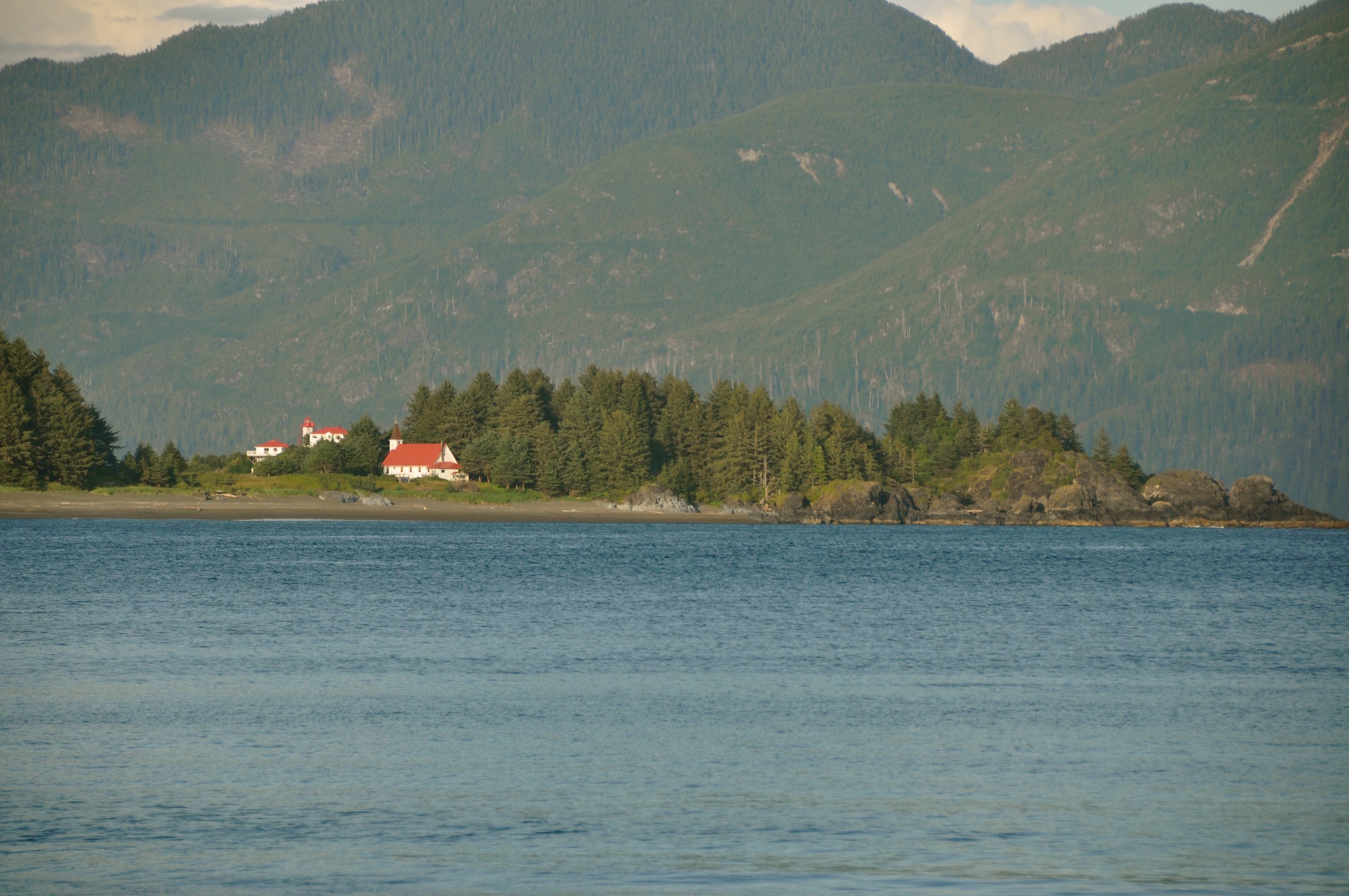
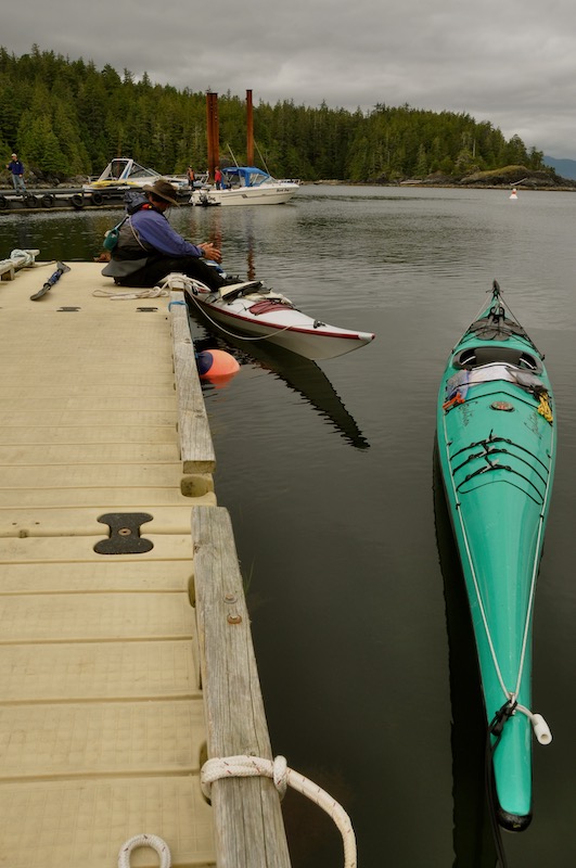
A VHF radio call to the keeper at the Friendly Cove Light Station confirmed for us that the Uchuck was due to arrive the next day. The next morning, after a leisurely breakfast we paddled around Yuquot Point and explored the Saavedra Islands in Nootka Sound. After lunch we came back to Yuquot and settled down on the dock to wait for the Uchuck III. While waiting we were entertained by bald eagles snatching fish scraps from the water that some fisherman had tossed out.
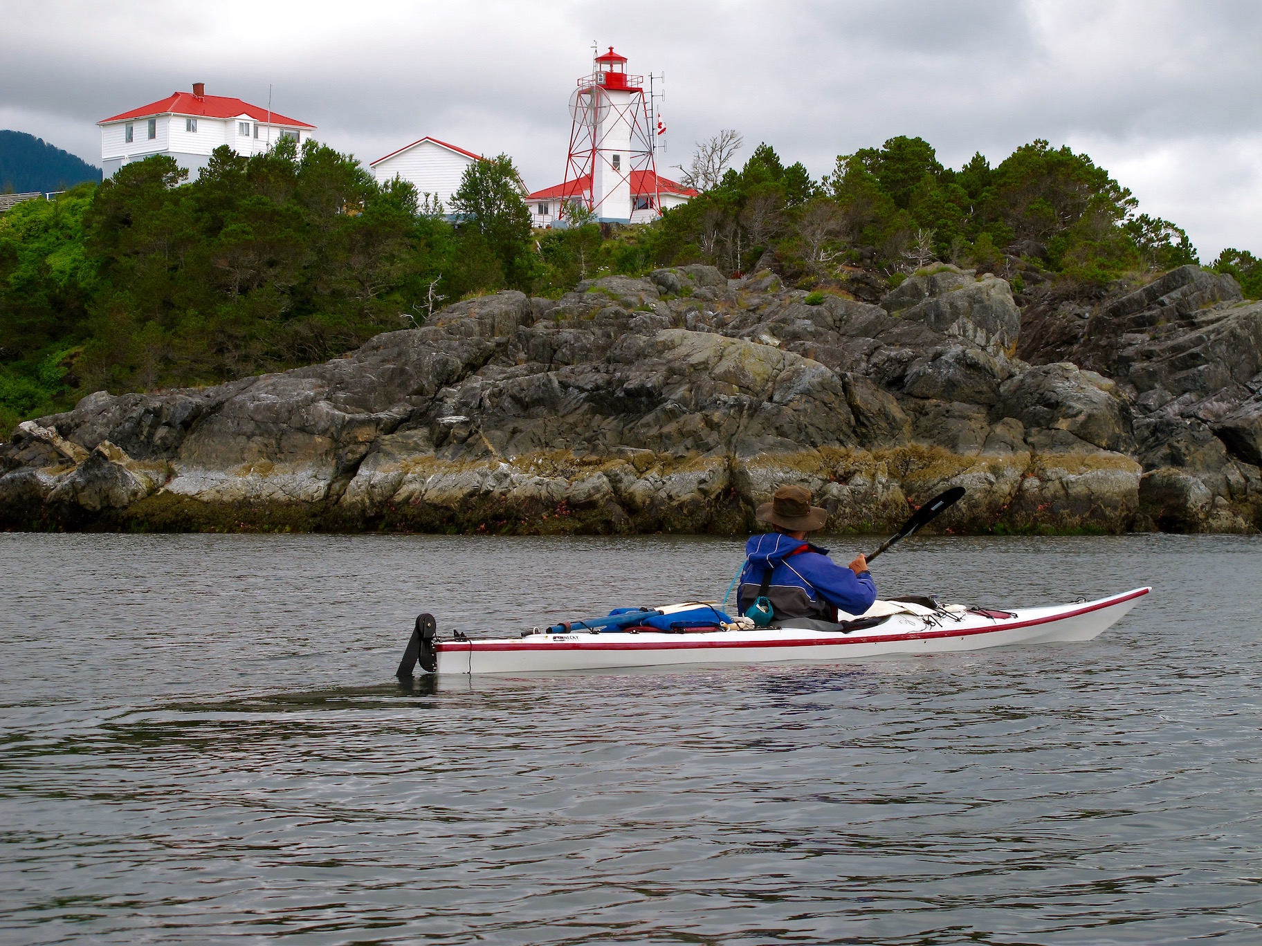
Friendly Cove Light Station
Waiting for the Uchuk at Yuquot
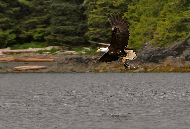
Bald Eagle picking up fish scraps at Yuquot
The Uchuck III – Yuquot to Gold River
After a successful loading onto the Uchuck, complete with an audience, the ride up the Muchalat Channel was relatively uneventful with only one stop to unload feed at a fish farm. As we docked in Gold River we saw the only black bear of the trip running across the docks as we approached. Turning around as we approached the docks, we could see the dark skies and rain of the frontal system chasing us up the inlet.
The Uchuck III approaching Yuquot
Loading onto the Uchuk III in Yuquot
The Uchuk’s final stop of the day at a fish farm in Muchalat Inlet before heading on to Gold River
Bad Weather following us up Muchalat Inlet on our way to Gold River
More Pictures
For more images of this trip or to purchase images for articles, websites, display etc, please check out our “Kyuquot to Nootka Sound” gallery at our sister website: Brakelightfoto.com
More Kayaking Posts
To see other posts of our kayaking adventures, click this link: Kayaking
Kyuquot to Nootka Sound Trip Map
Leave A Comment