

A Road Trip to the Pacific Rim
We live on BC’s west coast, on the southern end of Vancouver Island, and we can get some pretty amazing storms. Some packing hurricane force winds, which can make for some interesting days, but to experience to full force of mother nature, you have to head to the parts of the coast that are fully exposed to the full impact of the open ocean, the Pacific Rim.
Pacific Rim National Park and the towns of Ucluelet and Tofino are a great choice, relatively easy to get to and have lots of access to the water, including huge sandy beaches and spectacular rocky points. So, we plan to set off on an adventure to ‘Storm Watch’, which is a west coast euphemism for pretending to enjoy walking around in 80-90 km (43- 49 mph) winds while getting soaked to the skin.
We decided to leave our RV in Victoria and book a couple of nights at Water’s Edge Shoreside Suites in Ucluelet. As it happened, If all we wanted to do was storm watch, our timing couldn’t have been better. The forecast for the next couple of days was heavy rains with high winds gusting to 50 knots. That’s 92 kmh or 58 mph! The Environment Canada website for most of Vancouver Island was posting weather alerts, and the sunrise in Victoria was spectacular, fondly reminding me of one of my mother’s sayings, “Red sky in morning, sailors take warning!”.

Victoria Sunrise
The drive to Ucluelet is beautiful at anytime of year. It takes you up the east coast to Parksville, and from there you begin heading west across the island. The highway allows you to bypass the community of Coombs, which is mostly closed up this time of year anyway, but during the rest of the year it’s definitely worth a stop, particularly the Coombs Old Country Market…you can’t miss it, it’s the large building with the grass roof and goats! About 18 kms up the road is Cathedral Grove named for the stately Douglas Firs and huge cedar trees. A wonderful spot to take a break, stretch your legs and go for short walk through this amazing rain forest.
From Cathedral Grove you climb up over Summit Pass (elevation 435 m) and then descend into Port Alberni, which is a nice little mill town nestled in the mountains at the head of the Alberni Inlet. It’s a good place to take a break, grab some lunch and fill up the tank if you need it, as there won’t be any more fuel before Ucluelet and Tofino. Port Alberni has some very good restaurants and cafes. One of our favorites is the Swale Rock Café at 5328 Argyle St, which is the main drag running down to Harbour Quay on the waterfront. Harbour Quay is a colourful collection of waterfront shops, galleries, eateries and some interesting sculptures on the wharves and walkways.

The Port Alberni Train Station
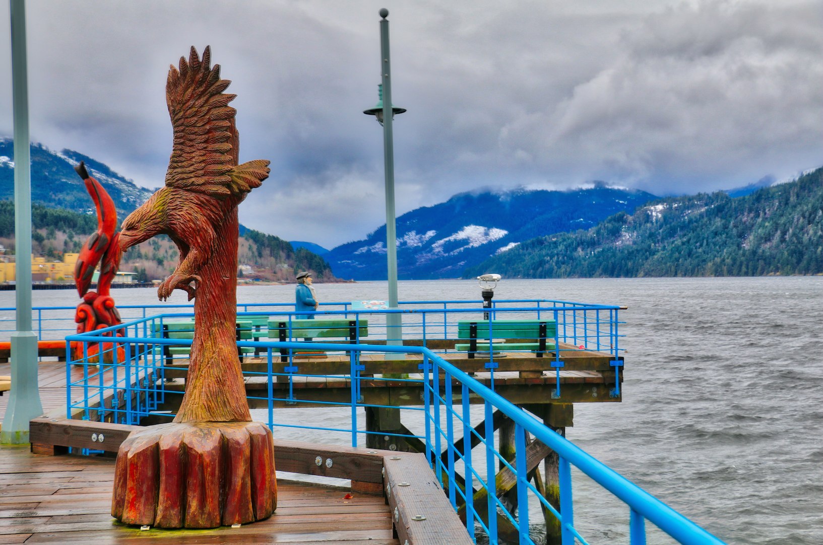
Harbour Quay, Port Alberni

Port Alberni Harbour

The Somass River and the Port Alberni Pulp & Paper Mill
Port Alberni has a long history of logging, supplying saw mills, including the historic Mclean Mill National Historic Site, and pulp mills. One of our followers used the above photo of the Somass River and the Port Alberni Pulp & Paper Mill in a music video he created. Check it out here: The Day They Closed the Old Mill Down
As you leave Port Alberni you will drive past Sproat Lake. There is a provincial park here with camping and picnic facilities and a beach. Sproat lake is has 4 roughly cross-shaped arms It is over 25 kms in length but has over 300 kms of shoreline! If you take one of the walking paths from the beach, across the arm you can see the home of the last Martin Mars water bomber, the world’s largest to fly operationally. Originally built for the U.S Navy during World War ll, this heavy-duty aircraft (with a 60,000 lb or 7,200 gallon payload) is now utilized to assist in international firefighting efforts.
Update: The Hawaii Mars is now on permanent display at the BC Aviation Museum in Sidney.

Martin Mars Water Bomber on Sproat Lake
Once you are past Sproat Lake the highway begins climbing up over Sutton Pass (elevation 240m)s to get to the coast. The road through here is very narrow, twisting and steep in places. Take your time, be safe and enjoy the view. There is a lot of traffic on the road in the summer time with lots of slow vehicles, if you are driving an RV please use the slow vehicle pulls outs whenever possible.

Highway 4 just past Sutton Pass. Note the snow.
There aren’t at lot of places to pull off and stop along this road, but there are a few and a notable one with lots of space to park is at a bend in the Kennedy River where the river spectacularly drops over a small fall.

The Kennedy River along Highway 4

Very wet driving conditions!
Once you’ve reached what looks like the end of the road you must make a choice, a right turn to head to the Pacific Rim National Park and Tofino, or turn left and drive to Ucluelet. Our path, this day, lead to Ucluelet.
Ucluelet, means safe harbour, and it perches on the tip of a peninsula at the edge of Barkley Sound It is bordered on three sides by the Pacific Ocean making it almost an island. It has a population averaging 1800. The spectacular beauty and pristine nature of Vancouver Island’s west coast surround Ucluelet, with incredible beaches, spectacular rocky headlands and thick old growth forests.

Waters Edge Resort, Ucluelet, BC

Ucluelet Waterfront

Big Beach
During the winter months, a lot of the businesses and restaurants in Ucluelet are closed. However, there is enough open to make for a very pleasant visit. There are a couple of gas stations, a CO-OP grocery/general store, a few liquor stores. Waters Edge Resort conveniently provided us a handy pamphlet telling which restaurants were open and on what days.

Weathered fish boat sits beside a local business on Pennisula Rd

Ucluelet Aquarium on the Waterfront

Ucluelet Waterfront
One of the highlights of our visit to Ucluelet was the Wild Pacific Trail. There is a short 2.6 km loop that loops around the peninsula where the Amphitrite Lighthouse is located, if you don’t do anything else, walk this loop. This spectacular point is a favourite for storm watchers as it is fully exposed to the full fury of the Pacific Ocean. The other section of the trails runs along the west coast for about 8 kms one way. You can do the whole thing and return or pick some sections to do.

Amphitrite Point LIghthouse, Ucluelet, BC

Storm Watching at Amphitrite Point, Ucluelet, BC

Storm Waves at Amphitrite Point

Waves breaking on Amphitrite Point

Waves breaking on Amphitrite Point

Heron watching the surf at Big Beach

Kayak on Big Beach, Ucluelet

The Wild Pacific Trail at Big Beach, Ucluelet

Picnic table on Wild Pacific Trail overlooking Big Beach

Big Beach
To top your trip off, make sure to drive back down the road to Pacific Rim National Park and Tofino. The park has many spectacular sandy beaches and hiking trails and Tofino has a few more shops and amenities than Ucluelet.

Pacific Rim National Park Interpretive Centre at Wickaninnish Beach

Cox Beach, Tofino

Cox Beach, Tofino
Be Prepared:
On the way to the west coast in the winter, you can experience anything from sunshine and dry roads, to heavy rains and fog, to snow. You cross a couple of mountain passes, so it is not unusual to encounter some snow during the winter months. Make sure you have good tires on your vehicle, good wiper blades, bring a shovel, carry chains if you don’t have good winter tires, and take extra warm clothing with you, just in case. You can get Highway 4 road reports and BC Highway webcams for Summit and Sutton passes at this link: BC Highway Reports
If you are going to storm watch and want to fully enjoy the experience, you are going to need some good rain gear and rubber boots. Make sure you also have rain pants because if the wind is blowing, you are going to get soaked. Umbrellas can be useful, but only if the wind has subsided. Make sure you have some way to protect you camera gear if you don’t have a waterproof camera. We use the ‘Rainsleeve’, by Optech USA, www.optechusa.com. A simple, inexpensive, but effective solution. I keep a couple of lens cloths in my pocket for the inevitable drops of rain and ocean spray that will get on the lens.

The Optech Rainsleeve
More Images
For more images or to purchase photos for websites, prints etc, click this Link: Tofino & Uclulet & Port Alberni


Leave A Comment