

There are few bike rides on Vancouver Island that pack as much reward into a single days ride as the stretch of the Cowichan Valley Trail between the Kinsol Trestle spanning the Kooksilah River and Skutz Falls on the Cowichan River. This old rail corridor has been transformed into a wide, gentle gravel path that cuts through pastoral farm lands, deep coastal forest, crosses a handful of historic trestles, and drops you at the edge of a Canadian Heritage river.
I chose this ride to continue my riding exploration of portions of the Great Trail on Vancouver Island having completed the section from the Humback Reservoir in Goldstream to the Kinsol Trestle. This section was fairly grueling with some significant hills. The Kinsol to Skutz Falls section is mild by comparison as it is all on rail grade.
The Route at a Glance
The ride is roughly 26 kilometres one way, so a break at the falls or the 66.2 Mile Trestle for lunch is a great way to break up the trip before you start back. Because the trail follows the grade of the former Canadian Northern Pacific Railway, the climbs are gentle, around 2% at most, making it accessible for mountain bikes, gravel bikes, hybrids, and even loaded touring rigs with decent tires.
The surface of a good portion of the trail has been upgraded to hard-packed fine gravel but there are still some rougher sections of dirt and gravel with larger rocks protruding that require a little more attention. After heavy rain, I would expect some soft spots and the occasional muddy section in these areas as well.

Forested gravel & dirt section of trail between Trestles 64 & 66.
Starting at the Kinsol Trestle
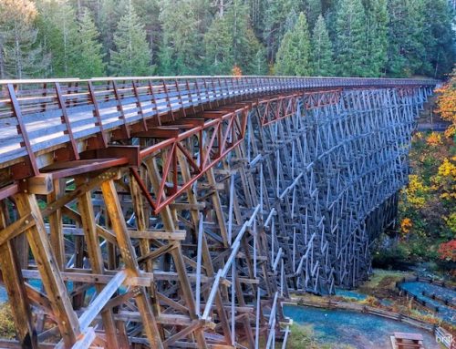
This ride begins at the parking area for the Kinsol Trestle, one of the tallest free-standing timber rail trestles in the world. About 1.2 km along the trail from the parking area, the trestle stands 44 metres high and stretches 187 metres across the Koksilah River valley. It’s a jaw-dropping way to start a ride.

Kinsol Trestle from the south viewing platform
Rolling across the wooden deck, you get your first real sense of the scale of this trail. Definitely plan to stop for pictures and take in the spectacular views from this trestle. There are viewing platforms at both ends of the bridge and a forest trail on the north side will lead you down to the river edge from some stunning views along the Koksilah River looking up at this spectacular structure.

Kinsol Trestle from the north viewing platform
Rolling Through Forest and Farmland
Once you leave the Kinsol behind, the trail settles into a rhythm that’s hard to beat. The route heads northwest across the Kinsol Valley through moss-draped forest and past quiet rural farmland. For a short portion, the trail shares a roadway which gives access to the properties along this section, so watch for vehicles.

Smooth riding through forest in the Kinsol Valley

One of the many rural properties along the Cowichan Valley Trail – Kinsol Valley
The forest is cool even in summer, with the large leaf maples and Douglas firs keeping the trail shaded for most of the ride. in many spots the dense foliage creates a living tunnel over the trail!

Cowichan Valley Trail
Around 6.5 kms from the Kinsol Trestle, you will spill out of the Kinsol Valley and begin crossing the Cowichan Valley. Here you will ride past more rural properties and farmland before passing the rural community of Deerholme.

Cowichan Valley Trail near Deerholme
About halfway along the route, you will come to the Glenora Trails Head Park. There are picnic tables, picnic shelters and heated washrooms here, so if you’re needing a break, it’s a great place to pull over. This also a great place to start a shorter exploration of the Cowichan Valley Trail, especially for residents of Duncan and the Cowichan Valley.

Genora Trail Head Park – Parking, heated washrooms, picnic shelters and playground
Within a kilometer past the park you’ll come upon the Holt Creek Trestle—a smaller but still impressive reminder of the rail era, built in 1922. On approach, the bridge looks fairly innocuous, but once you ride onto it and look over the side, you will quickly realize how wrong this is. The bridge crosses a narrow but very deep canyon. The canyon is deeply forested but there are glimpses of the river running underneath the trestle.

Approaching the Holt Creek Trestle from the south

Holt Creek running under the Holt Creek Trestle

Holt Creek Trestle
The gravel on this stretch of the trail is smooth and fast, and traffic is minimal. On a weekday morning, especially in the fall, you may have entire stretches all to yourself and if you’re timing is good, the colours of the fall foliage are stunning!
About 3 km from Holt Creek, keep an eye out for the occasional glimpse of the Cowichan River running off to your right and within another couple of kilometres you will come to the 64.4 Mile Trestle crossing a small creek. In the summer this creek is mostly dry and is worth scrambling onto the creek bed for a look. From here is is less than 2 kms to where the trail crosses the Cowichan River.

64 Mile Trestle

64 Mile Trestle

Himalayan balsam, or policeman’s helmet, a fall blossom seen near the 64 Mile Trestle

Colourful foliage tunnel
The Cowichan River
The trail crosses the Cowichan River on the spectacular 66.2 Mile Trestle, built in 1913. This trestle towers above river near the end of the Marie Canyon. The Cowichan River runs 47 kilometers, flowing from Cowichan Lake eastward to the town of Duncan before finally emptying into Cowichan Bay. It is known for its clear, turquoise water and strong salmon and steelhead runs, it’s a popular destination for swimming, whitewater kayaking, tubing, and fly fishing. The river is culturally significant to the Cowichan Tribes and is designated a Canadian Heritage River.

The 66 Mile Trestle

The Cowichan River flowing under the 66 Mile Trestle

The 66 Mile Trestle from the picnic area on the north side

The 66 Mile Trestle
There is a nice picnic area at the north side of the trestle with a couple of tables and access to the hiking trails that follow along the river. From here, it is a about 2.5 km to Skutz Falls and where the rail trail crosses River Bottom Rd you will need to turn left onto the road to get to the falls.

66 Mile Trestle picnic area

66 Mile Trestle picnic area
Skutz Falls
Skutz is not a towering waterfall, actually it is better described as steep rapid, dropping roughly 6 meters (20′) over a fairly short distance. The falls historically served as a natural barrier for fish until a fish ladder was constructed alongside them (noted as early as 1931) to allow salmon to pass. During the dry months of summer the water flow is quite low over the falls with just a small narrow chute of water, but during the fall and winter months it becomes a much more spectacular torrent!
Skutz Falls is a rather nostalgic place for me as this was the starting point of many memorable whitewater kayaking trips in the past.

This is me catching a wave on the Cowichan River
There’s a day-use area here with picnic tables and access to the water. After 22 kilometres of gravel on a warm day a dip in the river might be considered. The water is clear and quite comfortable in the summer as it is fed from Cowichan Lake. On a warm day you may see plenty of swimmers and inner tubers drifting by.

The Cowichan River just above Skutz Falls

Skutz Falls and fish ladders during low water

The Cowichan River just below Skutz Falls
Practical Notes
Getting there: A great starting point is the Kinsol Treste, but this is a 52 km return trip. For a shorter trip, about half the length, The Glenora Trails Head Park trailhead is a convenient starting point, and you will still get to cross 3 great trestles!. It is a short drive west from Duncan.
What to bring: Water, snacks, and a swimsuit. There are no services directly along this section of trail.
Best time to ride: Spring through fall is ideal. The trail is open year-round, but winter and early spring can leave sections muddy and soft.
Trail etiquette: This is a multi-use trail shared with hikers and equestrians.
The Verdict
This is one of those rides that reminds you why rail-trails are such a gift. The grade is kind, the scenery is consistently beautiful, and the destination—a beautiful river and a rushing waterfall—is exactly what you want at the end of a gravel grind. Whether you’re on a fancy gravel bike or an old mountain bike, the Kinsol to Skutz ride delivers.



Leave A Comment