

Kayaking from Prince Rupert to Klemtu on British Columbia’s Spectacular North Coast
My paddling partners, Heidi and Dugald and I have paddled quite a bit of the north and central coast of British Columbia with trips from Bella Bella to Port Hardy, Klemtu to Bella Bella, and a trip through Fiordland leaving from Klemtu and ending in Bella Bella. But we have always wanted to complete the north coast with a trip from Prince Rupert south to Klemtu.
So it was time to pull out the charts and Google Earth and start planning a route. As well, some of the best reference guides to paddling anywhere on the BC coast are those by John Kimantis of Wild Coast Publishing. His volume ‘The Wild Coast 2”, published in 2006, is still the most relevant and provides some of the best information for kayaking and camping on the north and central coasts. BC Marine Trails is another excellent resource and if you live on the west coast and kayak or are planning a trip here you should definitely join. They are a non-profit organization working to help secure long term public access to the British Columbia coast. Their website has an excellent map showing paddling routes and campsites all over the west coast of BC. Heidi also found an excellent blog site called 3meterswell which describes this group of paddlers kayak trips on the North & Central coast and provided us with some excellent information.
The problem with this particular section of the coast is its unforgiving shoreline with long stretches between landings where you can get out of your kayak to stretch the legs or take a bathroom break and even longer distances between campsites. As you get older, and the three of us are now all officially senior citizens, it is not only the distance paddled that affects you, but what is worse are the long hours sitting in the kayak, particularly at the end when you try to get out of the kayak…it seriously hurts!!

Heidi & Dugald recognized early on the challenges this trip would present and chose to use a double kayak. A double kayak reduces the stress on a single paddler and they are generally faster than singles. Indeed, I had to work much harder to catch up to Heidi and Dugald when I stopped to take photos on this trip. Double kayaks like the Current Designs Libra XT they paddled can carry a lot of gear which is important because doubles generally don’t hold as much gear as two good-sized singles.
We had planned for 23 days on the water to allow additional rest days because of the distances involved and also the possibility of extended weather delays. If you only have a few miles to paddle to another campsite you may not mind slugging it out through some headwinds and gnarly seas. But when that campsite is 21 miles away that becomes a different story! Looking at it another way, if your average cruising speed is 3 knots in good conditions, in a perfect world with no stops it will take 7 hours to paddle that 21 nm (nautical mile). Reduce your speed by 1 knot in strong headwinds and waves and you increase the paddling time to 10 1/2 hours! That’s a lot of extra time on the water!
With space being tight we got together and did a pre-trip test pack, something we generally haven’t had to bother with on previous trips as we’ve always managed to get everything in the boats. It wasn’t 100% accurate but it did gave us some confidence that we could make it work. In the end we did manage to cram all the gear in the boats without having to strap anything onto the decks although the center hatch of the Libra was certainly bulging more than usual for the first few days.
We began our trip from Prince Rupert after a long 2 day drive from our home in Victoria on Vancouver Island. We were very fortunate that a friend of a friend of Dugald and Heidi offered us a place to stay the evening we arrived in Prince Rupert and also a place to leave our vehicle. What’s more Chelsea cooked us an amazing dinner of Sockeye Salmon once we arrived! In the morning she kindly drove us to the docks and helped us unload and then drove our truck home to her place.

Bruce & Dugald moving the kayaks down to the dockside in Prince Rupert – Chelsea Photo
Thursday July 27th Prince Rupert to Gilbert Island – Day 1
During our trip planning we had decided we really didn’t want to start our paddle directly from Prince Rupert. There is a lot of open water to cross, a lot of shipping traffic, some gnarly outflow from the Skeena River, plus just some very long stretches down Ogden Channel we didn’t want to have to paddle. This section would also have added at least another 2-3 days to our trip.
So what we did instead was charter a boat to run us out to Gilbert Island at the southeast end of Porcher Island. Gilbert is a small island but it has one of the only decent beaches in the area where we could land and that would put us at a reasonable distance to the northern entrance of Petrel Channel where we wanted to start the paddling portion of our trip. The 32 nm (nautical mile) charter took 4 hours and was well worth the money spent. Our captain Sasha and his two dogs were great company. Sasha has spent his life boating on this coast, so he is very knowledgeable. His boat, the ‘Gretchen’, towing a skiff, was perfect for getting us and our kayaks and gear to Gilbert Island.

Chelsea, Heidi, Dugald & Sasha on the Gretchen at Fairview Harbour, Prince Rupert
Chelsea did me another big favour on this trip. While I had dressed in in the clothes I was going to be paddling the day of departure, I forgot to change my shoes and I had absolutely no room in my kayak for an extra pair of shoes. Chelsea had told us if we needed to send any gear back, give it to Sasha and she would get in touch with him and pick it up, so that’s what we did. Many thanks Chelsea & Sasha!!
We left Fairview Harbour in Prince Rupert motoring through a thick fog for the first third of the trip to Gilbert Island. By the time we reached Arthur Passage the fog was thinning and the first hazy glimpses of land were beginning to appear. As we turned into Ogden Channel we could see the islands all around us with low patches of fog gradually dispersing.

Sasha & Dugald – On the bridge of the ‘Gretchen’ leaving Prince Rupert in thick fog
We passed Oona River, a small settlement of about 30 people on the southeast end of Porcher Island near the northern end of Ogden Channel. Oona River was first settled by Scandinavian immigrants in the 1900’s and is one of the few small coastal communities in this area that has managed to survive. Their original economic base was fishing, logging and boat building and they are still logging today. There is also some boat building activity in the community according to Sascha who has a friend building aluminum boats there.

Oona River on Porcher Island

Leaving the fog behind as we move down Ogden Channel
The skies had completely cleared by the time we rounded Gilbert Island. Sasha anchored the ‘Gretchen’ just off the beach on the southwest corner of the the island. We passed a couple of other kayakers just leaving the bay. Likely they had been camped here the previous night.
It was turning into a spectacular summer day, sunny and warm with no wind. Unusual for the north coast! We quickly threw the rest of our gear into the skiff and launched the two kayaks into the water. Heidi and Sasha took the skiff to the beach while Dugald and I paddled the kayaks in.

Gear & kayaks on the beach at Gilbert Island
Thursday July 27th Gilbert Island to Elbow Point in Petrel Channel Day 1
We arrived at Gilbert Island early in the afternoon and were prepared to camp here for the night. However, since our gear was all packed and ready to load in the kayaks and the weather was perfect, we decided to take advantage of the great conditions, load up the kayaks and paddle down Petrel Channel to a campsite on the south shore of the turn at Elbow Point some 10 nm away.

Leaving Gilbert Island & crossing Ogden Channel
It was a very pleasant paddle down Petrel. The channel is quite narrow and the water was calm and reflecting the clear skies. We were cradled by the tall hills and the untouched forests surrounded us with greenery. This is what I love about the north coast. There are places like this where you can look all around and not see one sign of human disturbance. It’s an amazing experience!

Entering Petrel Channel
The 10 miles slipped by fairly quickly even though the boats were heavy and filled beyond capacity with gear and food. Once they were moving though, they glided along nicely. I spotted a mink up on the rocky shore, our first critter sighting of the trip. As we approached Elbow Point, where Petrel Channel takes a 90 degree turn, we picked up some wind as we made the crossing to the south shore. The beach at the campsite was full of large rocks and the wind and waves were complicating the approach, but there was one small area where other kayakers had cleared some of the rocks, making a bit of a landing zone. It was enough to get our two kayaks landed.
It was getting late in the day by the time we landed but sadly, the work for the day is not done. There are kayaks to unload, boats to move up above the high tide mark, tents to setup, food to secure from bears and mini-bears (other critters) and dinner to prepare. The hours slipped by quickly and by the time we were ready for dinner we unanimously decided that rather than prepare one of the dinners Heidi had packed, we would make do with soup and sandwiches as by this time we are all totally done in and ready for bed.

Heidi enjoying some down time at the end of day at the Petrel Channel campsite
Friday July 28th Elbow Point, Petrel Channel to Wright Island Day 2
We woke around 6:15 to a dull morning obscured by fog but the sun was working hard to burn through. In the distance we could hear a strange and very loud rapid quacking followed by an unusual variety of escalating wails and croaking. Very surreal! At the time we were puzzled as none of us had heard this kind of clamouring bird sound before. Although it sounded very close we couldn’t get a look at what was making the commotion as the culprits remained hidden in a distant fog bank. Later on, we would learn it was the calls of red-throated loons.

Red-Throated Loon
For breakfast we cooked up a batch of cream of wheat with dried fruit and almonds and of course, morning coffee!
Heidi has all the meals brilliantly organized. For example, we have a large dry bag with all of the breakfasts; cream of wheat with dried fruit and almonds, oatmeal with apples and coconut, grits with bacon and onions, couscous with dried fruit and finally granola. Each type of breakfast is in a larger package for easy identification. We carry powdered whole milk to add to all of these except the grits. Each mornings breakfast is individually packaged complete with instructions for the amount of water to add and basic preparation instructions.
After breakfast we were anxious to get started, but we didn’t end up on the water until 10:15. It was a fairly late start but we were still trying to get a handle on loading all the gear and food into the two kayaks. We also had to wait for the tide to rise to a point where we didn’t have to launch off large rocks.

Loading up for departure from Petrel Channel

Bruce leaving Petrel Channel Campsite – Dugald Nasmith photo
The fog was pretty much gone by the time we were loading the kayaks revealing a stunningly beautiful morning. We set off in absolutely still conditions, our reflected surroundings floating on the surface of the water. Soon after departure, Heidi and Dugald spotted a black bear foraging along the shore and a short while later I spotted something fairly large swimming towards us. At first I thought it was a seal, but the head looked odd so I thought, no it’s a bear. However, it actually turned out to be a wolf who quickly spotted us and headed for shore, climbing out and disappearing into the trees before I could get close enough to get the camera on it.

Petrel Channel

Mirror calm conditions on Petrel Channel perfectly reflecting the sky
Most of Petrel Channel is steep rocky shoreline. There are no beaches and not even any flat spots where you can get out of your kayak. You’re simply stuck in your kayak for the duration. Our goal for the day was the Wright Islands at the very southern tip of McCauley Island at the juncture of Petrel and Principe Channels some 13.5 nm away.
We were finally able to stop at a river estuary on a very rocky beach about 2 1/2 hours after departure. Since the tide was rising and the water incredibly calm, we were able to just let the boats float while we had some lunch.
Our lunches early in the trip were Dugald’s homemade bread with sausage, cheese, mustard and mayo. On this trip he formed the loaves into baguettes to make them more compact so they would fit better in the kayaks. Once they were gone we used pitas and corn and flour tortillas. Later in the trip if the cheese and sausage were used up or we wanted a change we carried canned sardines and peanut butter and jam.

Lunch stop at a river estuary on McCauley Island
We stopped at another river estuary near the south end of McCauley Island. We checked the rocky beach for a possible campsite but although it looked like it had some potential, it was so strewn with large rocks it was impossible to find any place to make a camp.

Not any luck finding a campsite on this beach!
Once back in the boats we paddled another 3.4 nm to Wright Island. Although we had GPS coordinates for a campsite there, we still had to paddle around a bit before we actually found a suitable site on one of the islets adjacent to Wright. We came in near low tide and much of the space between the islets and Wright Island is a muddy tidal flat splattered with large rocks and boulders which made landing difficult. We landed around 4:30PM and pulled out some of our gear but we let the boats float while we waited for the tide to rise. At that point we could float them around to a better landing spot that allowed us to get further up the beach and to a place that wasn’t quite so rocky and treacherous.

Low tide landing on Wright Island
There was no possible camping in the trees above the beach at this site. To make matters worse, we were dealing with spring tides (the highest tides of the cycle), so we were a little concerned about how far up the beach the water was going to rise that night. With a minimal amount of ‘environmental modification’ we managed to level out a couple of tent sites as high as possible on a section of beach under some overhanging trees. We just managed to stay above the high water, but there was some wading involved in getting from our kitchen area to the tents that evening. For dinner, Heidi prepared an awesome batch of Mexican Rice with her homemade chorizo sausage along with a fresh cabbage salad with a dill dressing.

Our campsite on Wright Island
Report on Bugs: The bugs were different on this trip than we’ve experienced before. There were very few mosquitoes…great news, but at most camps the black flies were quite bad and in some cases noseeums as well…very bad news. After the first couple of days the backs of my hands were all puffed up from the number of bites and my neck was covered in large lumps. I was feeling like something out of a horror movie! Everyone else was taking a fair bit of punishment as well. I hate using bug repellent, but I was definitely using it more often on this trip.
Saturday July 29th Wright Island to the Ralston Islands Day 3
I was up early to take on my self-appointed task of getting water on for coffee and getting our breakfast preparations underway. Heidi handles all the dinner prep, way more work, so it’s the least I can do. This morning it would be granola with milk, not Heidi’s favourite, but granola is our bulkiest breakfast so it was good to use some of it up and open up some space in the Libra.

The sun rising through a thickening fog on Wright Island

Early morning on Wright Island – you can see the extent of the bouldery beaches
Getting up early has its rewards, and the sun was just clearing the horizon and attempting to burn through a thickening layer of fog. It was quite spectacular, a big orange globe hovering in the gloom, however the fog eventually won out obscuring everything and turning the morning to a dull grey. In spite of being up early, which in fact may have been construed as a mistake, we were in not in any hurry to get on the water as there was none. We had no choice but to wait for the tide to rise and cover the tidal flats before we would be able leave. That turned out to be 10:20 AM.

Enjoying our coffee while waiting for the water to return at Wright Island
We left Wright Island paddling the 3.2 nm across the southern entrance to Petrel Channel, paralleling Principe Channel towards Anger Island. Our destination was the Ralston Islands at the southwest end of Anger Island. We passed by some stunning rocky shoreline as we left Wright Island in the fog. It was surreal, almost like a painting!

Departing Wright Island – Dugald Nasmith Photo
The winds were calm for half the crossing but only picked up to 4 or 5 knots on the way so the crossing was easy. As we approached the shore of Anger Island a couple of Pigeon Guillemots came flying past very low and crashing into each other. They eventually tumbled into the water in a crash landing then were off again. Strange behavior! Perhaps a mating ritual…bad pilots…we had no idea.
On the way to the Ralstons we needed to find a fresh water source and fill our containers. We poked into a bay on Anger Island and found a good stream. However, getting out of the kayaks was a bit of a challenge as there was no beach, only some relatively flat rocks to crawl onto. However, we found a good supply of water and after loading it on board we headed off to find the campsite.

Stopping on Anger Island to pickup fresh water
According to the ‘Wild Coast’ guide book, there are 2 possible sites in the Ralston Islands to camp. One we could not find, but the other was quite decent. It wasn’t a great beach to land on as it was rather rocky, but there were some good tent sites up in the forest off the beach and a good kitchen area above the high tide mark. This was one of our shorter paddles of the trip, rounding off at about 7.5 nm.

Ralston Island campsite
We got our camp set up and decided to put the rain fly up as it looked like we could be in for some showers. We did get rain overnight and it was then that I discovered the seams on my tents rain fly were leaking. I had missed the deterioration on my tent inspection before I left. Another oversight was that the seam sealer I had brought with us in my repair kit had set up and was useless. Dugald and I tried putting some ‘Tenacious Tape’, a fabric repair tape, on the some of the seams, but that had limited success and began peeling off later in the trip. The leaky seams along with a very leaky tent floor, a problem I have had for the last couple of trips but remedied this trip with a plastic tarp cut to fit, means this will be the last trip for this tent. Time for retirement of the tent.
Sunday July 30th – Ralston Islands Day 4
We decided on a layover day at the Ralstons as we were all pretty exhausted after 2 days of hard driving to Prince Rupert and 3 days of hard paddling. After a leisurely morning getting gear dried out and reorganized we decided that some fish would be a worthy addition to this evenings dinner. So that afternoon we got back in the boats and headed out around the islands on the edge of Principe Channel. I caught 4 brown rockfish all of which were too small and had to be released. Fortunately Dugald’s fishing skills were much better and he caught a good sized Kelp Greenling and a decent sized rockfish. That evening, along with Heidi’s delightful pesto pasta and carrot salad, we ate very well indeed!

Catch of the day, a Kelp Greenling!

Our campsite (right in the corner) on the Ralston Islands
We had more rain overnight and I figured out some creative ways to divert the water dripping into the tent. During the night I could hear a bunch of whales blowing out in Principe Channel and later on, the drone of a large ship moving past.
Monday July 31st – Ralston Islands to Monckton Inlet Day 5
The skies were beginning to clear in the morning and the forecast was looking great for the next few days, so after a breakfast of oatmeal with dried apples and coconut and topped with some freshly picked huckleberries, we started packing up camp.

Heidi & Bruce at breakfast on a damp morning in the Ralstons – Duglad Nasmith Photo

Oatmeal with freshly picked Huckleberries
The launch was a little more challenging as the tide was a long way out and the lower beach was filled with large slippery, kelp covered rocks. We could have waited for the tide to come in but we had a long way to go today and we wanted to take advantage of the calm conditions the morning was presenting. We paddled along in mostly warm sunny conditions. There were still some clouds around and we could see a lot of rain showers in the mountain valleys to the east as we paddled along the shore of Pitt Island.

Heidi picking her way back up the beach for another load as we prepare for departure from the Ralstons

Rain showers over Pitt Island to the east
We paddled into Lundy Cove on Pitt Island about 7.4 nm from our morning start. This beautiful cove is partially closed off from the outer waters of the bay by a trio of small islets and can be completely closed off at low tides. We paddled in here in search of some fresh water and a spot to get out for lunch. We managed to find a good stream and a rocky landing where were able to let the boats float while we filled up with water and had lunch. It was such a lovely spot it would have been wonderful to stay but sadly, there were no possible places to camp anywhere along the shores here.

Lundy Cove, Pitt Island

Lunch & water stop at Lundy Cove on Pitt Island
After lunch it was off south for another 9.6 nm of paddling to a cove just south of Monckton Inlet. That meant another 4 hours in the kayaks against 5-7 knot headwinds and against the current for about half of the distance. We would take rest breaks in the calm waters behind points. In some places the water was an incredible emerald green.

Remarkable green waters along this portion of Pitt Island where we stopped for a in kayak break
We were all hurting badly by the time we got out of the boats after a 17 nm day with aching joints and spasming muscles. I couldn’t believe how badly one of my knees was hurting. Normally the pain like that eases fairly quickly once I stand up, but I staggered up and down the beach for a long time before it finally began to ease.

Approaching the campsite in an unnamed bay south of Monckton Inlet
Once again, we were quite late getting into camp, exhausted and hurting so dinner defaulted to pitas and cheese with a bowl of soup. Simple, tasty and just what the doctor ordered.
The campsite here was actually very good. The beach was decent to land on and it was mostly course sand, gravel and rock around the kitchen area. Off in the southern corner was access to a flat area up under the trees with some good spots for the tents. It turned out to be very comfortable spot to camp!
Heidi & Dugald set up their tent within the thickly moss covered logs of a cabin that someone had started building many years before and abandoned. I found a nice flat spot further up on the point amongst a meadow of False Lily of the Valley. There were also many heavily berry-laden Huckleberry bushes all around. As a bonus, this campsite turned out to be pretty much bug free unlike all the others so far.

Our campsite on Pitt Island on the bay to the right

The path to my tent through a meadow of False Lily of the Valley

Heidi & Dugalds tent on the foundation of an old unfinished log cabin
Tuesday Aug 1st – Monckton Inlet Campsite Day 6
After the grunt 18 nm paddle yesterday we all readily agreed that another layover day was in order. We all had a great night’s sleep and even decided to sleep in a bit…that meant around 7:15 for me instead of 6! I got up and got the coffee and a batch of couscous with mixed fruit and almonds on the go. A mink wandered onto the beach, but didn’t stick around long. Then a Stellars Jay made his presence known and followed me around a bit as I went through my morning chores. The harsh, scolding call of the Stellars Jay is certainly distinctive if not pleasant.

Stellars Jay
We had a pretty relaxed day and even found a small stream at the north end of the beach which gave us some usable water. It gave us a decent enough supply to get cleaned up and do some laundry. While the skies were mostly overcast, it was quite bright and the temperature was around 21°C early on but later, it would clear up and the temperature would rise to 25°C, perfect for warming up after a bath and getting laundry dried.
Heidi spotted a couple of beautiful green toads hopping up the beach. Something you don’t often see on the coast. Later on I spotted a brown one. They were Western Toads.

Western Toad on the beach near Monk Inlet
Later in the afternoon Dugald and I picked a bowl of huckleberries as there were tons of them around. We would have them as a fresh addition to our breakfast in the morning. That evening Heidi presented her newest camp dinner recipe, sausage with bell peppers, poured over a bed of grits and served with brazed cabbage…quite delightful and a big hit!! As a side note, brazed cabbage and poorly ventilated tents can precipitate a bad olfactory experience.

Sunset over Principe Channel
Wednesday Aug 2nd – Monckton Inlet to Campania Island Day 7
I had just finished packing up my tent in the morning when we all heard the distinctive call of Sandhill Cranes down on the beach. I hustled down hoping I might catch a picture of them. The beach was very foggy but the two birds were foraging at the north end of the beach so I managed to sneak down and get some shots. Because of the fog, distance and the sub-optimal lighting the pictures weren’t the greatest. But still awesome to see these huge birds and hear them calling!

Sandhill Cranes at campsite on Pitt Island south of Monckton Inlet
After our breakfast of granola and huckleberries we packed up the kitchen and began hiking our gear down to the water, which was a long way away because of the low tide. It was very calm but the fog was thick. Our thoughts for the day were to get across Otter Channel to Campania Island while the winds were good and hopefully find some camping in Lindsay Bay on the northwest end of Campania Island some 11.2 nm away.

Huckleberries

Loading up

Sea Star keeping eyes on us as we pack for departure
The paddle down the rest of the coast of Pitt Island was surreal in the thick fog with bright sunshine overhead. The tide was low and there was a lot of intertidal life exposed on the rocky shoreline including colourful sea stars, bright red sea urchins and in places, hundreds of sea anemones clinging to the rock face. Some of the anemones were closed up tighter than others but without water to support their weight, sagged like partly-filled water balloons and looked slightly pornographic.

Foggy morning departure from Pitt Island – Duglad Nasmith Photo

Surreal conditions along Pitt Island

Sea Urchins

Sea Stars and Sea Anemones along the shore of Pitt Island
You don’t see much in the distance in foggy conditions so you miss the the big picture of what the surrounding islands and mountains look like, but what you do see is magical and the miles flew by as we paddled along. The fog was lifting as we approached Otter Channel and we found a bay with a bouldery beach we were able to get out on for a short break before tackling the 3 nm crossing. Otter Channel is one of the crossings care must be taken on, as currents and winds can make this a gnarly place to be. Today we would be fortunate as the winds were light, just few knots, and it was sunny and warm.

Cruising in calm waters on Principe Channel once the fog lifted. Banks Island is in the background

Rest stop at the south end of Pitt Island on the edge of Otter Channel
As we started across Otter Channel we could hear the shotgun crack of whales breaching in the distance. Along with that we could also hear a roar of water. We all got our binoculars out and in the distance we could see a group of humpback whales porpoising along like Orcas. Totally awesome! None of us had ever seen behaviour like this and it was rather awe inspiring to watch. You could see and feel the explosive power of what was happening even at a distance!

Looking across Otter Channel at Campania Island
We crossed Otter Channel and entered Lindsay Cove on Campania Island an hour or so later. Once in the cove we were not confident at all in what we were looking at, which was a very low and boulder strewn shoreline. We did find a place where we could get out and have lunch, but it was plainly obvious that there would be no camping anywhere on this shore. Sadly, that meant the only place left to consider were the beaches south of us on Campania Island below Mount Pender, about 10 nm away. We had already paddled 11.4 nm so it was going to be long day and as it would turn out, the longest of the trip.

Lindsay Cove on Campania Island
We pushed out of Lindsay Cove in light head winds, but as we turned south along Campania, the breeze shut off and the water glazed over to a glistening calm. A perfect paddling day! We could see Campania Island in all of its glory. Much of the island is low lying and fairly flat, but In the middle Mount Pender rises to 740 m (2,427 ft). It is an unusual mountain for the coast. Its sides are are very steep with lots of of exposed bedrock interspersed with alpine-like meadows and there is very little tree cover. Only the lowest portion of the island is fully forested.

Heading south down the coast of Campania Island after leaving Lindsay Cove

Mount Pender on Campania Island

Approaching the southern tip of the Jewsbury Peninsula – Mount Pender behind
There are a few unique beaches on Campania along the coast of McMicking Inlet across from the end of the Jewsbury Peninsula. These beaches are quite rare for coast as they are white sand. As we paddled around the end of the Jewsbury Peninsula and approached the shore it was like we had been transported into a tropical paradise with the blazing white sand beaches and stunning emerald green waters blending into royal blue.
 Rounding the Jewsbury Peninsula and heading for the middle beach with Mt Pender behind
The tough decision we had now, was which beach do we choose? The most northerly one we discounted as it was up McMicking Inlet a ways and there was a yacht anchored up there. So we decided to land at the middle one as it was the closest. However, we had read that the most southerly beach had a water supply, so before deciding to set up camp we opted to paddle down to that next beach to have a quick look since we were planing to stay here at least another day. Once there though, we decided that that beach wasn’t going to be as good even though it had water. The carry up the beach was much further and it was a bit more exposed, so we opted to hop back in the boats and return to the middle beach.

The middle beach on Campania Island – where we would come back to camp

Approaching the southern beach on Campania Island
It was a long tough day of paddling and it was dark by the time we got our tents up. The day had also became a little grouchy as I discovered that the Joos Solar Charger/battery that we were relying on to keep my iPhone charged had quit working. While not essential, we were relying on the iPhone connecting to our inReach so we could send out decent reports on our progress. You can still message on the inReach without the iPhone, but it is painfully slow. I also needed the iPhone to fly our drone, which had now just become useless equipment to be carried. Between the long day and that, I was probably not the best of company that evening!
Thursday Aug 3rd – Campania Island Day 8
In the wee hours of the morning all of us heard some movement around the tents. Heidi heard something rustling around their tent and heard a whine like a dog would make. Shortly after she heard some clamouring out on the beach at our kitchen area. She got up to check things out and found something had dragged our fry pan kit out onto the beach as well as one of the wines-skins we use as a water bag. The culprits turned out to be wolves as they left lots of their telltale footprints in the sand. They also left their telltale tooth marks in the water bag…it was toast! There were two sizes of prints as well, some large ones and some smaller, obviously made by a pup.

Wolf tracks in the sand on Campania Island
It was once again another foggy morning! However, foggy mornings like this when the skies are clear above are stunningly beautiful. This morning definitely called for a leisurely breakfast of grits with bacon and onions…delicious and an extra cup of coffee! We weren’t planning on leaving this beautiful spot yet. We needed a chance to recover from yesterday’s exertions and we wanted to explore the beach and the forest behind it. As the fog burned off and the breakfast mess was cleaned up it was time to take care of some chores and do some exploration.

Morning fog on Campania Island

An islet of our campsite appears to be floating in the fog

A ‘fogbow’ during breakfast
Dugald and I headed off south down the beach, climbing over a narrow, steep, rocky point to the next beach. Here we discovered a nice stream with easy access to a deep pool, which meant we didn’t have to get back in the boats to go get water. We had the challenge of getting the water back over the point but with Heidi joining us, we formed a bucket brigade of sorts to get the water containers up and back down the other side.

Dugald demonstrating some impressive rock climbing moves as we head off to search for water

Collecting water on Campania Island

Setting up a bucket brigade to get our water back over the point
The rest of the morning was spent on chores like laundry and getting gear organized. After lunch there was time to just enjoy this beautiful spot and savour our afternoon coffee under the shade of our tarp. A bit later Dugald and I hiked a short trail behind the beach leading into a peat bog below Mount Pender. We climbed a small rocky outcrop and enjoyed some great views of the bog and the mountain. Campania Island is quite different: rather than thick rain forest with big trees and lots of moss and undergrowth, you have bog plants and lots of scrubby pines. It feels like you’re somewhere else and not on the BC coast.

Enjoying afternoon coffee in the shade of our tarp

Scrubby pine trees, the peat bog and the exposed bedrock of Mount Pender behind our campsite
Campania Island is definitely an attraction for yachters because, arguably, it is one of the most beautiful islands on the coast. We saw three yachts cruise past us heading up McMicking Inlet to anchor. That evening, during sunset, a power boat from one the yachts came back past the beach towing a wave boarder. Someone wake boarding is not something you expect to see this far out in the wilderness!
As we would learn later its pristine white sand beaches are also an attraction for tour boat operators coming out of Prince Rupert or Klemtu. One showed up on a beach where another kayak group we met were already camped and dumped a dozen people on shore – some who proceeded to defecate up in the woods alongside the stream that is used as a fresh water source! Apparently, trying to discuss this with the tour operators, it fell on deaf ears…sad.

Wave boarder from a yacht at sunset
We were lucky and really weren’t disturbed by other people during our couple of days on Campania other than the odd yacht drifting by. However, as beautiful and tropical looking as it is, camping in the sand is not one of our favourite things and there are so many other beautiful places on this coast that are also great places to camp and much less likely to attract unwanted visitors.
That evening we sat back and enjoyed the sunset over Principe Channel and the Estevan Group on the opposite shore. On top of Musgrave Peaks, on Trutch Island, there are one of the few signs of human presence in the area…a couple of microwave towers and some old troposcatter antennas left over by the military. They were part of the early warning defense system during the cold war. My father was an officer in the Canadian Air Force in those years and heavily involved in the defensive radar systems across Canada. He was able to identify them for me.

Cold War Troposcatter Antennae and Microwave Towers on Trutch Island
Sunsets are worth spending time enjoying, and not just until the sun disappears below the horizon. As the sun reaches the horizon it is often spectacular; but once it disappears below the horizon is often when the lighting magic really begins, especially on days like this when the water is flat calm, perfectly reflecting the colours of the sky as they begin to change. First the whole sky turns orange, then the colours begin to intensify at the horizon as the upper sky begins to turn a rich cobalt blue. You also have to look around. Even though the sun is below the horizon, it can sill be illuminating higher points of land. On this evening behind us, Mount Pender was glowing a deep luminous pink.

Sunset over the Jewsbury Peninsula

Campania Island sunset – the skies beginning to turn a beautiful cobalt blue

Mount Pender illuminated by the setting sun
Friday Aug 4th Campania Island to Rennison Island Day 9
We were up early around 6AM and ready to hit the water. It was a lovely calm morning with the water reflecting pastel pinks and blues from the sky. A huge flock of gulls was clamouring around a small islet just off the beach silhouetted against the gradually lightening sky. We got some caffeine coursing through our veins and carbed up on some cream of wheat and were on the water by 9.
It was an easy paddle down the coast of Campania Island along a rocky, reef-strewn shoreline, passing through ‘uncharted‘ waters. We laughingly say that, as the large scale chart we were carrying showed no detail at all for a good part of the southwest coast of Campania Island.

Gulls in flight early in the morning

Early morning looking over Principe Channel

Morning departure from Campania Island

Calm waters reflecting Mt Pender as we depart the Campania Island campsite
Our plan for the day was flexible as the forecast was indicating a change coming in the weather. Our lovely calm days were going to come to an end and we still had a 7.5 nm open water crossing of Caamano Sound to negotiate. There is one more cove on the west coast of Campania Island with a sandy beach and a place to camp. It is near the southwest tip of the island. This was a possible option in order to break up another long day of paddling.

Heading south along the reef-strewn, ‘uncharted‘ waters of Campania Island
On landing, however, we decided we should listen to the weather forecast again. It turned out there was a good possibility of strong southwest winds coming up in the next day or so. If this turned out to be the case it would be right in our face during the crossing. This decided things for us and since the conditions right then were perfect, we got back in the kayaks and made ready to get the last major, exposed crossing of the trip out of the way.

A break and weather check at the south end of Campania Island
Almost anyway. Just as I got back in my kayak I jammed on my left rudder pedal and felt something give. Oh oh, this was not a good time for a broken rudder cable as we wanted to get moving! We got lucky though, it turned out that during our Fiordlands trip when my rudder cable had broken, I hadn’t crimped the swage enough and it had finally slipped. So all we had to do was slip another swage on the cable, crimp it well, and we were set to go.
The crossing was relatively uneventful and the winds were calm most of the way across and only a light breeze had picked up as we approached Rennison Island on the other side. As we were paddling across we could hear humpback whales breaching and blowing in the distance. We could almost feel the explosive concussion as they hit the water! About half way across a Beaver float plane flew overhead. We made sure to wave as Chelsea had mentioned that she may overfly some of the area we were paddling on her way to work with her various DFO projects on the coast.

Crossing Caamano Sound – Campania Island in the background

Crossing Caamano Sound – A Beaver floatplane overhead & Rennison Island in the distance
We only averaged 2.5 knots as we crossed Caamano Sound as we were being impactd by currents flowing north out of Laredo Sound. As a result we were on the water for a good 3 hours before landing. We landed in a cove on the northeast end of Rennison Island…14.5 nm from our start at the Campania Island campsite that morning. It was a long boring crossing and at one point I got so sleepy I could hardly keep my eyes open. For some reason Heidi and Dugald refused to tow me so I could have a nap!

Approaching the campsite on Rennison Island
The campsite at Rennison Island had very little high tide beach to use, so we had to find a couple of tent sites up in the woods. There wasn’t really anything there so Dugald and I went to work with the ‘Bear Grylls’ machete and our folding saw. We managed to clear out a couple of sub-optimal sites. However, they did end up working. One plus side of this campsite was a great little stream right at the corner of the beach only a 100’ +/- away. It worked out perfectly for a quick bath after all the sweaty work of clearing the tent sites!

Bundled up against the blackflies on Rennison Island.
The blackflies at this site were also sub-optimal finally forcing us to use bug repellent and head nets just to keep them off the back of our heads and ears while we ate dinner, which by the way, was Heidi’s delightful Mexican Rice and dill cabbage salad.
Saturday Aug 5th – Rennison Island Day 10
I had a great sleep last night after all that paddling and tent site clearing. Unfortunately, Dugald may have overdone the work with the saw and was having very painful spasms in the muscles around his shoulder blade on his right side. Heidi and I both worked the really knotted muscle trying to get it to release. Along with some Tylenol & Ibuprofen for the pain & inflammation he managed to get it marginally under control so we could head out in the kayaks for some exploration and fishing.

Sunlight breaking through the fog during breakfast on Rennison Island
Before we left for our day paddle we watched lots of whales pass the beach in the distance. First a large pod of Orcas past right to left. This was soon followed by a few humpback passing left to right. Then, the Orcas came back left to right soon followed by some humpbacks going in the opposite direction.

Humpback whale in Caamano Sound

A pod of Orca’s passing our campsite
We paddled west around the northern tip of the island and heard a whale blowing nearby. We think it was a Minke and he/she was by him/herself circling the bay we were paddling by. Once we started fishing, we caught 3 good sized brown rockfish in fairly short order, one each, then headed into a nearby bay to clean and filet them and have for a bite of lunch.

Heading out for some exploration & fishing on Rennison Island – Dugald Nasmith Photo

Dugald using his ‘sawed off’ fishing rod
There is a campsite at the bay we landed at but the beach here was composed of large rocks, so while landing here with empty boats wasn’t too bad, we wouldn’t want to have done it with loaded kayaks. As well, even though this was a fairly deep, sheltered bay, this side of the island is much more exposed to possible winds and swell action so we were glad to have camped where we did.

Lunch stop on a very rocky beach on the northwest side of Rennison

Dugald preparing to clean & filet the catch of the day
The sea fog began to roll in while we were having lunch, but the sun was still shining through overhead, so it made for a beautiful paddle back to camp. The shoreline along this more exposed side of the island is very rugged with very sharp igneous rock and stunted trees bent and shaped by the wind. In the fog it has a almost ghostly appearance.

Heading back to camp

Surreal rocky shoreline and wind swept trees on the west side of Rennison Island
Once were back at camp the first priority is to get water boiling for afternoon coffee and cookies, something we all look forward too! Then Dugald and I were onto some well needed kitchen improvements, we have to keep our cook happy! Then pasta, carrot salad and fresh fish for dinner!

Happy faces during dinner preparation on our ‘improved’ kitchen site on Rennison Island
The forecast for the next day was still calling for light winds, but it looked like they would be picking up by Monday afternoon and Tuesday. Our plans for the morning were to head south down Laredo Channel to Baker Point on Aristazabal Island where we would hole up for a couple of days.
Sunday Aug 6th – Rennison Island to Baker Point, Aristazabal Island – Day 11
When I got up in the morning, the fog was very thick down low over the water and there was no sign of the sun. However, it wasn’t long before the first first glow of its orb was making a ghostly appearance through the thinner layers of fog once it rose a little higher above the horizon. That didn’t last long as the fog thickened up and the sun disappeared completely in the gloom, turning our surroundings into monochrome grey.

Foggy sunrise on Rennison Island
We were packed and on the water by 9:25 and navigating around the northeast end of Rennison in zero visibility. As we were ready to cross the channel to Aristazabal island, the fog was so thick it was leaving mist on everything, including my glasses making visibility even worse. Since there was nothing to see, I used the GPS to set a heading then relied on the compass to get us to Ulrich Point on the northeast corner of Aristazabal, about 1.5nm across Beauchemin Channel. I’ve paddled in a lot of fog before, but it was weirdly disorienting this time with some movement in the fog and the very calm water. I really just had to focus my eyes on my compass and concentrate on that. There wasn’t anything to see anyway. After about 30 minutes or so of paddling the first shadows of Aristazabal Island began to emerge from the gloom.

Morning departure from Rennison Island in thick fog
As we continued south down the shore of Aristazabal, the fog gradually began to thin and the first vestiges of sunshine began to peek through. Our goal was Baker Point, only 5.8nm from our campsite on Rennison Island, so this was going to be our shortest paddling day of the trip.

Thick fog on Laredo Channel as we cross to Aristazabal Island
The rocky shoreline of Aristazabal Island we had been following finally began to give way to a beach of sand and gravel. This is actually one of the longest beaches on the North Coast. Just before Baker Point is a bit of an indentation, I hesitate to call it a bay or a cove, but it would provide good protection from southerly winds that would blow up Laredo Channel later on.
This is where we would set up camp. Others have camped here before as there are quite a few cleared sites back in the trees off the beach. This beach would also allow for good beach camping as there are plenty of flat spots well above the high tide levels.
We spent a very pleasant afternoon at Baker Point taking advantage of the sunny warm afternoon to get our camp set up and our gear spread out to dry. We also got the tarp set up as we were expecting our sunny weather to end and rain showers to begin at some point.

One of the Baker Point tent sites

Bruce enjoying an afternoon nap at Baker Point – Dugald Nasmith Photo
In good weather the views from Baker Point are absolutely stunning! The water fades from aqua green near the shore to a deep royal blue. Across Caamano Sound to the northwest we could see the high mountains on Campania Island and the hazy southern shores of Gil Island further in the distance to north. Beside that further to the east the shores of Princess Royal Island run into Laredo Channel and disappear in the distance to the south.

Baker Point – Stunning views across Caamano Sound – Campania Island at the center

Looking across across Caamano Sound at Campania Island
We enjoyed a pleasant evening of good weather and great views and had our evening chocolate sitting in the sun near the light marker on Baker Point. We watched a tug towing a large barge loaded with containers heading north up Laredo Channel.

Enjoying the evening sun on Baker Point – Looking across Laredo Channel at Princess Royal Island

Sunset at Baker Point
Monday Aug 7th – Baker Point, Aristazabal Island Day 12
There was still some sunshine as we got up in the morning, but there were a lot of ominous clouds in the distance. We could also see dark bands of rain showers moving up Laredo Channel. For now at least, they were all blowing onto the opposite side of the channel. We had a pleasant and relaxed breakfast as we were planning to spend at least another day here. We were joined during breakfast by a very bold fox sparrow who worked around us gobbling up sand fleas and almost getting underfoot. He actually came and sat on the log between Dugald and I as we ate. We felt like he was one of the party.

Breakfast with our Fox Sparrow friend

A Fox Sparrow hanging out with us during breakfast
To our surprise and some disappointment, around 4 in the afternoon a large group of 10 kayakers came around Baker Point from the south. It turned out to be the SKILS ‘Spirit Bear Quest’ tour, a group of 2 guides and 8 clients on a 20 day trip around Princess Royal Island leaving from Klemtu. They had just paddled 18.5 nm from Monk Bay at the southern tip of Princess Royal Island in the rain and wind, although the wind was at least at their backs. They landed right in front of us and began to unload their kayaks. To their credit, the guides Justine and JF came over and asked us permission as they wanted their clients to be able to use the tent sites up under the trees behind us as it was now raining steadily and the winds would get worse. And obviously, they wanted to shelter behind the point as well.

SKILS ‘Spriit Bear Tour’ arriving at Baker Point
Unfortunately for us it meant we had a large group of people setting up their kitchen and tarp just 30-40 feet from ours with people tromping back and forth past us to get their tent sites. Once again to their credit, JF came over and told us they had caught a lot of salmon and he came by later and dropped off a huge chunk of Coho. JF is a great fisherman and even teaches courses on fishing from kayaks. He also asked us if there was anything else he could help us with. We took him up on his offer us the use of his backup battery to recharge our inReach and Dugald’s headlamp since our solar charger had died back on Campania.
The winds remained a steady 10 knots gusting to 15 with steady rain all afternoon. We pretty much spent the afternoon huddled under the tarp reading and watching the water. Dinner was Heidi’s most excellent Mediterranean offering of tabbouli, cabbage salad and humus served with Pita bread. Of course we added a huge appetizer of fresh salmon to the mix! Dessert is always a couple of squares of dark chocolate, just enough for to satisfy that craving for something sweet.

Dinner prep under the tarp – check that slab of salmon!
We had a rainy wet night. My tent wasn’t doing great, but I managed to keep my sleeping bag and pad slid to one end away from the drips at the opposite end and used a combination of a plastic bag and dry bag on my attic to divert the drips coming dripping down through a the center of the tent. My plastic tarp kept everything thing off the wet tent floor so things actually weren’t too bad.
Tuesday Aug 8th – Baker Point, Aristazabal Island Day 13
The rain ended in the early morning so we only had to deal with the odd shower blowing through the rest of the day. Weather conditions overall weren’t too bad, but the winds were still blowing around 10 knots and we didn’t really want to paddle into headwinds and showers if we could avoid it so we decided to stay at Baker Point another day. Fortunately, the SKILS group were heading across Laredo Channel so they were packing up to leave.
Just as they were putting on the water we spotted 3 more kayakers heading our way…I’m left thinking that this is one busy place for such an isolated spot on the north coast! Fortunately they pulled in well down the beach and set up their beach camp there. David and Tanya are a husband and wife team from Vancouver and were paddling from Prince Rupert with their 17 year old daughter Pilar. Their destination was also Klemtu, but they were planning on catching the ferry south to Port Hardy.

Rain has ended, but gloomy skies and lots of showers blowing up Laredo Channel

SKILS tour pre-departure meeting
David and Tanya also have a son who was working at a nearby fishing lodge as a guide. The next evening he motored over and picked them up and took them for dinner at the lodge…what a nice treat for them! He also left them a bunch of salmon and they very kindly gave us some.
There are a couple of decent streams running off Aristazabal Island near Baker Point. One actually had quite a large pool. They were a little distance down the beach, but it’s fresh water, so who’s complaining about the walk. However, after all the rain overnight and all day, the couple of streams turned into many streams, and the larger ones had scoured large channels across the beach making hiking down the beach a lot more of a challenge.

Dugald collecting fresh water from a pool on Aristazabal Island pre-rain

The same stream turned from from serene pool into a small waterfall after the rain!
Later that morning a cruise ship emerged from the fog heading north up Laredo Channel. It was a little incongruous seeing something so large, pretentious and sporting Mickey Mouse ears passing by in such a pristine and remote location.

Disney Cruise Ship passing Baker Point
Wednesday Aug 9th – Baker Point to Shotbolt Point, Aristazabal Island – Day 14
The weather wasn’t really showing a lot of sign of improvement, but it also didn’t look like the winds would be too bad. They remained blowing from the south which meant we would have headwinds all the way down Laredo Channel. The big move for us was to get to Monk Bay at the south end of Princess Royal Island about 18.5 nm away. We decided to break this up by moving a few miles down the coast toward Shotbolt Point. JF from SKILS had told us there was a lot of beach camping most of the way to the point. So we packed up and set off into gloomy skies with rain showers looming in the distance.
Not long after leaving the Baker Point we heard a solitary humpback whale in the distance and soon spotted the blow spout. Shortly after the whale exploded out of the water in a breach. I snapped a couple shots with my waterproof camera which didn’t have a very long lens, but the whale kept breaching so I decided try and get my camera and long lens out of the ‘Watershed’ bag in my cockpit. Fortunately, I managed to get a couple of shots with it before it stopped. I hadn’t noticed, but Heidi had been watching the whale with binoculars and noticed there was a calf swimming along with it.

Humback Whale blow spout in Laredo Channel

Humback Whale breeching in Laredo Channel
We made our way as far as Shotbolt Point, but looking around we realized that the beaches had begun giving way to rocky shoreline. We had to turn around and paddle back about a mile to find a section of beach which would be around a corner out of the wind. The spot we found wasn’t a great site and it was all beach camping, but it certainly did the job and we had knocked 5.5 nm off the following days paddle. That would turn out to be a big help the next day!

Campsite on Aristazabal Island near Shotbolt Point

Dugald cooking up the salmon David & Tanya gave us!
Thursday Aug 9th – Shotbolt Point, Aristazabal Point to Monk Bay, Princess Royal Island Day 15
We woke to cloudy skies and there were dark rain showers moving down Laredo Channel towards us. Fortunately, many of those drifted off to the east side bypassing us. After a hearty breakfast of couscous with dried fruit we began loading our kayaks in preparation for departure. David, Tanya and Pilar paddled past by just before we were ready to launch.

Tanya, David & Pilar paddling past our campsite near Shotbolt Point
After a couple of miles we decided it was time to make the move across the channel. We were near the narrowest point, which is around 1.5 nm across and we wanted to get across sooner than later in case the wind picked up any more. We had about 8-10 knots of wind against us and some current as well so our progress was slowed. We ferried across the channel and began working our way down the shore of Princess Royal Island.

Dark skies and rain showers coming toward us on Laredo Channel as we prepare to cross

Pushing up the west side of Princess Royal Island after crossing Laredo Channel
Unfortunately, the first place we could get off the water was 9.5 nm away. The spot, however, was a Indian Reserve and former village site. This beautiful village site is in the territory of Kitasoo/Xai’xais First Nations and is protected. They don’t want any one camping or exploring there without permission from the First Nations and a guide. As a side note, this part of the coast of Princess Royal Island is part of The Kitasoo Spirit Bear Conservancy, which is centered on Laredo Inlet. The Conservancy is in the territory of Kitasoo/Xai’xais First Nation who collaboratively manage the area with BC Parks.

Bay with First Nations Village Site on Princess Royal Island
We landed on a side beach well up from the main beach at the end of the bay where the village would have been located. We really needed to get out boats for a break and to grab a quick lunch. After our break we continued on our way and eventually rounding Dallain Point at the southern tip of Princess Royal Island and paddled into Monk Bay- our destination for the day. A hard-won distance of 13.5 nm, soaking wet from a long day of paddling through headwinds, rain showers and 2-3 foot waves.

Rounding Dallain Point, Princess Royal Island in rough seas
Monk Bay is not a very inviting place, particularly on an overcast day. The campsite is located at the end of a fairly long cove. The beach is mostly large rocks and a ton of driftwood including very large logs. There is one wedge of sand that looks like a paved boat ramp right in the center of the beach so at least landing the kayaks was easy. Beyond that the beach is treacherous. Between the large rocks and all the large driftwood logs there was a constant risk of falling and doing some real serious harm.

The treacherous beach at Monk Bay
When we first landed, it had stopped showering so we set up the tarp up and got some hot chocolate on the go to get warmed up. There were some good cleared tent sites up in the trees, but getting to them over the huge logs strewn across the beach was a real challenge. Heidi & Dugald chose to clear their own site a little closer to the kitchen to avoid the walk down the beach and the treacherous climb up the logs.
Through the afternoon we had a few sunny breaks so I was able to get my tent dried out a little bit before setting it up. We had dinner, cleaned up and then checked the weather again. It was not looking good for the foreseeable future so we also began discussing our options for the coming days.

Kitchen site at Monk Bay
Our original trip plan was to catch the ferry back to Prince Rupert in Klemtu on the 18th of August, which was next Friday, a week away. However, did we want to risk hanging around Laredo Sound for another week in the rain and wind? Where would we hole up, what would we do? There weren’t a lot of paddling options if the winds were bad.
We knew there was a ferry leaving Klemtu this Saturday, the 11th at 4 PM. Could we conceivably catch this ferry? Could we get hold of Chelsea and was she available to pick us up from the ferry this Saturday and could she put us up for evening? These were the questions we needed to answer.
This meant getting on the inReach and getting some messages out. By this time it was starting to get dark and the rain had started up again, perhaps helping to make the decision easier. In the end we decided to make the move up into Meyers Passage the next day then onto to Klemtu the following morning. We just had to hope that the possible high winds that were forecast wouldn’t be as bad or would hold off until we crossed Laredo Sound.
We had a miserable time getting food and gear back in the boats that evening, staggering back and forth in the rain across the slippery rocks and logs. Then the challenging climb over the logs up to the tent with everything soaked once again. Such is life paddling on the north coast!
Friday August 10th – Monk Bay to Meyers Passage – Day 16
The morning dawned overcast with on and off rain showers blowing through. The winds were still blowing across Laredo Sound at 10-12 knots with a 2-3 foot chop so the first 3.6nm to the Aitken Islands were pretty wet. We took shelter in the islands for a break and some snacks before continuing another 1.3nm to Milne Island where we could finally get out of the boats.

Departing Monk Bay in wind and drizzle

Entering the sheltered waters of the Aitkens Islands in Laredo Sound
Milne Island is a well established campsite with tent sites up under the trees. The landing is on a very rocky beach, but visitors have been moving rocks around over the years and improving the accessibility to the beach, making landing here, especially at lower tides, a bit easier. We have camped here on previous trips and this would have been our campsite today had we stayed with our original trip plan, However, with the drizzly rain continuing and still another 12 nm to go before we reached our campsite for the night, we didn’t stay long.

A quick, wet rest stop on Milne Island near the entrance to Meyers Passage
We rounded Milne Island and headed for the entrance to Meyers Passage, a short distance away. Fortunately, once we were in the passage we were finally out the wind and onto calm water. Although the low clouds and the fine drizzle made visibility poor, Meyers Passage was still beautiful! It was a glassy strip of water reflecting the grey monotone skies and edged by a band of deep green forests all gradually fading away to more grey.

Entering the west entrance of Meyers Passage
Meyers Passage is a very narrow channel that leads from Laredo Sound all the way to Tolmie Passage, just north of Klemtu. It runs through steep forested hills and there are only a couple of places where you can land a kayak. At its narrowest point it is only a few hundred feet wide.

Fog and heavy drizzle in Meyers Inlet
Our run up Meyers was relatively smooth and uneventful. We were cruising along most of the way at around 3.5 knots, so we were making pretty good time. As we approached the narrows our speed increased to 4.5 knots as we started to pick up some more current. Halfway through, we could see that the current was actually swirling around getting ready to change direction. On the other side we were pushing against the current.

The ‘Narrows’ in Meyers Inlet
Our first stop in Meyers Passage was at the ‘Elbow’ about 8 nm from Milne Island. The passage at this point turns 90 degrees towards the north. In the very southeast corner there is a beach and a campsite. We pulled in here to take a break and have a quick, chilly, wet lunch before setting off again. From the ‘Elbow’ you can look back west for a good view of the ‘Narrows’. It was very misty and ethereal on this particular day.

Lunch stop at the beach at the “Elbow’ in Meyers Passage – Looking north up Meyers Passage

Departing our lunch stop at the ‘Elbow’ – looking west at the ‘Narrows’
We just had a few miles left to reach our camp at a gravel beach and midden site about half way along the northern stretch of the passage. This is a great little campsite on a gravel, rock and shell beach. Our first goal after landing and unloading the kayaks was to get the tarp up and the water heating for afternoon coffee because we were all soaked and a bit chilled from paddling in the steady drizzle all day. After that it was time to get out of the wet paddling gear and into some dry clothes. During coffee we had time to look around and enjoy the views across the passage. With all the fog and mistiness it was absolutely beautiful!

Landing at the Meyer Passage Campsite
This campsite here was very small, so we had to set up our tents in the kitchen area. After dinner we assembled the tents under the tarp because we really didn’t have much other choice, but it also kept them dry. Because mine was so leaky, we kept it under the tarp. Heidi and Dugald’s ended up butted right up to mine half under the tarp. Their larger tent was pretty crowded at the edges.

The ‘Midden’ campsite in Meyers Passage
Saturday Aug 11 – Midden Campsite, Meyers Passage to Klemtu – Day 17
In the morning the rain had pretty much stopped and while it was still overcast and misty, it was absolutely beautiful once again. It was a very west coast view…low cloud obscuring the tops of the mountains with patches of fog drifting between the lower hills and trees. All of this was almost perfectly reflected in the calm waters of Meyers Passage. I definitely had to grab the camera and get a few shots while the coffee water was heating up.

Low clouds and fog in the morning at the ‘midden’ campsite, Meyers Passage

Looking north up Meyers Passage from the campsite
Putting on our wet paddling clothes in the morning was definitely not fun, but they soon warmed up as we start moving about carrying gear and kayaks down to the waters edge. While we were loading the kayaks a group of sea lions were working at the edge of the bay at a small stream outflow.
We were packed up and on the water by 10AM and heading off onto a calm mirrored surface only disturbed by the passage of our kayaks and the dip of our paddles. Rounding Split Point into Tolmie Channel at the very northern tip of Swindle Island we ran into a pack of sea lions who were splashing about and performing some synchronized porpoising trying to impress us with their antics.

Departure from the ‘midden’ campsite in Meyers Passage – Dugald Nasmith Photo

Rounding Split Head on Swindle Island as we approach Tolmie Channel

Sea Lions in Tolmie Channel
As we turned into Tolmie Channel we stayed tight to the shore since the current was against us, running a good knot or more in places. We took as much advantage of the slower water against the shoreline and in the back eddies as we could.

Hugging the shore and taking advantage of the eddies because of the currents in Tolmie Passage

Heading south on Tolmie Channel towards Cone Mountain & the BC Ferries terminal at Klemtu
It was only 6.3 nm to Klemtu from our campsite so we arrived at the ferry terminal in Klemtu just after noon hour, completing 133 nautical miles (153 miles) or 246 kilometers of paddling over 17 days.

Approaching the landing at the BC Ferries Terminal, Klemtu
The new terminal at Klemtu is a couple of kilometers from Klemtu itself, so there is nothing there except a paved parking area, a small waiting area and the dock itself. Once on shore we were able to use the inReach to confirm with my lovely wife Linda that she had managed to get our reservations on the ferry changed.
The landing at Klemtu is a bit of a nightmare for kayakers as it is a shoreline of sharp blasted rock used during the construction of the ferry terminal. It is very difficult to get kayaks in or out of the water with out damaging them especially if they are fully loaded. Fortunately we landed at high tide and were able to let the boats float while we unloaded the gear. We were then able to lift the boats out and set them down without a problem.
Other paddlers have been working to clear a path through the rocks since the last time we were there, which certainly helped when it came time to carrying the gear up the beach. We pulled all our gear and kayaks up into the parking area and got our paddling gear spread out to dry since it was starting to warm and brighten up. It was now time for coffee and a bit of lunch while we waited for the ferry to arrive.

Gnarly landing on the rocks at Klemtu

Some time to relax & organize gear at the BC Ferries terminal at Klemtu
Linda had let us know that BC Ferries said to be at the dock 2 hours early and talk to the staff there. The local guys who come and open up the gates and help tie the ship in when it arrives actually weren’t very helpful as they had no information available to them. They did tell Heidi that they weren’t optimistic about us getting on since we showed up unexpectedly, but said they would call the purser on the radio once the ship was in range.
This wasn’t our first rodeo, so we were pretty sure everything would be fine and there would be plenty of room for us even if we had to carry our boats onto the ferry. Besides, we knew that Linda had arranged things with BC Ferries as to our change. It did turn out that everything was fine. When the ferry finished docking, we were able to load all our gear into the ferry’s baggage carts and they wheeled the kayak trailer off and we were able to load our kayaks on that. All we had to do after that was walk on with our personal gear. The Purser did indeed have our reservation change, so all we had to do was book our shower. Yes, they have a shower which only costs $5.00. It only handles one person at a time, but they give you soap, shampoo and a towel…one heck of a deal and great benefit to us and everyone else on board!

BC Ferries ‘Northern Expedition’ arriving at Klemtu

Boarding the ‘Northern Expedition’
The ferry left the dock pretty much on time around 4pm and set off down Tolmie Channel. A small cruise ship was coming through Sarah Passage past the Boat Bluff Light station just as we crossed, so it ended up following us up the Inside Passage. I spent the first couple of hours watching the scenery drift by. This part of the inside passage is quite spectacular. There are some very high and steep mountains surrounding the area and there are lots of waterfalls falling off the cliffs into the passage. There are also quite a number of humpback whales in the passage.

Heading up Tolmie Channel – Cruise ship behind us

There are lots of steep mountains and waterfalls along the Inside Passage
The ferry passes by Butedale, an abandoned community that was established in 1918. There are a couple of houses still standing and the deteriorating remains of the canning plant and a spectacular waterfall cascading into the inlet at the north end of the site. Butedale supported fishing, mining and logging in the area and its once thriving fish cannery and reduction plant operated until the 1960’s. At its peak, Butedales summer population was 400 people. It is one of the few remaining cannery villages on the coast.

The abandoned town of Butedale
Further along the passage, the ferry enters the 70 km (44 mile) long Grenville Channel. The mountains surrounding the channel range from 460 – 920 meters (1500 – 3000’) and rise steeply from the water. The narrowest portion is only 425 meters (1,400 feet) wide with a water depth of 494 meters (1,620 feet), which allows vessels to travel very close to the shore.
We were passing through Wright Sound as we sat down for a prime rib dinner in the ships restaurant. It wasn’t much longer before the fog, rain and darkness obscured the visibility for the rest of the trip to Prince Rupert.

Fog, rain and darkness spell the end of sight seeing as we pass through Wright Sound
We arrived in Prince Rupert right on schedule at 11:50 PM and Chelsea was there to meet us. It was so good of her to put in such a late night and put us up again for the evening! After breakfast in the morning and a quick trip into the local Safeway to grab some food for the road, we were on our way home.
Trip Post Mortem
On previous trips, Dugald has talked about everything having an expiry date. As we get older, as our strength, endurance and skills decline, certain activities and certain trips are no longer within the realm of possibility. The expiry date on us achieving this particular kayaking trip was coming up. The unforgiving shoreline and long stretches without anywhere to land and the long distances, up to 21 nm between campsites, made this trip one of the hardest any of us have ever done.
We have done longer trips in terms of mileage as well as days, and we have done trips with significantly more challenging water conditions, but this trip probably taxed us all more both physically and mentally than any of the others. We eat very well on these trips, thanks to Heidi, but Dugald and I both lost 10 lbs over the 17 days of this trip!
Still, none of us regret the trip and we are all glad to have finally paddled this amazing section of the coast and to have seen the incredible beauty this part of the British Columbia’s coast has to offer!
Trip Map
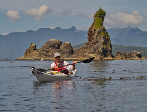
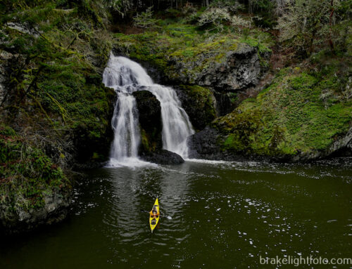
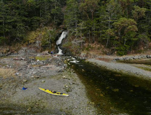
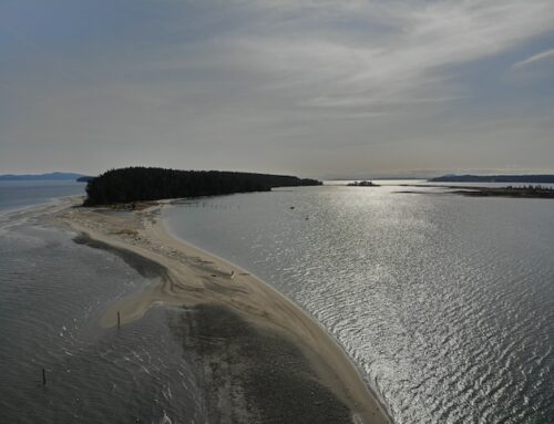
More Photos
If you would like to see more images of this kayaking trip or purchase images, click this link: Kayaking Prince Rupert to Klemtu
Amazing photos and breathtaking scenery! Thank you for sharing your journey.
Thank you Marta so glad you enjoyed them!!! Cheers! Bruce!
Loved the trip report. Really well done. Your photos are superb and take me back to my own trips up that way. Thank you for sharing.