The Richardson Highway stretches 366 miles – from Fairbanks, Alaska in the north to Valdez on Prince William Sound in the south.
It was Alaska’s first road, known to gold seekers in 1898 as the Valdez to Eagle Trail. It was up-graded to a wagon road in 1910, up-dated to an automobile road in the 1920’s and hard-surfaced in 1957.
This article concerns the 82 miles from Valdez to the Edgerton Highway Junction.
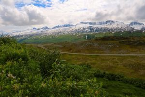
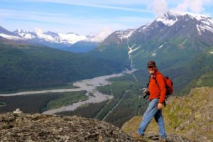
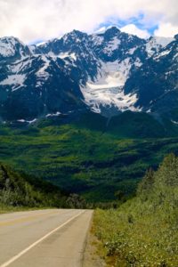
This is a marvelous stretch of highway … so much so that it’s hard to concentrate on driving … there are so many things to look at around each turn in the road!
It’s a good road … I was decidedly nervous after reading the warnings about the narrow and winding road through the Keystone Canyon, but although it’s got some rough and narrow spots … it’s really no worse than any other road in Alaska! And better than a lot of them!
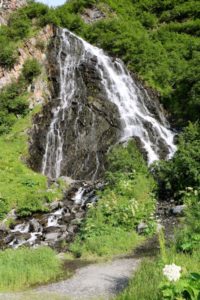
The first thing you come to when driving out of Valdez that’s worthy of a stop is Horsetail Falls – a beautiful fan-shaped waterfall at around mile 13. There’s a good pull-out which lets you get out and photograph this beautiful gem of a waterfall – I even saw some people (mostly kids) climb ½ way up the rocks that make up the edges of the falls. Not for this old gal, but it looked like fun!
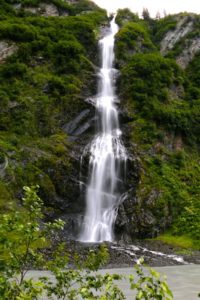
If that wasn’t pretty enough … only about ½ mile further and on the other side of the highway is the Bridal Veil Falls. Again very photogenic and easy to stop in the good sized pull-out.
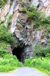
If you look closely you can see an abandoned railroad tunnel at about mile 15.
A sign reads:
This tunnel was hand cut into the solid rock of Keystone Canyon and is all that is left of the railroad era when 9 companies fought to take advantage of the short route from the coast to the copper country. However, a feud interrupted progress. A gun battle was fought and the tunnel was never finished. The Iron Trail by Rex Beach describes these events and this area.
Note: You can walk into this tunnel.
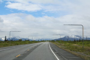
You then enter Keystone Canyon beside Lowe River Rapids and shortly thereafter you begin a slow climb (7.5 miles) to Thompson Pass Summit at 2,678ft. Along the way you’ll see snow poles along the highway that guides snow plows in the winter!
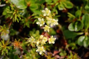
About ½ way through your climb (about mile 20), there is a big pull-out to stop and look at the magnificent view. You’ll also see a sign for the ‘Trail of ‘98’ … part of the route taken by the Gold Rush hordes. It is WELL worth your while to get out and walk down the path even for a bit. It’s easy walking … and there are magnificent views all around as well as lots of wildflowers (in season) which will make your head spin with their beautiful aromas!
Thompson pass is actually comparatively low in elevation but above the timberline. The National Climatic Centre credits snowfall extremes in Alaska to the Thompson Pass station, where a record was noted in the season of 1952 – 1953 of 974.5”. (That’s 81 FEET folks!) Now you know why there are guides for snowplows along the road!
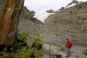
Shortly after the summit of Thompson Pass you’ll see a sign for the National Natural Landmark that’s Worthington Glacier. This is one of the few glaciers that you can easily walk to … a VERY worthwile stop!
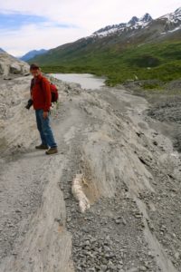
There’s a very large parking area … big enough for large RV’s (and busses!) with restrooms and interpretive displays. Very informative. There is a short, paved, wheelchair accessable path to a viewing platform with a telescope. Most people don’t stop here tho … just below the platform is a small dirt trail that eventually will lead you right up close and personal to the foot of the glacier. It’s not an extremely difficult walk, but there are some small streams to hop across and some of the path is less a path than just scrambling over rocks.
The glacier that’s viewable is only a small portion of what’s actually there. Much of the rock and dirt you see next to the glacier … is also glacier … just with debris piled on top as it moves and gathers what’s underneath as it goes.
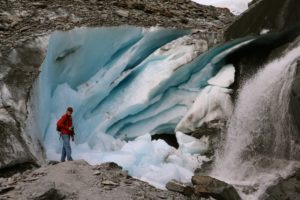
The part that you do see however is unbelievable! Very blue and you feel like you can look right into it … and think about the eons that it’s been growing and retreating. A small waterfall cascades down the side of the glacier that forms the streams you crossed to get there. The interpretive signs talked about ice worms … tiny invertebrates that apparently live in the ice … but we didn’t see any … drat!
Onwards to the north! At around mile 48 you’ll see the Billy Mitchell rest area with views to Mount Billy Mitchell. It has covered picnic areas, outhouses and some room to pitch tents. There are dumpsters & fire rings, but no water. There is an old log cabin near the entrance and historical signs with information about Billy Mitchell.
“Lieutenant William “Billy” Mitchell (1879 – 1936) was a member of he U.S. Army Signal Corps, which in 1903 was completing the trans-Alaska telegraph line (Washington-Alaska Military Cable and Telegraph System) to connect all the military posts in Alaska.
In his later years, Billy Mitchell became the “prophet of American military air power” with his idea that “He who holds Alaska will hold the world as far as defending the North American continent.” He received the Medal of Honor posthumously for his foresight.”
The Milepost
Further along, you’ll see numerous ponds and lakes and rivers that are known for many types of fish such as Dolly Varden and arctic grayling. You’ll also catch glimpses of the oil pipeline that runs from the top of Alaska at Prudhoe Bay to Valdez. Construction began in 1975 and completed in 1977. It is now owned and operated by Alyeska Pipeline Service Company, which is a consortium of oil companies. The 48” diameter pipeline winds through 3 major mountain ranges, though valleys and peaks until it is finally gravity fed down to Valdez where it runs either into tanks directly into waiting oil tankers.
At mile 82 you’ll come to the junction of The Richardson Highway and The Edgerton Highway that leads to Chitina and then on to McCarthy. A worthy side trip – see our full post on McCarthy & Kennecott Mine.
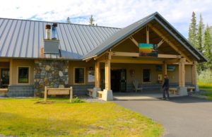
A short way up the road is the Wrangell-St. Elias main National Park Headquarters. There is a lot here to look at … the visitor centre has lots of hands-on interactive and informational displays, stuff to see and touch … history … and an Alaska Geographic book store and gift shop! There is also the Ahtna Cultural Centre in the same location.
Lots of parking for the biggest of RV’s here.
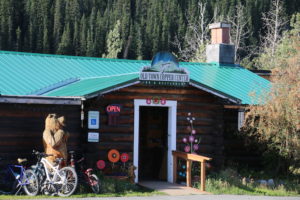
An interesting small side-trip is into Copper Centre at around 105 miles north of Valdez. It’s on the old Richardson Hwy. which is a loop through the town and will take you back to the ‘new’ Richardson Hwy. There’s some historic buildings, a lodge & restaurant and small museum. A nice little diversion!
Shortly thereafter you’ll come to Glennallen … this is the place to fill up with gas before heading either to Tok or Delta Junction and Fairbanks … nothing much else along the way.
The Richardson Hwy. isn’t simply a way to get from point A to point B … this is simply one of the most beautiful drives we saw in Alaska and a destination in it’s own right!

Leave A Comment